Data engineering is a crucial step in preparing, exploring, and visualizing data. Data can come in many forms and in ArcGIS Pro 3.6, Data Engineering has been extended to support raster layers with a raster attribute table. All the useful tools and functionality offered by the Data Engineering view are now available for raster layers with raster attribute tables. This exciting enhancement means you can now use Data Engineering to work with raster layers with raster attribute tables.
Opening a Data Engineering view from a raster layer with a raster attribute table
To open a data engineering view from a raster layer, the raster layer must have a raster attribute table. You can create a raster attribute table for certain rasters using the Build Raster attribute table tool.

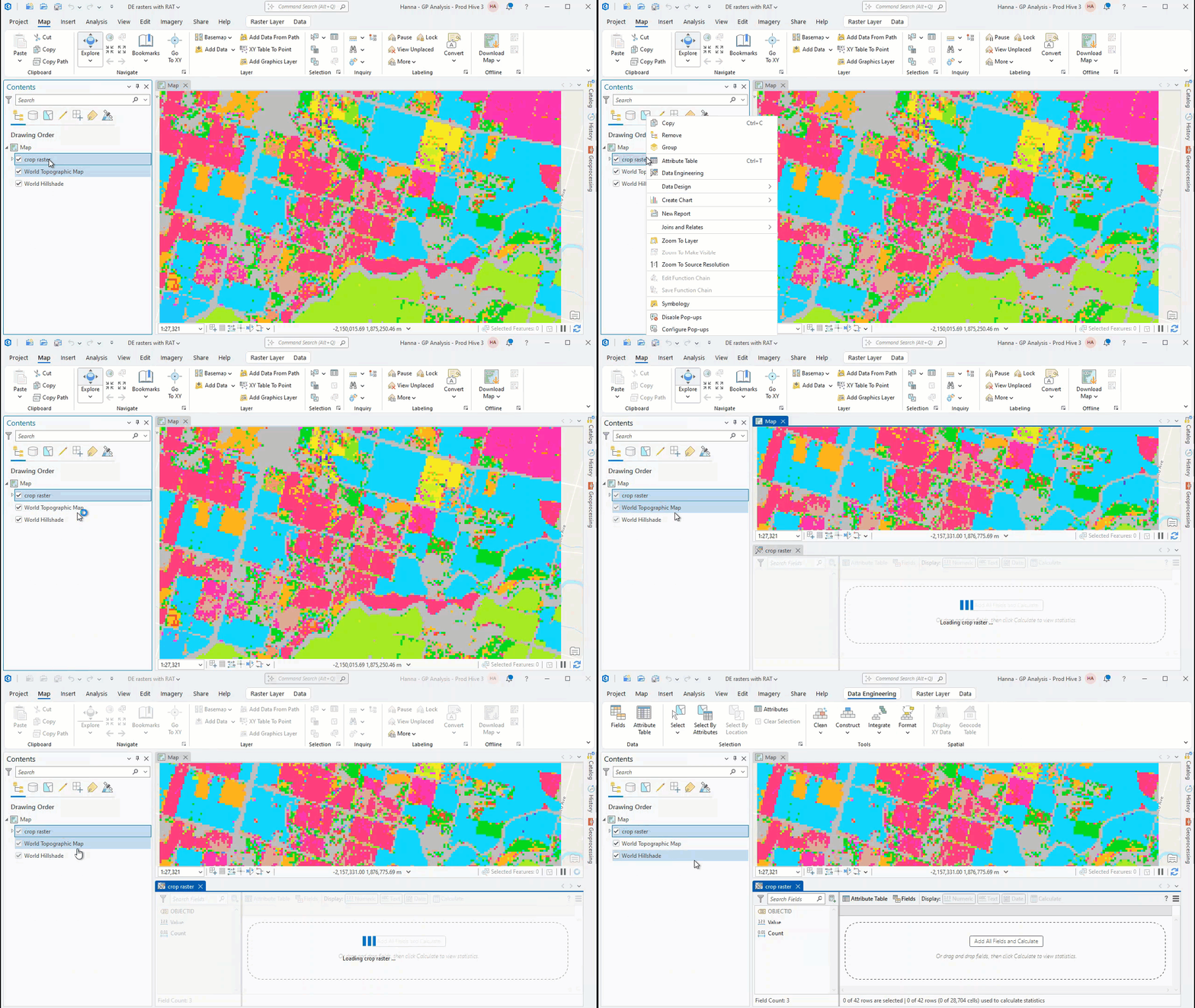
To open a Data Engineering view from a supported raster layer right-click the layer and click Data Engineering. If a raster attribute table exists, the Data Engineering view will open, otherwise you will be prompted to use the Build Raster attribute table tool to first build a raster attribute table.
Exploring rasters with a raster attribute table
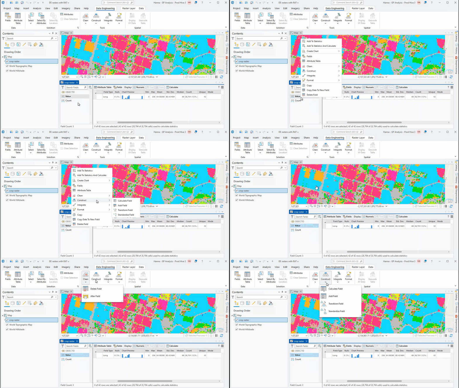
Once open, the Data Engineering view will include the Data Engineering Ribbon, a statistics panel, and a fields panel. The fields panel contains every field in the raster attribute table. A raster attribute table summarizes the contents of a raster. Every raster attribute table has a Value and Count field. The Value field lists all the unique values in the raster layer while the Count field displays the number of cells with that value. The raster attribute table will also include any additional fields you added.

All the features and functionality of the Data Engineering view, which were previously only available for feature layers and tables, are now possible for rasters with a raster attribute table. View the functionality available for each field by right-clicking the field in the fields panel and selecting an option in the menu. You can also use the Data Engineering Ribbon to find tools and features available for rasters with raster attribute tables.
Understanding statistics for raster layers with a raster attribute table
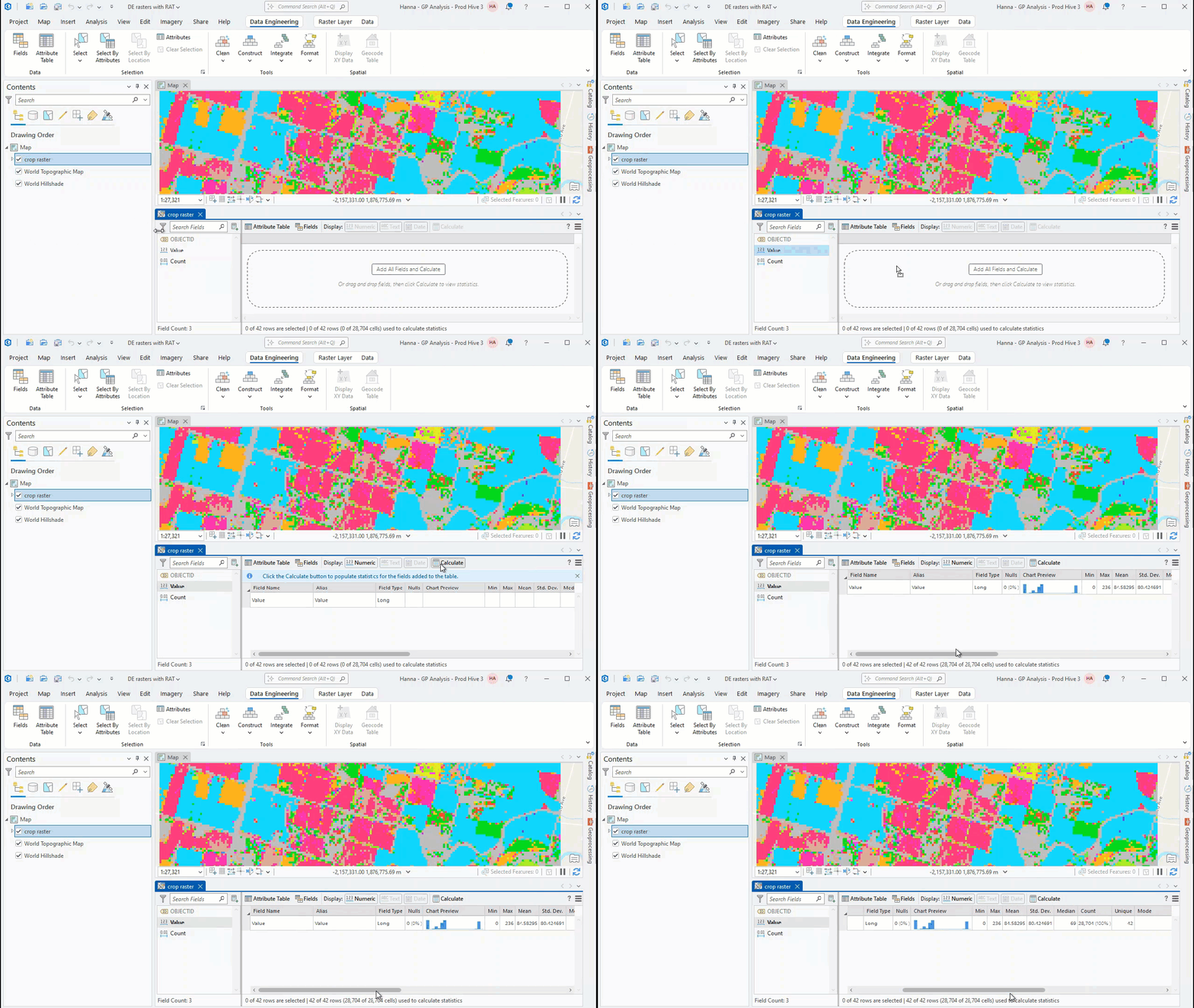
You can calculate statistics for a field by selecting a field in the fields panel, adding it to the statistics panel, and clicking the Calculate button. The statistics for the field will appear in the statistics panel.

Statistics are calculated considering all raster cells. The raster attribute table summarizes the contents of the entire raster so to calculate statistics from the raster attribute table, statistics are weighted by the Count field.

Article Discussion: