Sure, you could use a boring line to draw your rivers and then label them. But why not cut out the middle man??
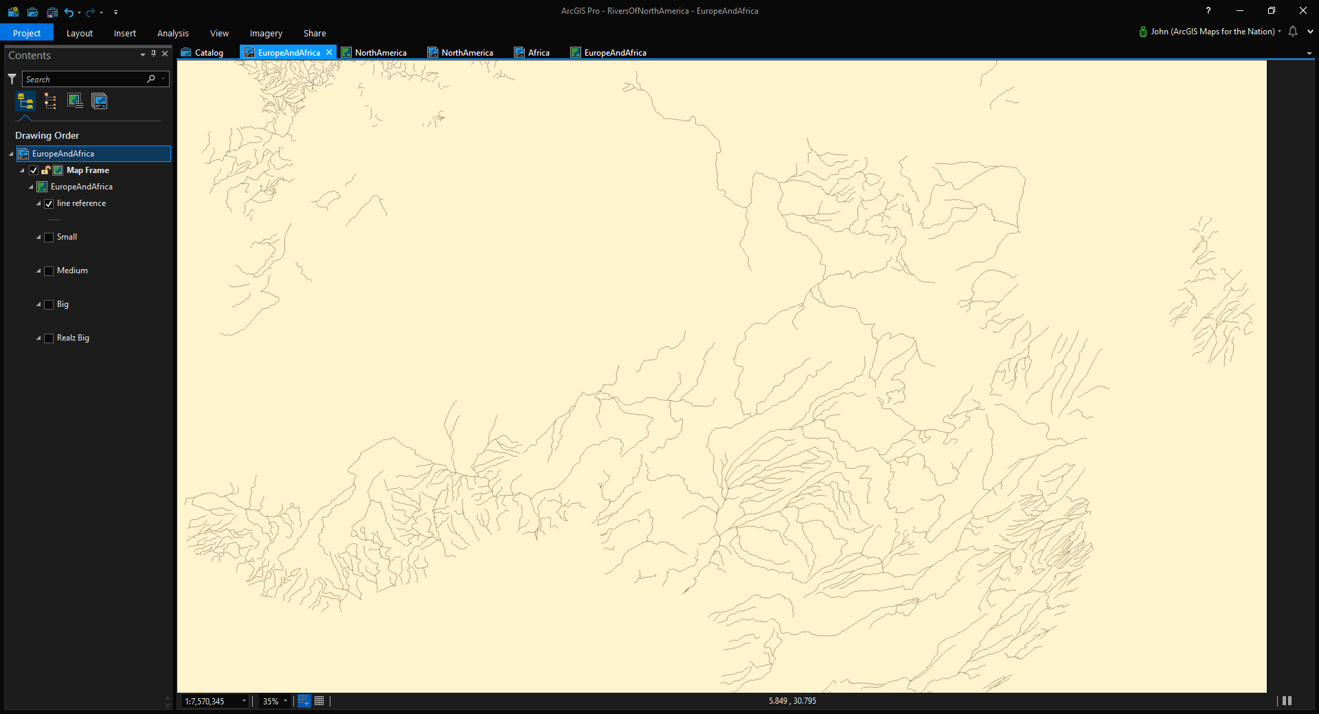
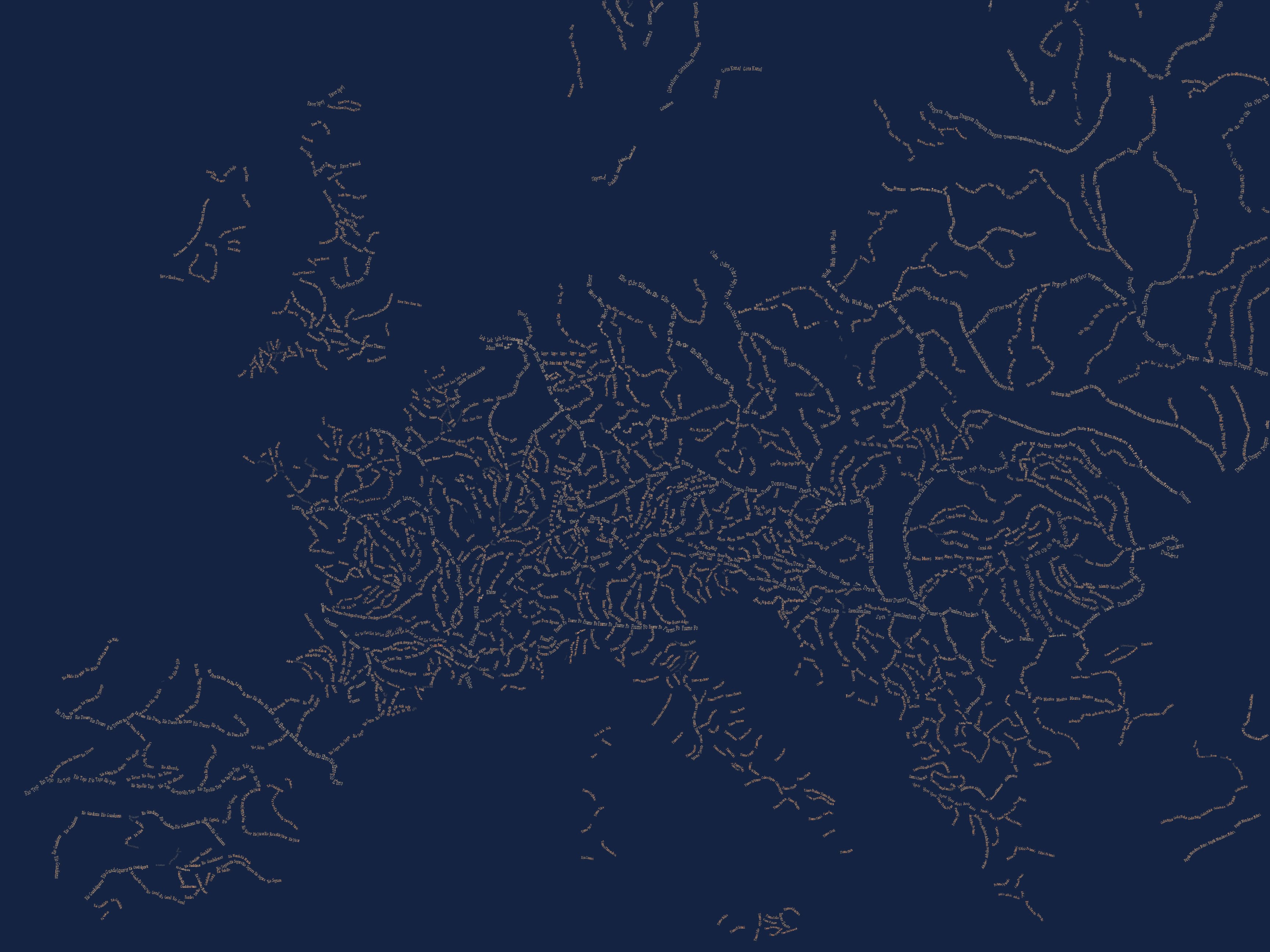
Here is a map of Europe’s and Africa’s rivers where the rivers are shown as just their names…

Before you ask me, “hey John, have you seen the typographic maps Andy Woodruff made using only feature labels?” let me just tell you now absolutely I’ve seen them and they are gorgeous. There is something sort of magical and cognitively easing about typographic maps. If there are many types of landcover shown, like in Andy’s maps, the features are immediately keyed to their type or name. No reason to choose where/how to label because the thing itself is a label. And your brain thanks you for not making it load up a key of symbols into its leaky working memory while your eyes dart back to the map. The data is encoded directly as the features. That’s pretty great.
When you strip it back to only show a single sort of feature, like rivers, you get a sense of flow and hierarchy, the river names painting in the density and length naturally and sort of wonderfully.
Creating a typographic map of rivers in ArcGIS Pro is actually really straightforward. Why don’t I just shut up and show you?
Here are the major steps:
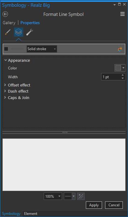
- Label with “River Placement”, centered and curved right over the feature.
- Do not remove duplicate labels and give them a minuscule separation interval.
- Leave river layer turned on but turn off all of its symbology layers.
- Break out your rivers by size and scale each layer’s labels accordingly.
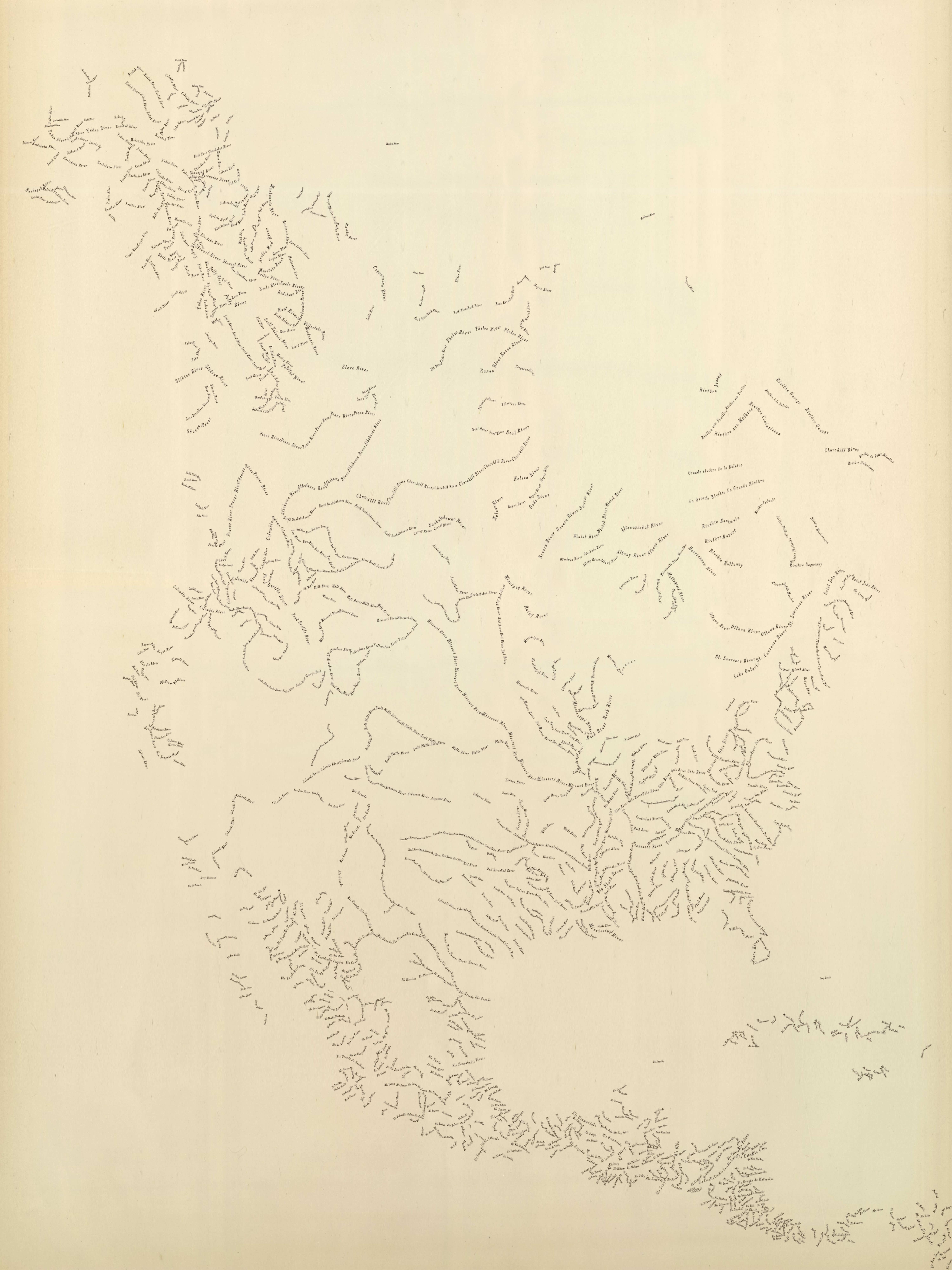
Here is my map, with unlabeled rivers shown as lines..
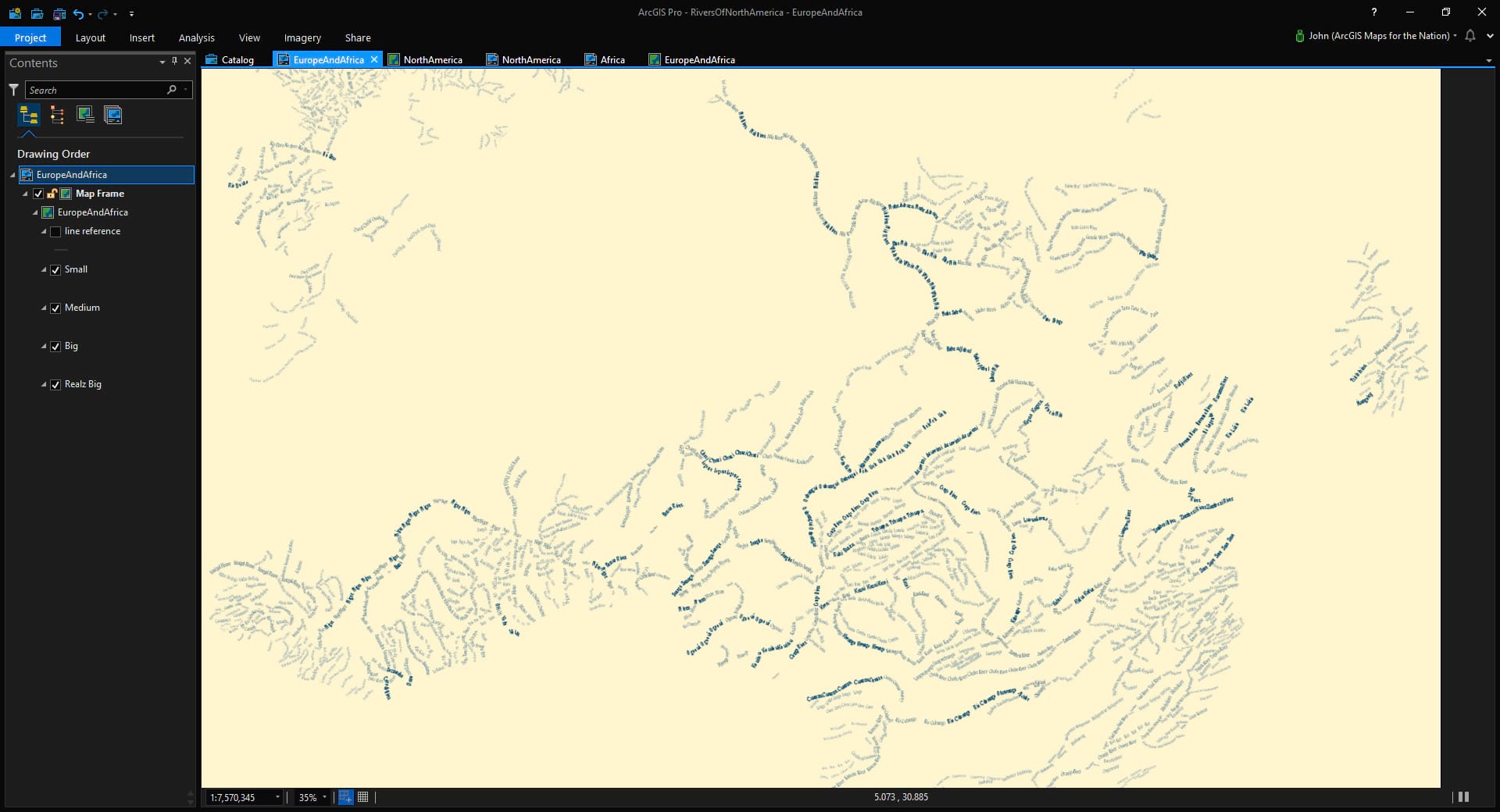
Then I leave the layer tuned on but uncheck all of the symbology items so labels can appear but there isn’t any line symbology getting in the way…
Then I play with the label properties so all I see are rivers of text…
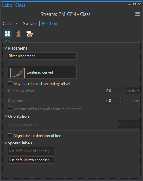
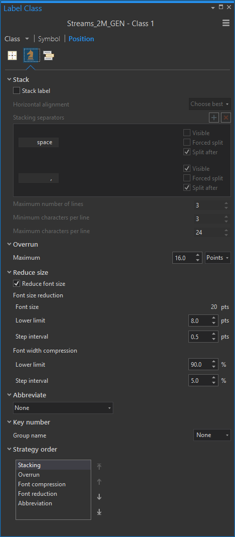
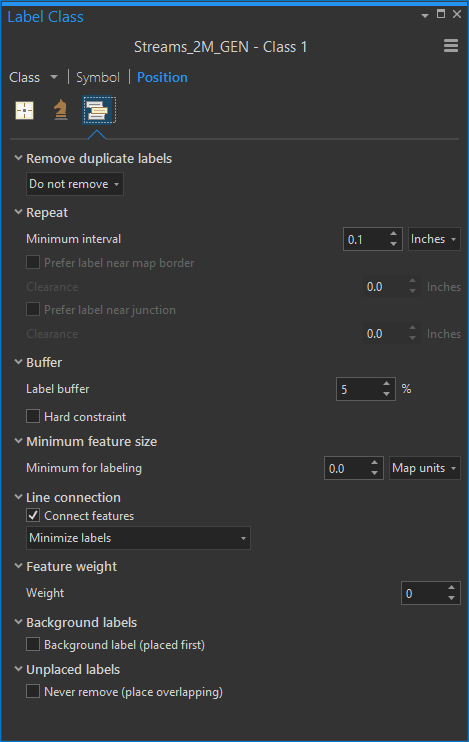
Wait, but how? No worries, here are all the settings for the label tabs that I used for my rivers (“position” is that target thing, “fitting strategy” is the knight chess piece, and “conflict resolution” is that little stack of boxes, though, if I were designing the icons, it would look like a little picture of Stuart Smalley)…
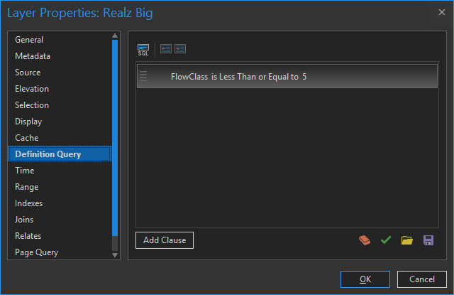
Lastly, I split my river layer up into several layers, based on river size, using definition queries (with the layer selected, go to the Data tab, then expand the Definition Query section)…
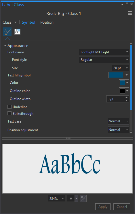
And I gave larger rivers bigger font sizes and bolder colors and smaller rivers smaller font sizes and lighter colors.
And that’s it, my friend!
Here’s another look, this time just Europe with some different colors…
Now, if you are feeling bold and eager for extra credit, you can apply some Style magic of the sort described here and make a typographic river map that looks like it is trapped with a damaged time machine in 1885…
But Why?
Well, I mean, in addition to it being cool looking and stuff, sometimes there are practical applications for mapping only one feature type without supporting context…
- It can communicate a fuller and more focused structure that might otherwise be diluted by additional layers.
- It engages an audience perhaps more than a standard map.
- It illustrates a phenomenon as being a critical element to an ecosystem, so fundamental to a place that locations can be recognized just with that single layer.
So, if you work for a department of transportation and need to capture attention for a planned roadway among other roads, or if you are on a planning department and want to illustrate the availability of local waterways, or if you are on a parks department and want to make a promotional map of all the hiking trails, or if you work for a utility and want to show a de-cluttered but information-dense view of your network, then this sort of thing has your name on it.
Sometimes the oddest maps have a direct application in very practical settings. And lastly, if you can surprise and delight someone with a map, then the message that map carries has an infinitely better chance of making it home.
Happy Typographic Mapping! John

Commenting is not enabled for this article.