ArcGIS has the tools you need for linear referencing applications, whether for roadways and railroads or pipelines and water resources. ArcGIS Pro 2.9 with ArcGIS Enterprise 10.9.1, added significant enhancements to Linear Referencing and Location Referencing.
These manifest as:
- core linear referencing in ArcGIS Pro
- advanced location referencing in ArcGIS Pro extension of Roads and Highways
- advanced location referencing in ArcGIS Pro extension of Pipeline Referencing
Route feature class is central to linear reference systems (LRS) in ArcGIS. Depending on the toolset used, there are multiple methods to create and edit route features along with the measures inherent to the geometry. Alongside the measure embedded in the route geometry, persisting these measures as attributes is common practice.
Use cases
The following use cases for measure attribution are predominant in the industry segments that use LRS:
- Reporting for operating budget plans, regulatory compliance, and capital expenditure projects, use measure attributes for mileage
- Modelling and analysis use measure attributes for computation and comparing various what-if scenarios
- Risk models that leverage LRS dynamic segmentation, use measure attributes for roll-ups and drill-downs
Core capabilities in ArcGIS Pro like Calculate Geometry, Python expressions, Arcade functions and Attribute Rules have made it easier than ever before to maintain measurement systems. This blog provides examples on each of these methods, enabling users to choose the best option that meets their use case.
Calculate Geometry
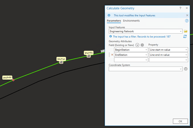
You can use the attribute table that offers Calculate Geometry to update measure attributes as shown below.

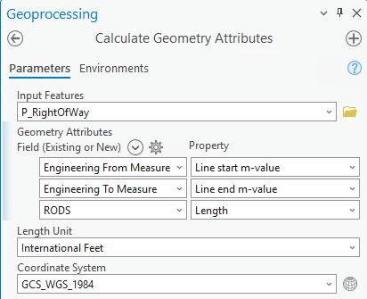
Additionally, the Calculate Geometry Attributes in Features toolset provides the same capability and may be used for batch processing and running scheduled jobs.

Python Expressions
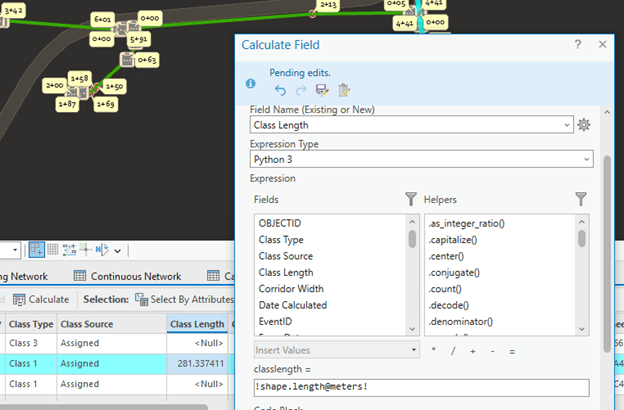
Alternately, use the attribute table that also offers Calculate Field to insert a Python expression as shown below.

There are numerous Calculate Field Python examples. The following expressions come in handy for measure attributes.
Calculate the start and end measure of a route polyline
Expression: !shape.extent.MMin! !shape.extent.MMax!
Calculate the length of a route polyline
Expression: !shape.length!
Calculate the length with unit conversion
Expression: !shape.length@miles! !shape.length@meters!
Attribute Rules
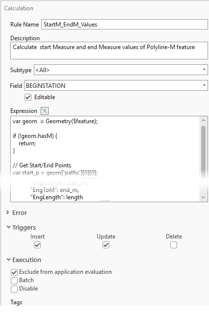
Preferably, use an arcade script to configure an attribute rule, that will trigger immediately after edits to automatically calculate measure attributes. Explicit triggers can be defined for data inserts, updates and deletes. Use Data Design > Attribute Rules Ribbon to configure an attribute rule.

The arcade snippet for measure attribute calculation is posted at respective Esri Community places:

Commenting is not enabled for this article.