ArcGIS Reality Server is now generally available with ArcGIS Enterprise 12.2. As part of Esri’s broader family of reality mapping products, Reality Server brings scalable, secure, self-hosted reality mapping processing into the enterprise GIS.
For organizations working with growing volumes of drone, aerial, and satellite imagery, ArcGIS Reality Server provides the infrastructure to process large imagery collections, support multiple projects, and produce high-quality 2D and 3D content within ArcGIS. The resulting products can include true orthos, digital surface models, point clouds, 3D meshes, and Gaussian splats that can be used across ArcGIS maps, scenes, applications, analysis, and digital twin workflows. It also combines distributed processing with organization-managed infrastructure, giving customers greater control over how reality mapping fits into their enterprise GIS.
The result is a more scalable way to move imagery through processing and into ArcGIS, while maintaining control over the infrastructure, data, and workflows behind it.
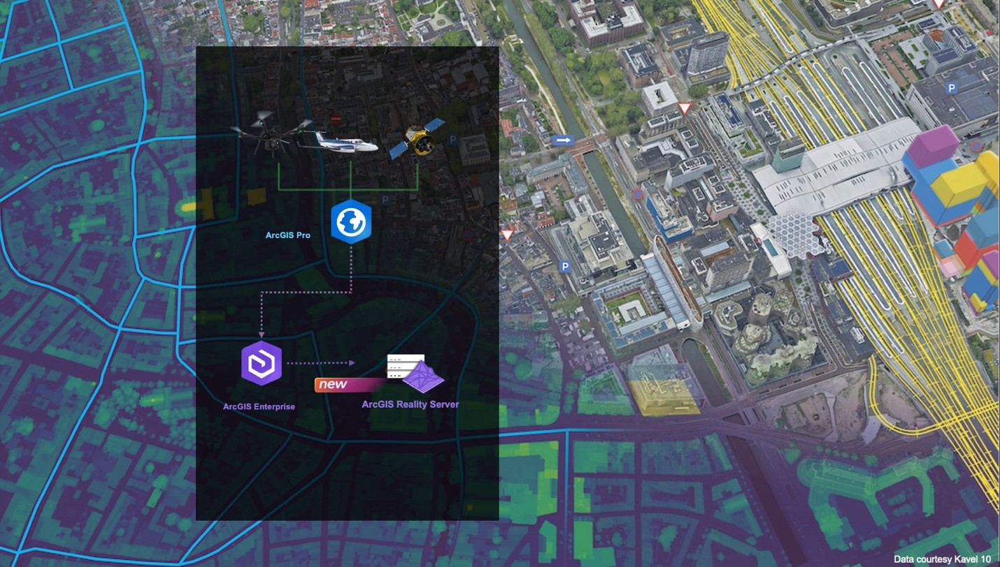
Secure reality mapping within your enterprise
For organizations managing sensitive, regulated, or proprietary imagery, maintaining control over data, processing, and infrastructure is critical.
Consider an AEC organization already using ArcGIS Enterprise to support major construction and infrastructure projects. Drone and aerial imagery may contain sensitive project information or be subject to contractual, security, governance, or data residency requirements.
With ArcGIS Reality Server, self-hosted deployment means that imagery and processing can remain within the infrastructure the organization manages, either on-premises or in a private cloud. IT teams maintain full control over where data resides, who can access it, and how the underlying infrastructure is configured and governed.
Scale reality mapping across your organization
Enterprise processing also changes how organizations can think about access to reality mapping resources. Instead of processing capacity being tied exclusively to the hardware available to a particular user, ArcGIS Reality Server provides centralized processing resources that can support reality mapping projects and users across the organization. Processing can be distributed across multiple server machines to support large projects or multiple missions running simultaneously, with additional capacity added as processing demands grow.
Multiple users can also work with the same reality mapping project, with access managed through project membership. This makes it easier for teams across the organization to contribute to and work with reality mapping projects through ArcGIS.
And because Reality Server is natively integrated with ArcGIS, the resulting 2D and 3D content can flow directly into maps, scenes, applications, analysis, digital twins, and operational workflows.
Choose the right experience for your workflow
Different users and workflows call for different ways of working with reality mapping. Whether they work from ArcGIS Reality Pro, through the ArcGIS Reality Web App, or programmatically, users can choose the experience that fits their workflow, or work across applications as projects progress, while ArcGIS Reality Server provides the processing behind the scenes.
Connect desktop workflows
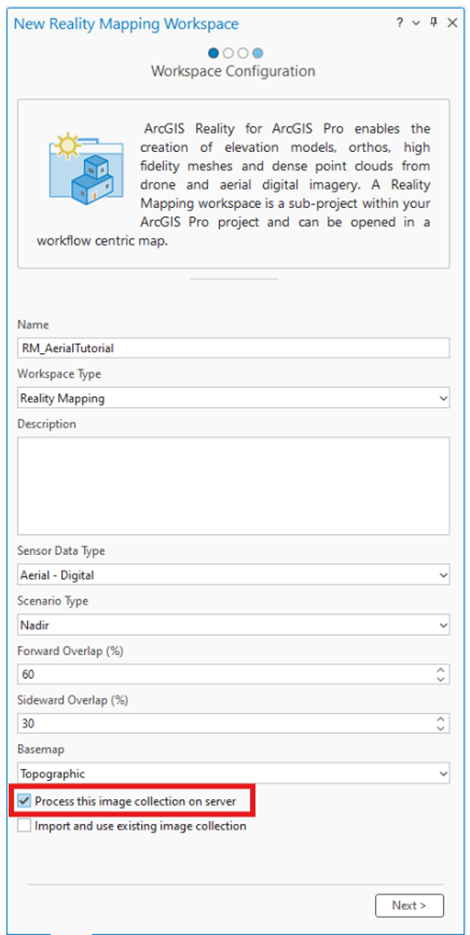
ArcGIS Reality Pro provides the professional authoring experience for ArcGIS Reality Server, allowing GIS professionals to set up and manage reality mapping projects in a familiar ArcGIS Pro environment, then send processing to their organization’s Reality Server infrastructure. This gives teams the flexibility to author projects with familiar desktop tools while taking advantage of organization-managed processing and infrastructure at enterprise scale.
Automate high-volume and repeatable workflows
Not every reality mapping workflow needs to begin manually on the desktop. Organizations can use the reality mapping module in the ArcGIS API for Python to automate image processing and product generation, reducing manual steps when new imagery is processed repeatedly.
Developers can also use reality mapping operations in the ArcGIS REST API to integrate Reality Server processing into custom applications and enterprise workflows.
Explore the ArcGIS Reality Web App (Beta)
Looking for a more streamlined way to get started with drone mapping? The ArcGIS Reality Web App, available as a beta feature, provides an intuitive, web-based experience for managing projects, processing drone imagery with ArcGIS Reality Server, reviewing results, and sharing 2D and 3D outputs. It extends Reality Server workflows beyond desktop authoring and makes it easier for more users across an organization to participate in drone mapping workflows. The ArcGIS Reality Web App is available in beta for ArcGIS Enterprise 12.2 customers with access to ArcGIS Reality Server.
Next steps
With ArcGIS Reality Server generally available with ArcGIS Enterprise 12.2, organizations can begin bringing secure, scalable reality mapping into their existing enterprise environment.
Want to learn more about ArcGIS Reality Server? Contact your account manager to start planning your deployment.
- Ready to deploy ArcGIS Reality Server? Review the system requirements and architecture recommendations and consult step-by-step instructions for installation and configuration to determine how Reality Server fits within your ArcGIS Enterprise environment.
Ready to use ArcGIS Reality Server in your image processing workflows?
- Follow the tutorials to see how ArcGIS Reality Pro and Reality Server work together to create 2D and 3D products.
- Build repeatable workflows using ArcGIS API for Python and ArcGIS REST API, or check out sample Python notebooks for different sensor workflows.
- Try the Reality Web App beta and share your feedback by joining the Early Adopter Community for ArcGIS Enterprise 12.2 New Features.
New to reality mapping? Learn more.


Article Discussion: