ArcGIS Solutions helps you make the most of your GIS by providing purpose-driven, industry-specific configurations of ArcGIS.

In the March 2026 release, you will find four new solutions for state and local governments, utilities, and public safety agencies. There are also many enhancements to the existing solution portfolio that can be leveraged by organizations of all types.
What’s new
Emergency Shelter Management
Accurate shelter information is vital during emergencies. It reduces confusion and supports rapid decision-making. Traditionally, emergency managers have used outdated, or inconsistent, tracking methods to manage emergency shelters and they miss key details required to effectively manage shelter status and allocate resources.
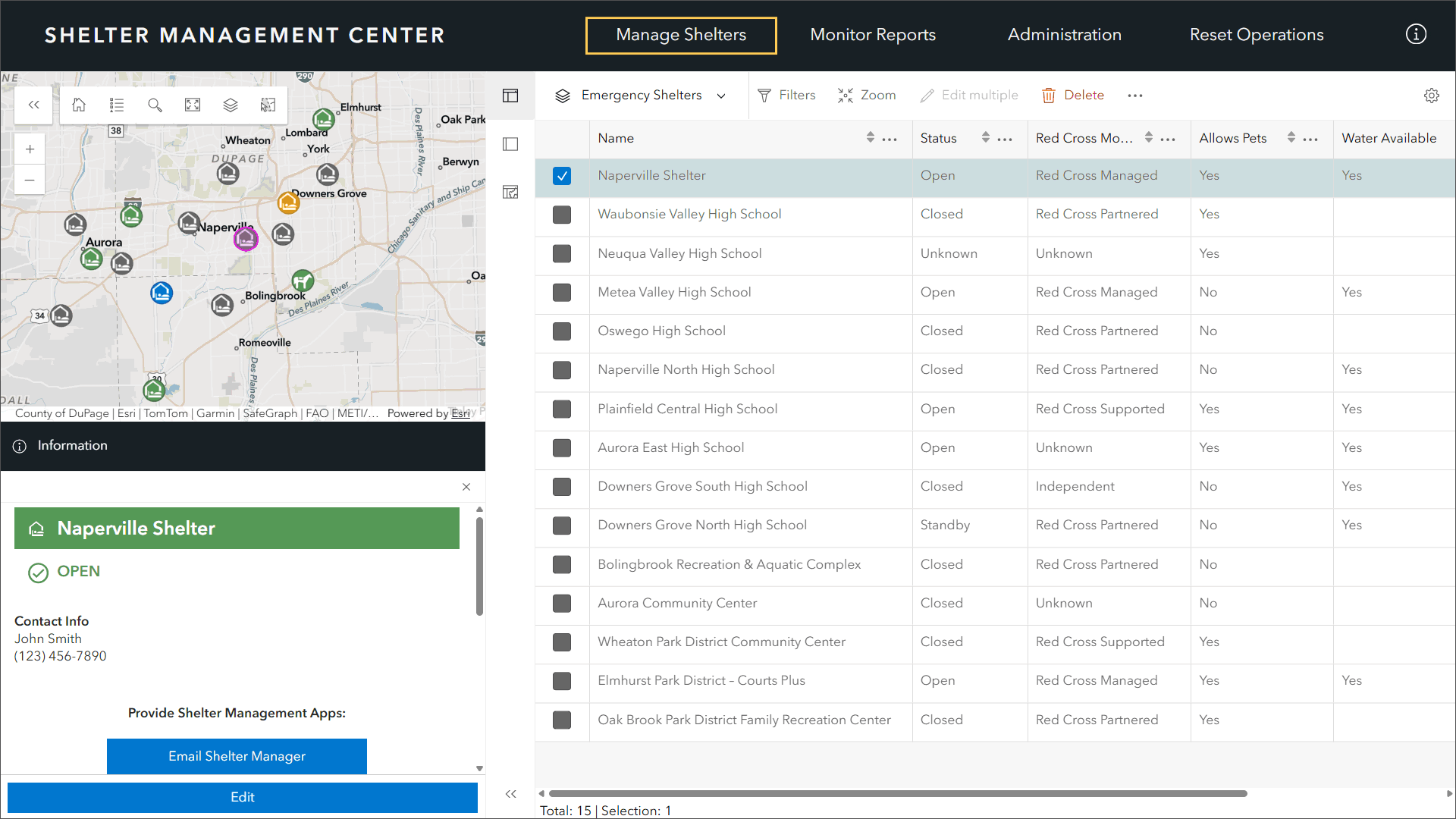
If you are an emergency management agency that wants to understand where open shelters are located and what their current occupancy might be, we believe the Emergency Shelter Management solution will help.

Invasive Vegetation Management
Invasive vegetation endangers native ecosystems, threatens agriculture, and can encroach upon utility and transportation corridors if left unmanaged. Managing vast landscapes with antiquated technology solutions strains available resources and makes it very difficult to prioritize target areas, track treatment locations, and measure progress over time.
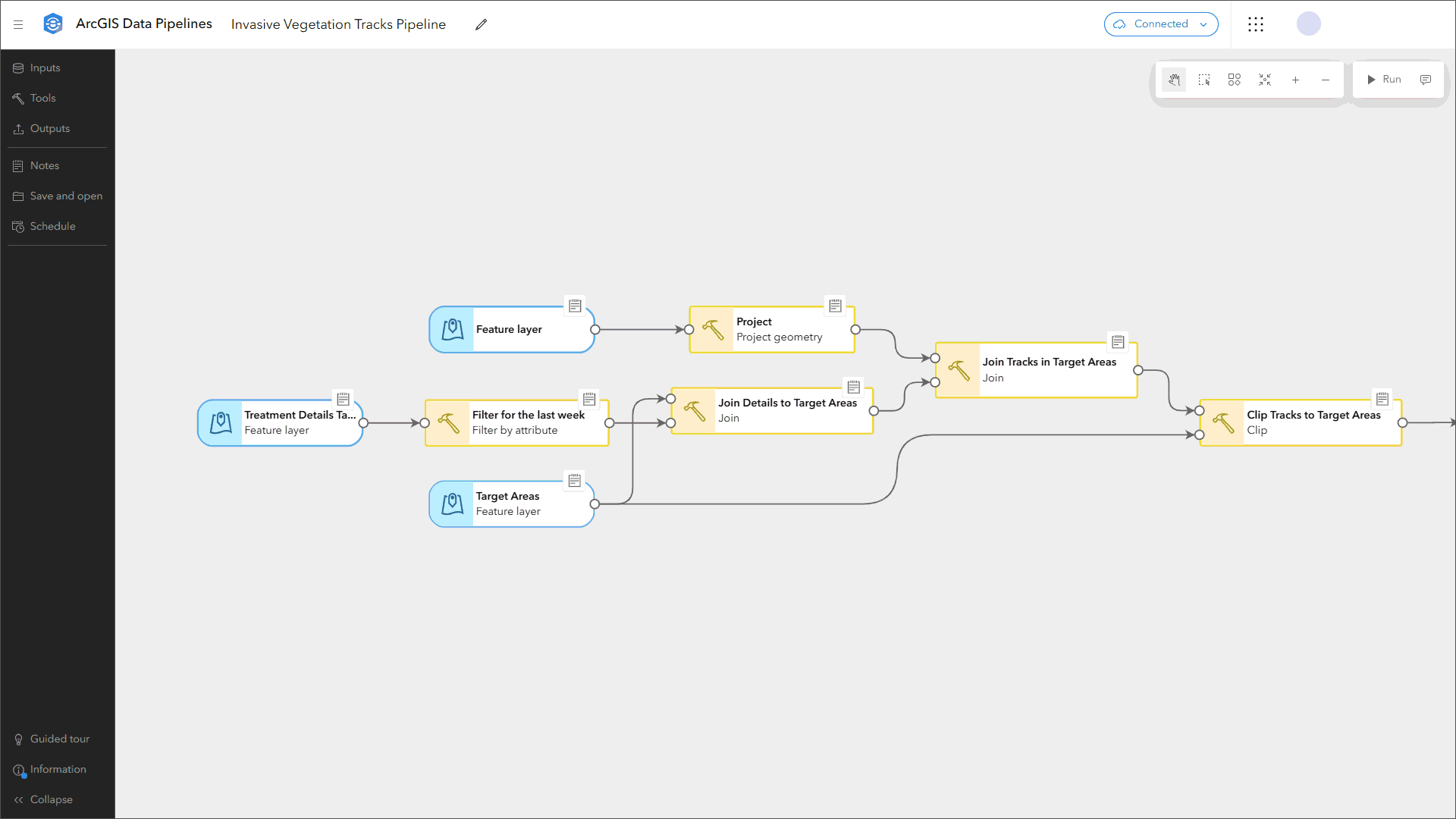
If you are a natural resources organization that wants to understand where infestations are occurring and document control methods used, we believe the Invasive Vegetation Management solution will help.
Land Development Outreach
Planning authorities rely on zoning ordinances and related regulations to share requirements with the community and regulate land development. Complex, or fragmented, land use regulations introduce uncertainty and increase the time it takes to develop, or improve, a property.
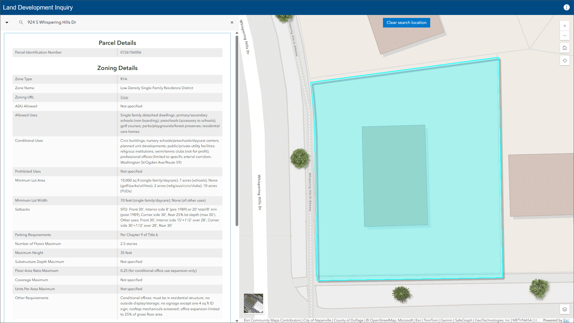
If you are a planning organization that wants to provide a location-enabled destination that simplifies access to regulations and reduces confusion, we believe the Land Development Outreach solution will help.
Protected Area Management
Protected areas require ongoing stewardship to balance conservation goals with public access, safety, and daily operations. Antiquated systems make it difficult to respond quickly to issues observed in the field, share consistent information with stakeholders, and effectively manage protected areas.
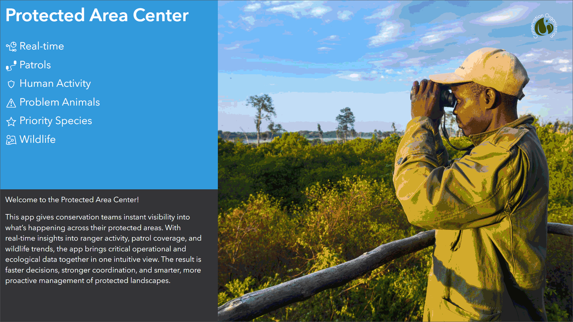
If you are a conservation agency that wants to understand where conservation and enforcement activities are occurring across the geographic extent of a protected area, we believe the Protected Area Management solution will help.
Enhancements
There are ten major enhancements to the existing portfolio in this release.
- Community Risk Reduction
- District Energy Utility Network Foundation
- Election Management
- Election Outreach
- Gas and Pipeline Referencing Utility Network Foundation
- Gas As-Builting
- HLZ Suitability
- Pipeline Referencing Foundation
- Plans and Drawings
- Stormwater Utility Network Foundation
Learn more about the minor enhancements to the existing solution portfolio also in this release.
Lifecycle changes
The following Local and State Government solutions have been moved to Mature lifecycle phase: Adopt-A-Stop, Agricultural Best Management Practices, Business Inclusion, and Land Use Outreach.
Help documentation for solutions moved to the Mature lifecycle phase can be found on the Archived help page.
Learn more
For more information about ArcGIS Solutions, check out the following resources:
- Explore the ArcGIS Solutions gallery.
- Learn more about ArcGIS Solutions.
- View the full collection of solution demo videos available to the community.


Commenting is not enabled for this article.