ArcGIS Solutions helps you make the most of your GIS by providing purpose-driven, industry-specific configurations of ArcGIS.

In the November 2026 release, you will find three new solutions for utilities, and public safety and defense agencies. There are also many enhancements to the existing solution portfolio that can be leveraged by organizations of all types.
What’s new
CCTV Program Management
Closed circuit television (CCTV) pipe inspections help sewer utilities and stormwater organizations make informed asset management and maintenance decisions. However, logistical challenges and limited resources make it difficult for utilities to plan inspections, coordinate work, and track progress across extensive underground pipe networks.
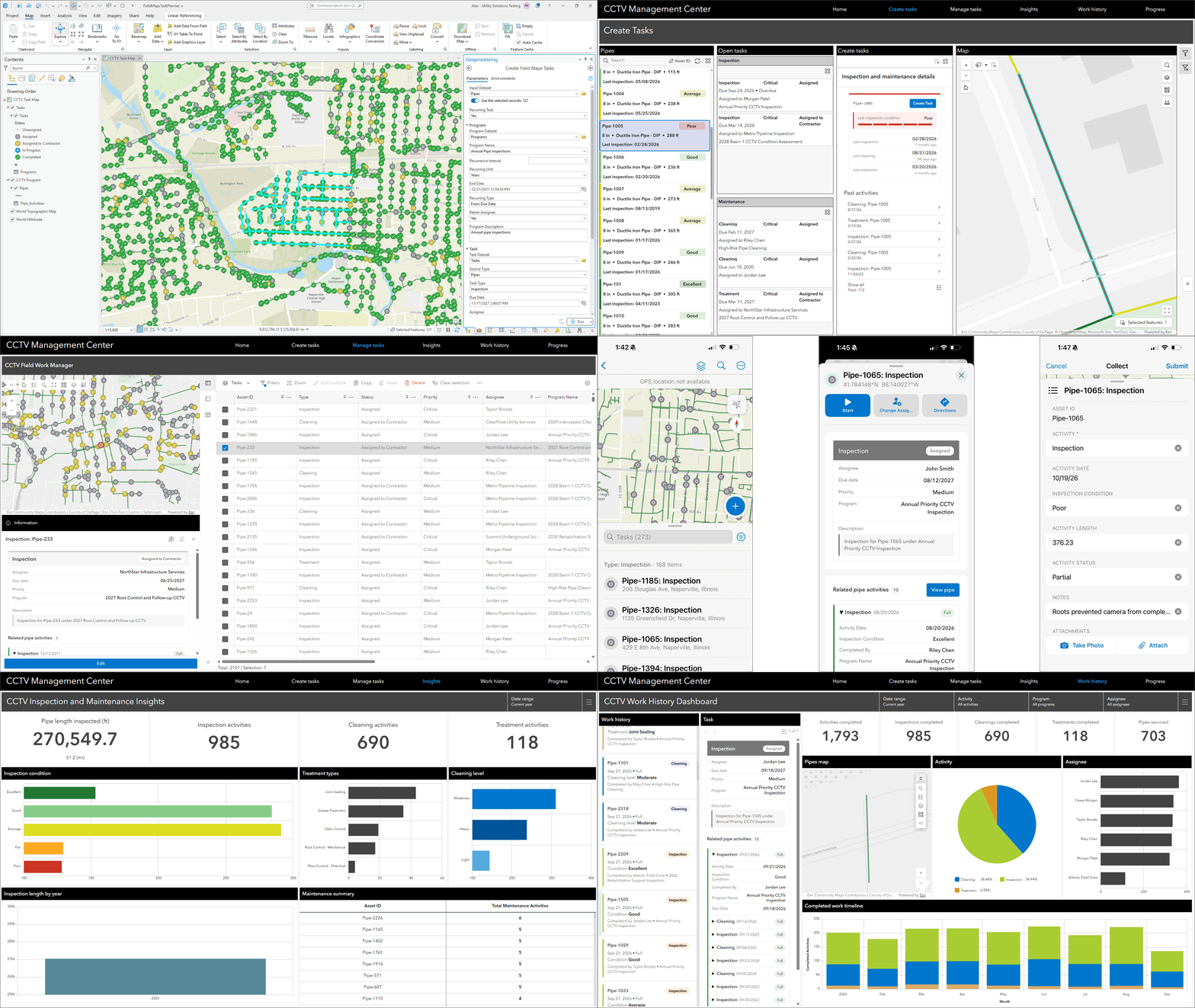
If you are a sewer utility or stormwater organization that wants to connect CCTV pipe inspections and maintenance activities with a GIS asset repository so you can visualize progress, we believe the CCTV Program Management solution will help.

Crime Analysis Web
Hot spot, or place-based, policing directs limited patrol and investigative resources to places in a community where crime and disorder disproportionately cluster. It is an essential strategy that has been shown to effectively reduce crime. Many law enforcement agencies want to adopt hot spot policing, but without trained analysts they lack the mapping and analysis tools needed to pinpoint where crime and disorder occur.
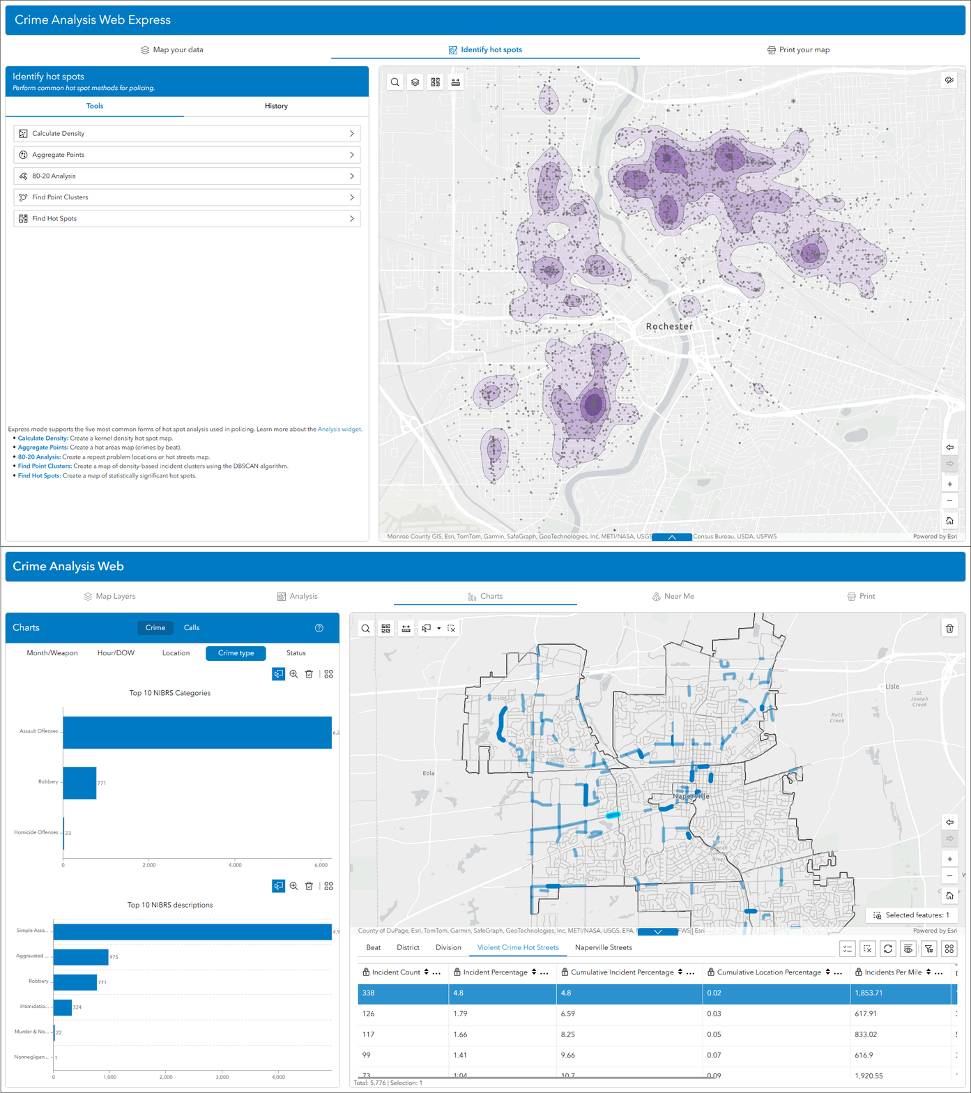
If you are a law enforcement agency that wants to implement fundamental crime mapping capabilities, we believe Crime Analysis Web solution will help.
Gap Crossing
Gap crossing operations are complex and critical aspects of modern military campaigns. Successful crossing operations require rapid, and repeatable, data analysis and risks increase when information is difficult to create and share across military organizations.
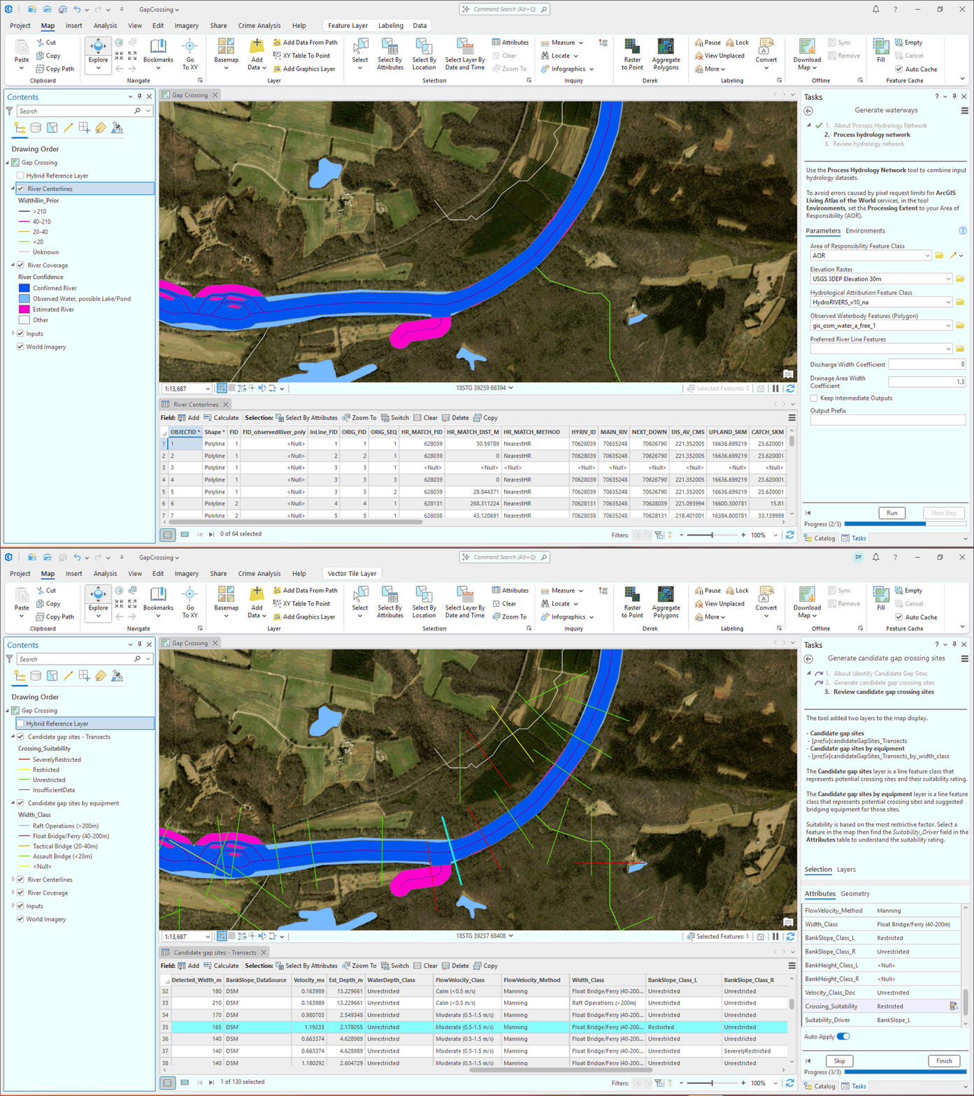
If you are a defense agency that wants to implement a standardized, repeatable, and doctrinally aligned geospatial process that identifies candidate gap crossing sites, we believe the Gap Crossing solution will help.
Enhancements
There are thirteen major enhancements to the existing portfolio in this release.
- Emergency Management Operations
- Fire Accreditation Analysis
- Fire Incident Dashboard
- Gas As-Builting
- Gas Distribution Data Management
- GIS Request Management
- Parks and Grounds Management
- Roadway Management
- Sign Management
- Signal Management
- Streetlight Management
- Tree Management
- Watch Center
Learn more about the minor enhancements to the existing solution portfolio also in this release.
Lifecycle changes
The following solutions have been moved to Mature life cycle phase: Recreation Outreach, Sustainable Development Goals, and CCTV Manager.
Help documentation for solutions moved to the Mature lifecycle phase can be found on the Archived help page.
Learn more
For more information about ArcGIS Solutions, check out the following resources:
- Explore the ArcGIS Solutions gallery.
- Learn more about ArcGIS Solutions.
- View the full collection of solution demo videos available to the community.



Commenting is not enabled for this article.