ArcGIS Solutions helps you make the most of your GIS by providing purpose-driven, industry-specific configurations of ArcGIS.

In the September 2026 release, you will find five new solutions for state and local governments, utilities, and public safety agencies. There are also many enhancements to the existing solution portfolio that can be leveraged by organizations of all types.
What’s new
Beach Analysis
Modern force design and operational concepts are increasingly centered on littoral operations, expeditionary advanced base operations, and distributed naval expeditionary warfare. Operational success depends on a detailed understanding of coastal terrain, beach characteristics, and nearshore bathymetry.
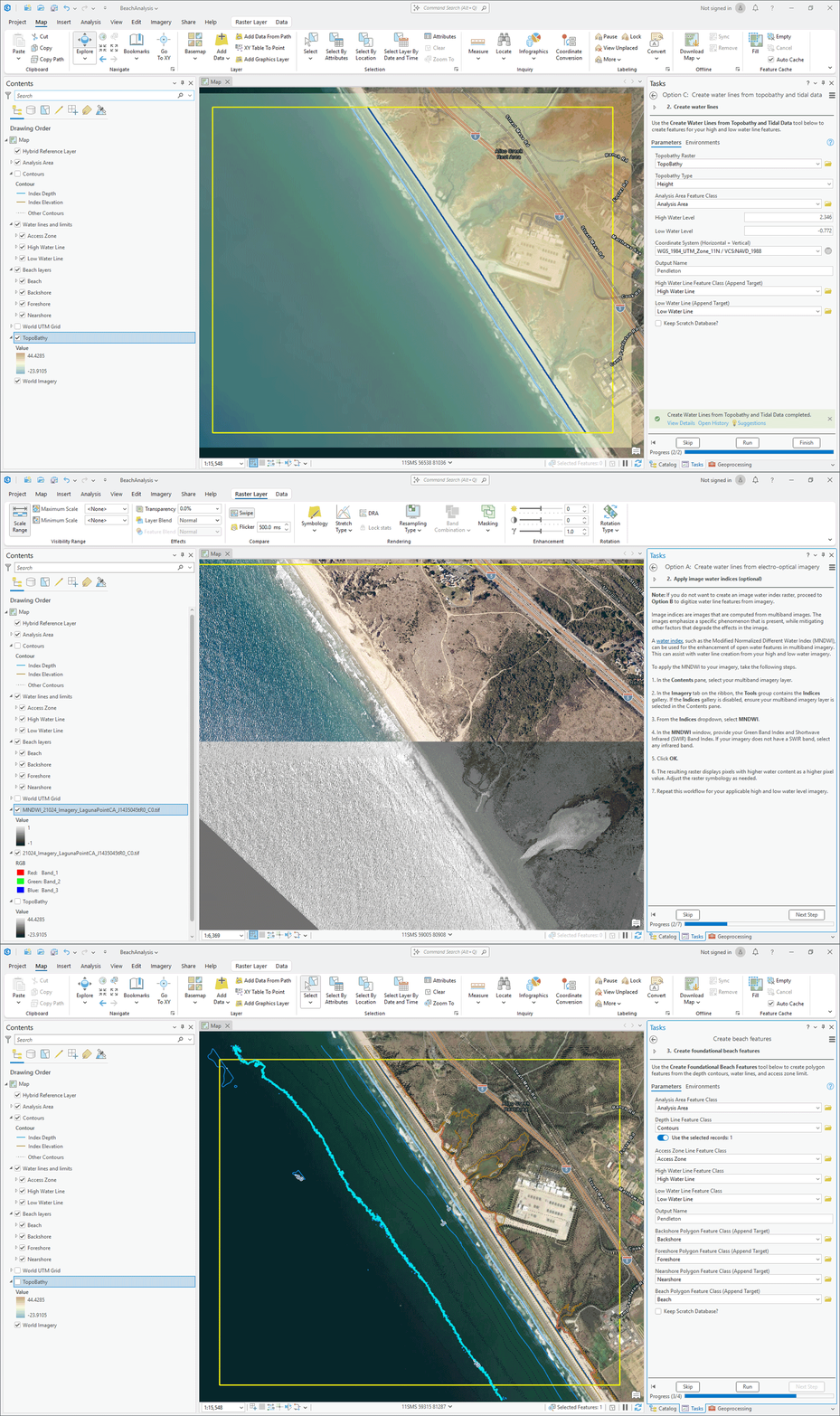
If you are a defense agency that wants to implement repeatable workflows that enable analysts to rapidly characterize beaches and create foundational geospatial data, we believe the Beach Analysis solution will help.

Electric Joint Use Permitting
Joint use formalizes the partnered use of utility and communication poles and the growing proliferation of telecommunications equipment on these poles is increasing the volume of joint use attachment requests. To meet increasing demands, utilities need to understand where attachments have already occurred and a streamlined permitting process that expedites future attachment requests.
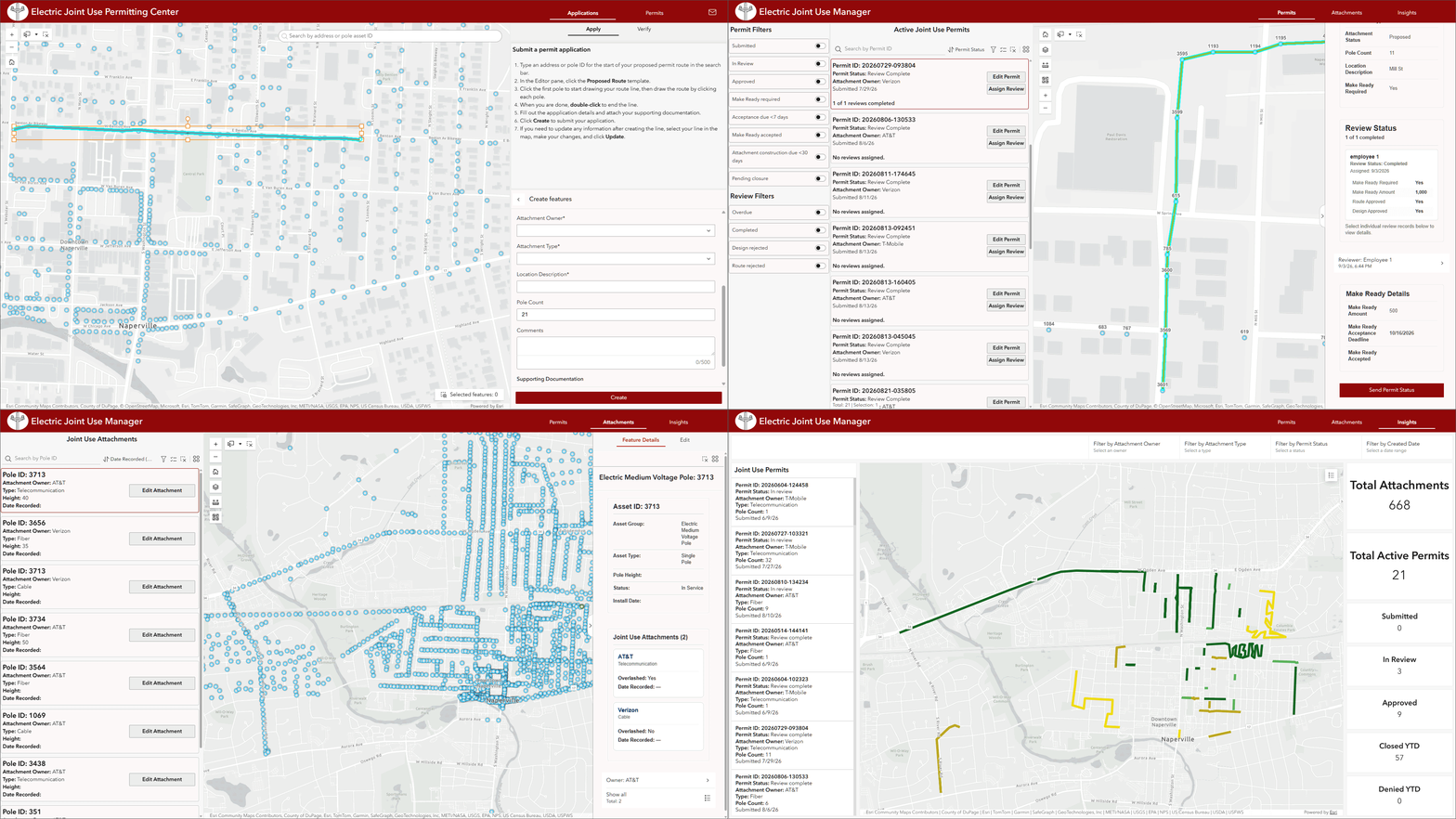
If you are an electric utility that wants to maintain more accurate and timely attachment inventories, we believe the Electric Joint Use Permitting solution will help.
Market Planning and Development
Businesses must continuously evaluate site performance and market conditions to make strategic investment decisions. Unfortunately, this information may be stored in diverse business systems that lack geographic context.
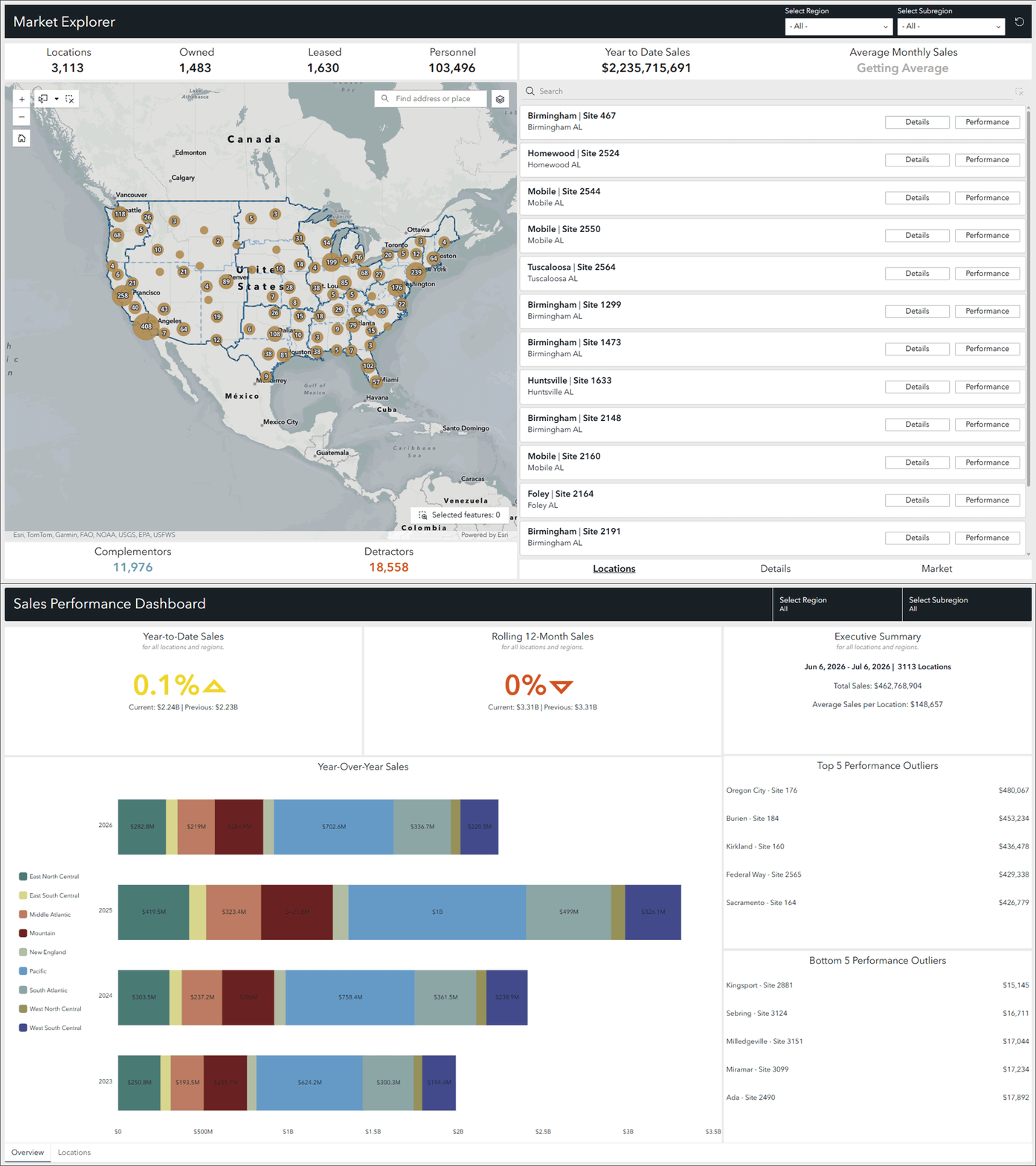
If you are a business that wants to evaluate individual sites and how they are shaped by customers, competition, demographics, and market conditions, we believe the Market Planning and Development solution will help.
Solar Panel Inspections
Solar facilities are increasingly being used to meet growing energy demands and these sites can contain thousands of interconnected solar panels that require routine inspection. Unfortunately, many organizations have not developed consistent inspection processes that ensure panels are operating safely and producing energy at an optimum level
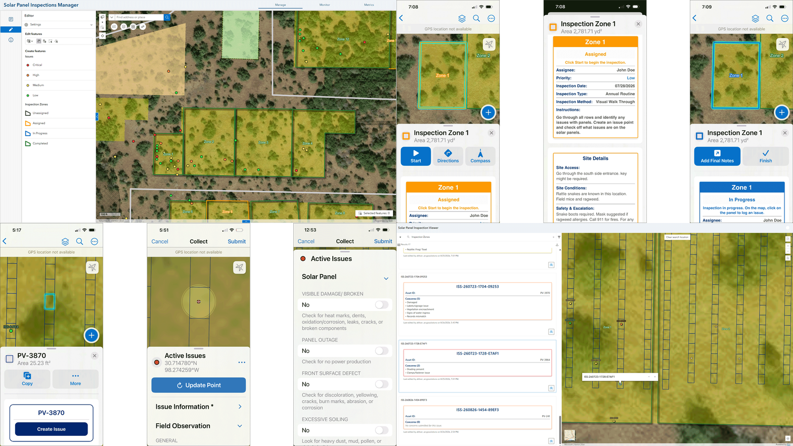
If you are an energy company that wants to define focused inspection areas across these vast geographies, coordinate assignments, and visualize panel inspection results, we believe the Solar Panel Inspections solution will help.
Virtual Damage Reporting
Conducting initial damage assessments in the field is often a time-consuming and resource intensive process that relies on windshield surveys, field reports, and other on-site methods. But with the convergence of post-disaster imagery and GeoAI models, damage classifications can be rapidly made from safe locations.
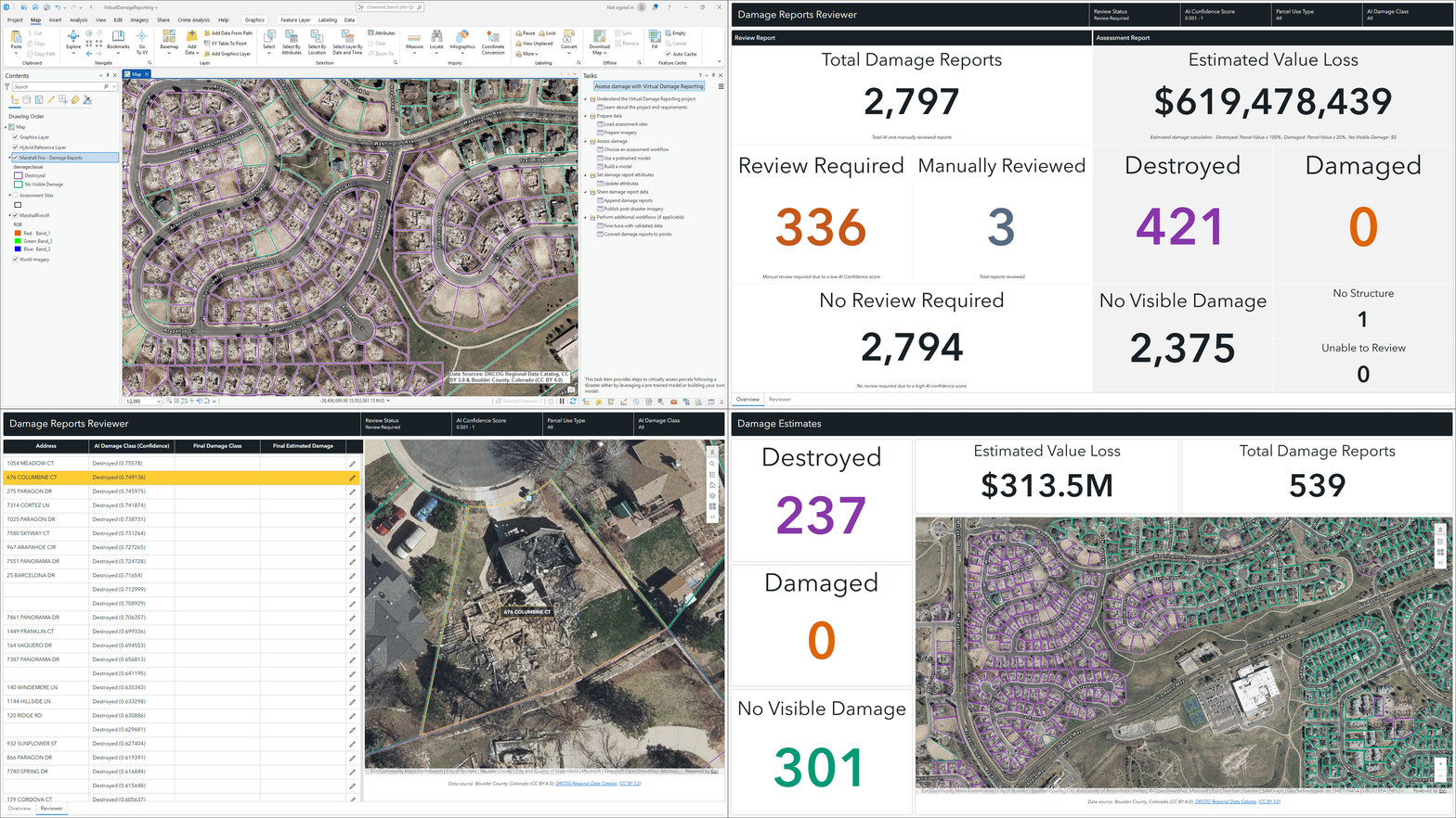
If you are an emergency management agency that wants to improve the speed of early damage estimates and understand where resources might be needed, we believe the Virtual Damage Reporting solution will help.
Enhancements
There are seven major enhancements to the existing portfolio in this release.
- Communications Utility Network Foundation
- Crime Analysis
- Emergency Debris Management
- Environmental Review
- Incident Awareness and Assessment
- Pre-Incident Planning
- Resource Management
Learn more about the minor enhancements to the existing solution portfolio also in this release.
Lifecycle changes
The following Local and State Government solutions have been moved to Mature life cycle phase: Community Data Aggregation, Electric Joint Use, My Neighborhood Services, Neighborhood Stabilization, and School Locator.
Help documentation for solutions moved to the Mature lifecycle phase can be found on the Archived help page.
Learn more
For more information about ArcGIS Solutions, check out the following resources:
- Explore the ArcGIS Solutions gallery.
- Learn more about ArcGIS Solutions.
- View the full collection of solution demo videos available to the community.



Commenting is not enabled for this article.