We have received some great feedback on the tools included in the Utility Data Management Support toolbox and wanted to share some details on the improvements we have made. If you are not familiar with the tools, please review our first blog on the toolbox.

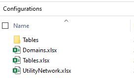
Batch Trace and Building Starting Points: We made several enhancements and bug fixes to the Batch Trace and Building Starting Points. Austin Water discovered these tools and reached out to see if they could be used to calculate an upstream summary of the length of pipes for each sewer main in their system. We worked through the problem with them and discovered we could accomplish this with some minor enhancements to the Batch Trace tool. We added the ability to store the function or summary information from a trace on the starting points used for that trace. For their workflow, we created a starting point at every pipe connection device, which are contained in manhole structure junctions. The Batch Trace looped over these pipe connections, one at a time, running an upstream trace and through a new option, stored the summary info on the starting points. This new ability to store summary information on the starting points opens a lot of options, such as storing the sum of ERUs from service locations, or number of upstream critical customers, the list of possibilities goes on. We also realized we did not provide the schema for the starting points layer and this caused them and others some challenges to get started. The internal code will generate the schema for you, but we have not exposed that in the GP tool yet, so you must provide an existing layer. You will find this schema in the repo to simplify getting started. We have a backlog item to expose the ability to generate a new table and a feature class for you. Big thanks to Austin Water to testing out these tools and sharing a great workflow.
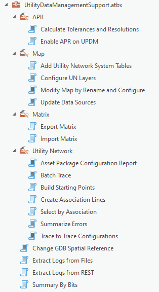
Toolbox: We have reorganized the toolbox and added a new toolset called Utility Network, that organizes the tools that are specific for the Utility Network. The Batch Trace, Building Starting Points, Create Association Lines, Select by Associations, Trace to Trace Configurations(renamed from Trace results to Trace configurations) have been moved to this folder.
In this toolset, you will find some new tools for the Utility Network.
Asset Package Configuration Report: This tool generates a collection of Excel Workbooks/Sheets to review the what properties are include/removed from the result by selecting 1 or more configurations. Multiple configurations can be selected to compare the results. Running this tool is much faster than running Apply Asset Package and reviewing the results in a GDB.

Summarize Errors: A dirty area in the Utility Network can contain 1 or more errors. Deciphering these errors and running reports on them to determine the types of errors in the system during data migration can be complicated. This tool generates a Mobile GDB with features for each error in the Utility Network and summary views. Making it easy to review errors, create a report of the types of errors and evaluate batch processes to resolve errors.

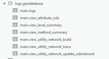
Extract Logs from Files/Rest: The log files created by ArcGIS Server and ArcGIS Pro are very useful in troubleshooting performance and configuration issues. These tools extract that information and stores it into a Mobile GDB, which is a SQLite database. A series of views are prebuilt to allow you to hone in on particular operations. If you are querying a lot of log information from ArcGIS Server, instead of using Extract Logs from Rest, it is faster to use Extract Logs from Files and browsing to the ArcGIS Servers log folder.

Thank you for your feedback and please log any issues you encounter in our repo with the tools.
Commenting is not enabled for this article.