ArcGIS Solutions helps you make the most of your GIS by providing purpose-driven, industry-specific configurations of ArcGIS.
Wind turbines are high-value assets. A single wind site can span hundreds of acres and include more than a hundred wind turbines, along with a complex network of cables, transformers, poles, sensors, and met towers. The result? Thousands of turbines operating across vast, often remote landscapes.
Wind site operators are not only responsible for managing this intricate inventory, they’re also in charge of managing site boundaries, access points, and environmental constraints. Maintaining accurate, up-to-date records of their infrastructure and assets is challenging, and without a centralized system, keeping track of everything can be overwhelming.
But you can take a deep breath; ArcGIS Solutions has you covered. Designed specifically for operational wind farms—both onshore and offshore—our new Wind Site Data Management solution includes a set of easy-to-use tools and data models to help you map, manage, and maintain your wind sites.
Easily map your site
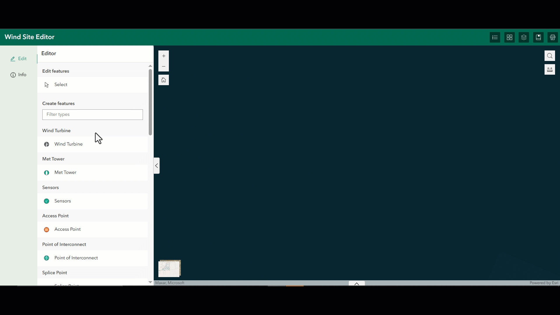
Whether you’re building a new site map from scratch or integrating existing records, you’ll be blown away by how easy it is to get started with Wind Site Data Management. The solution comes with a set of preconfigured layers and fields that reflect the most common wind site features, making it simple to load existing site data online or using ArcGIS Pro
If you’re just getting started, you can easily begin building your inventory by using the existing layers and templates that come ready for use with the initial solution deployment.
After your data is in place, you can immediately begin viewing, editing, and sharing it across your organization.
Instantly visualize in 3D
With Wind Site Data Management, in addition to the traditional 2D maps, you can visualize your wind site in 3D. This makes it easier for you to visualize and understand your wind site and plan maintenance activities. And best of all, the solution simplifies the 3D configurations needed to make a scene. Because the solution includes default values and smart configurations, you can generate a 3D scene with just a few clicks. You can then customize attributes like turbine height, rotation, and elevation to match real-world conditions or customize the visualization to highlight.
Track turbine components
Wind turbines are a combination of many parts, and tracking them individually can be critical for maintenance and warranty management. The solution includes related tables that you can use to track component-level details such as component name, description, model and part number and when it was installed. Field techs can use this information to look for patterns in maintenance and make more informed maintenance decisions.

Access, view, and edit info anywhere
With Wind Site Data Management, data only needs to be added once, and then both stakeholders and your team have the same real-time access to it. Fieldworkers can capture and modify assets using a mobile device, and editors can view or update that same data back at the office. And with built-in sharing tools, collaborators can view the same data and dashboards—like turbine metrics and power output—without missing a beat.


One-click deployment
Wind Site Data Management is included in ArcGIS and can be deployed to your ArcGIS Online organization with a single click. Start mapping your wind site today!
Learn more
For more information about the Wind Site Data Management solution, check out the following resources:
- Learn how to deploy, configure, and use the solution.
- View a demo video.
- Learn more about ArcGIS Solutions.

Commenting is not enabled for this article.