As military forces adapt to evolving global conflicts and threat capabilities, greater emphasis is being placed on littoral environments. Amphibious and expeditionary operations depend upon a detailed understanding of coasts, beaches, and nearshore bathymetry, creating a need for geospatial intelligence of these areas.
To support these missions, analysts need repeatable workflows that help them rapidly characterize beaches, document findings, and create foundational geospatial data. Esri’s Beach Analysis solution helps defense organizations streamline this process. Included with ArcGIS, Beach Analysis can be deployed and then downloaded for use in ArcGIS Pro or ArcGIS AllSource.
Streamline geospatial intelligence
The Beach Analysis solution includes an ArcGIS Pro project that intelligence staff can use to assess tidal limits, create littoral topography features, characterize beach conditions, and share the resulting geospatial intelligence.
Assess tidal limits
High and low tide water lines are foundational littoral reference features that help define the extent of beach features. These water lines also have significant operational impacts. How much of the beach is exposed at low tide? At high tide, how wide is the beach for landing craft? How far will a unit need to travel across open beach before reaching cover and concealment further inland? An accurate definition of tidal limits helps answer these questions and provides critical context for beach analysis and operational planning.
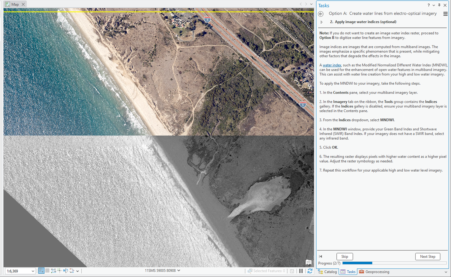
Using Beach Analysis, an intelligence analyst can digitize water line features from electro-optical (EO) or synthetic aperture radar (SAR) imagery. The solution also provides a geoprocessing tool that generates water line features from water-index rasters created from EO imagery.
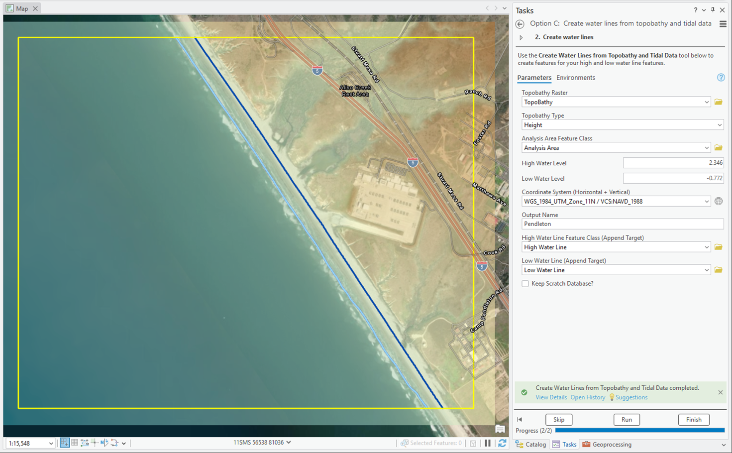
Analysts can use a second geoprocessing tool to generate water line features from topobathy and tidal data that reference the same vertical datum.
Create littoral topography features
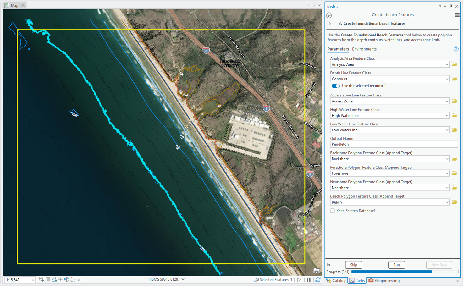
In addition to water line creation, Beach Analysis guides users through loading and processing topobathy data and digitizing access zone limits. The topobathy contours and zone limits are then paired with water line features and used in a consolidated geoprocessing tool to create foundational beach features. The resulting features include backshore, foreshore, nearshore, and beach polygons that adhere to doctrinal schema requirements.
Characterize beach features
Feature attribution is just as critical as feature geometry when delivering comprehensive geospatial intelligence. The solution provides step-by-step guidance for populating beach feature attributes such as configuration, elevation, surface slope, and vegetation conditions.
Disseminate analysis
After completing their analysis, analysts have several options for sharing information with operations staff members or leadership directly from ArcGIS Pro or ArcGIS AllSource. For example, they can publish and share services through their ArcGIS Online organization or ArcGIS Enterprise portal. These services can then be added to planning or operations applications that can be used by the entire team.
Analysts can also create a map layout that can be shared as a PDF file or even printed and distributed to other staff members.
The Beach Analysis solution helps defense organizations create foundational beach geospatial intelligence. By making this information accessible to operations staff and leadership, these organizations can reduce information silos and improve overall unit effectiveness.
Learn more
For more information about the Beach Analysis solution, check out the following resources:
- Learn how to deploy, configure, and use the solution.
- View a demo video.
- Discover related solutions: HLZ Suitability, Military Ground Mobility, Weather Operational Effects.
- Learn more about ArcGIS Solutions.

Commenting is not enabled for this article.