More than six years after its addition to ArcGIS StoryMaps, the map tour block remains one of the app’s most popular features, and it’s easy to see why. Allowing authors — even those with little to no GIS training or experience — to easily create immersive, map-based, multimedia experiences is what sets StoryMaps apart as a place-based storytelling tool.
For storytellers who are interested in adding extra context or information to a map tour, there are some additional options in the map tour block. One of those options is the ability to pull in your own basemap; to do that, just Edit the tour block in the builder and choose Browse more maps in the basemap picker (as shown in the short video below). You’ll be able to select from any web maps created by you, people in your organization, and even a huge array of public maps and pre-designed maps from the ArcGIS Living Atlas.
This article will outline some clever uses for custom basemaps that can provide a more robust experience for your map tour audience.
Layers of context
One key benefit to using a custom basemap in a map tour is that it will include any feature layers visible in the map’s default view (though note that feature pop-ups will not be accessible within a tour block).
These additional layers can provide thematic data that gives readers a better understanding of the tour content. For example, a tour of animal habitats might include species ranges. A tour of national parks might display park boundaries, and so on.
Sketch layers and media layers can also be added in Map Viewer and then used to great effect within map tours.
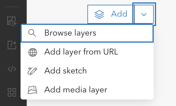
Sketch layers allow manual creation of points, lines, polygons, and annotations. For instance, an author could draw a specific route line for a guided tour (generalized progress lines between points are togglable in the options for a guided tour, but those lines don’t follow actual streets or waterways, etc.). Media layers allow map creators to paste an image directly onto a map as its own layer. In terms of a map tour, these layers can be used to add additional iconography or imagery to tour points.
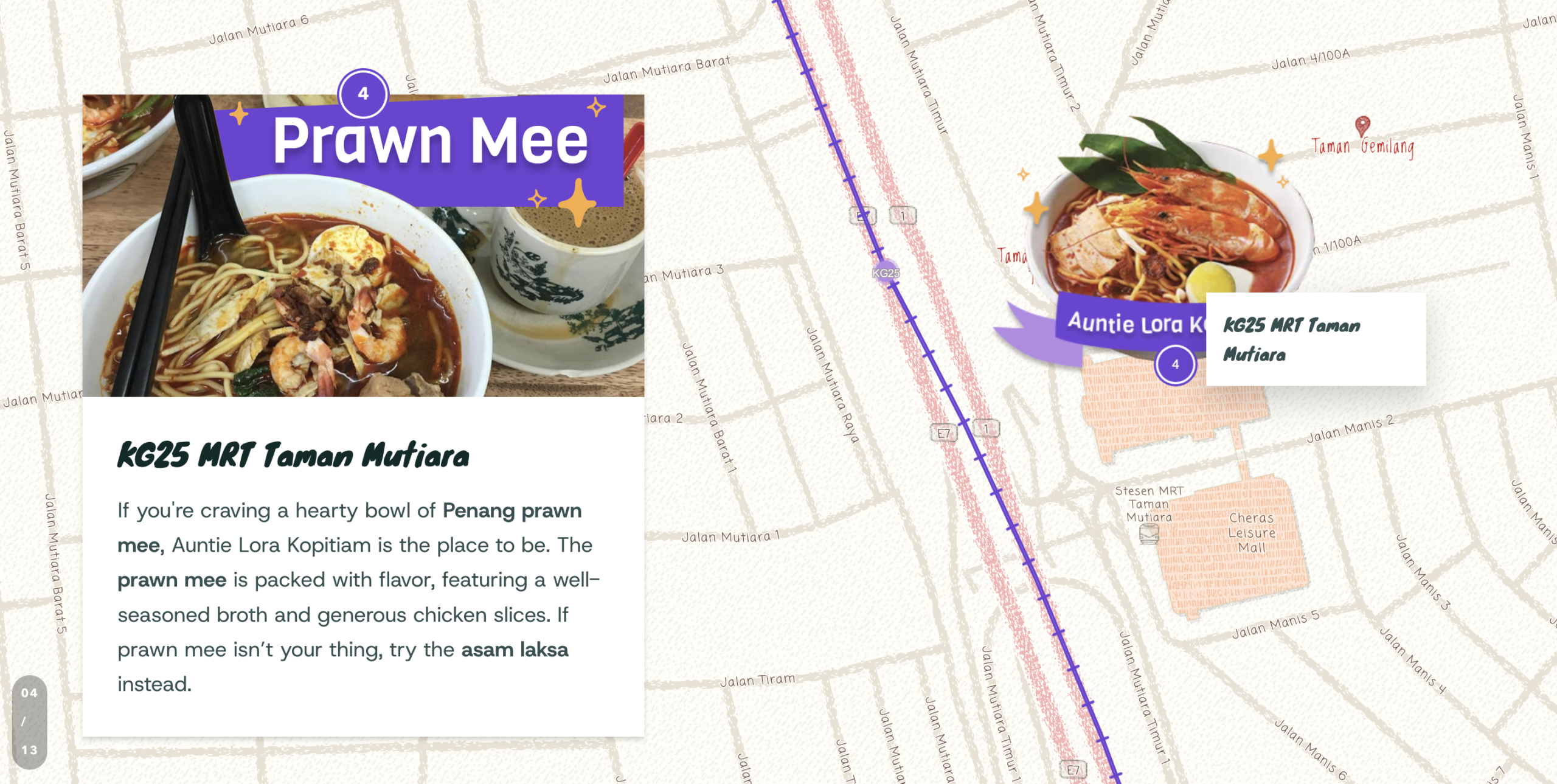
The story May I Walk You Home? uses a basemap with additional layers quite creatively to make a map tour come to life. The tour uses particular restaurant dishes to illustrate the benefits of transit-oriented development. A “train track” illustrates the transit route atop Living Atlas’ playful colored pencil basemap, while media layer images of each mouth-watering menu item appear directly on the map at each stop.
Building a better basemap
Sometimes, relatively small tweaks to the basemap itself can make a significant difference in how that map works in conjunction with other content, like in a map tour. ArcGIS makes those tweaks possible using the Vector Tile Style Editor (VTSE). [If you’re unfamiliar with it, this tutorial can help you get up and running.]
Here are some ways the VTSE can be used to modify basemaps for use in a map tour:
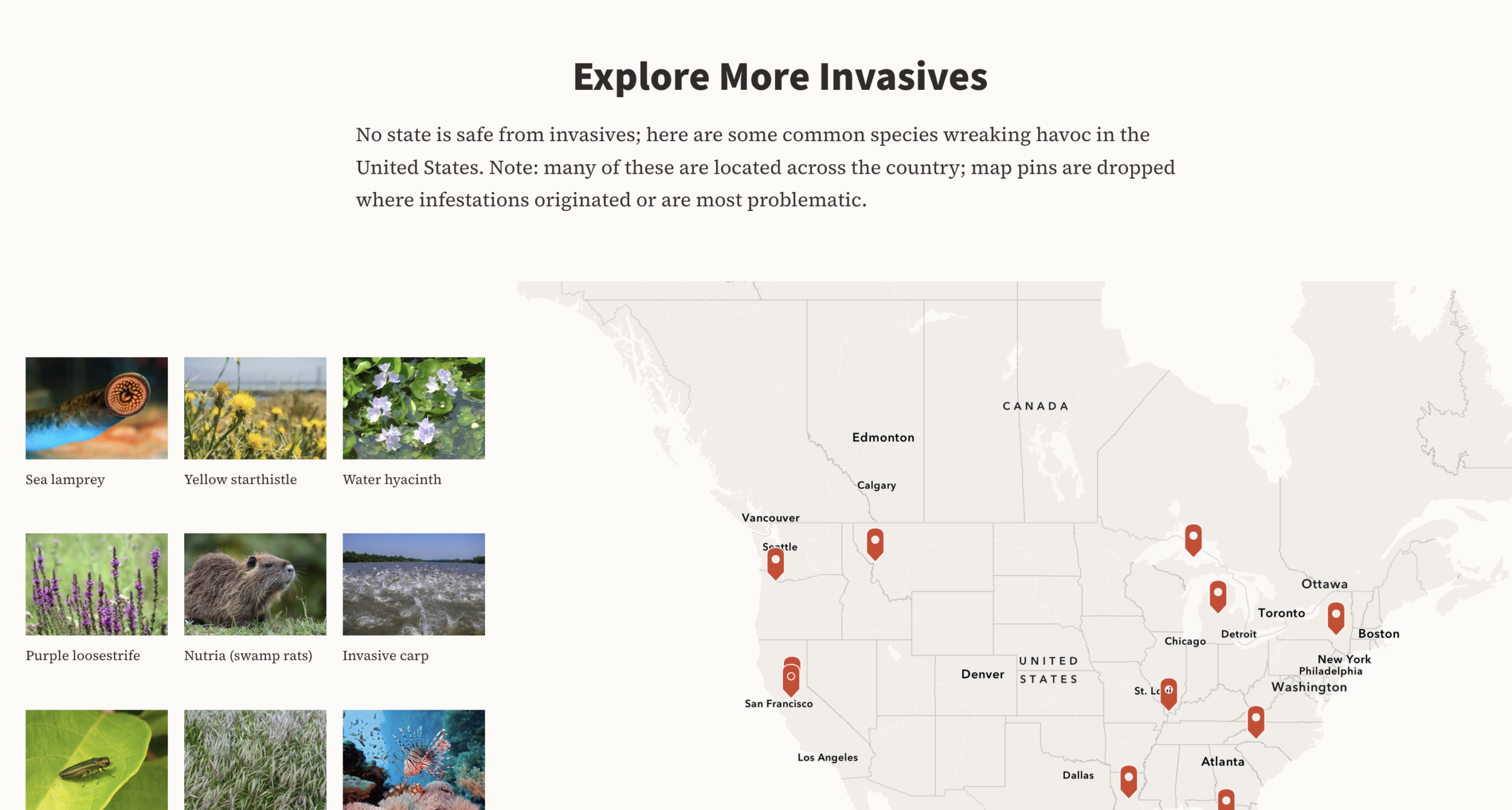
- Matching story design seamlessly — changing elements like the ocean or land colors to precisely match the overall story theme can go a long way toward giving the audience a seamless, cohesive reading experience. In the story What’s that bug?, for example, the ocean color is exactly the same as the story background, making the tour block feel like part of a natural progression in the story rather than a sudden intrusion to it.
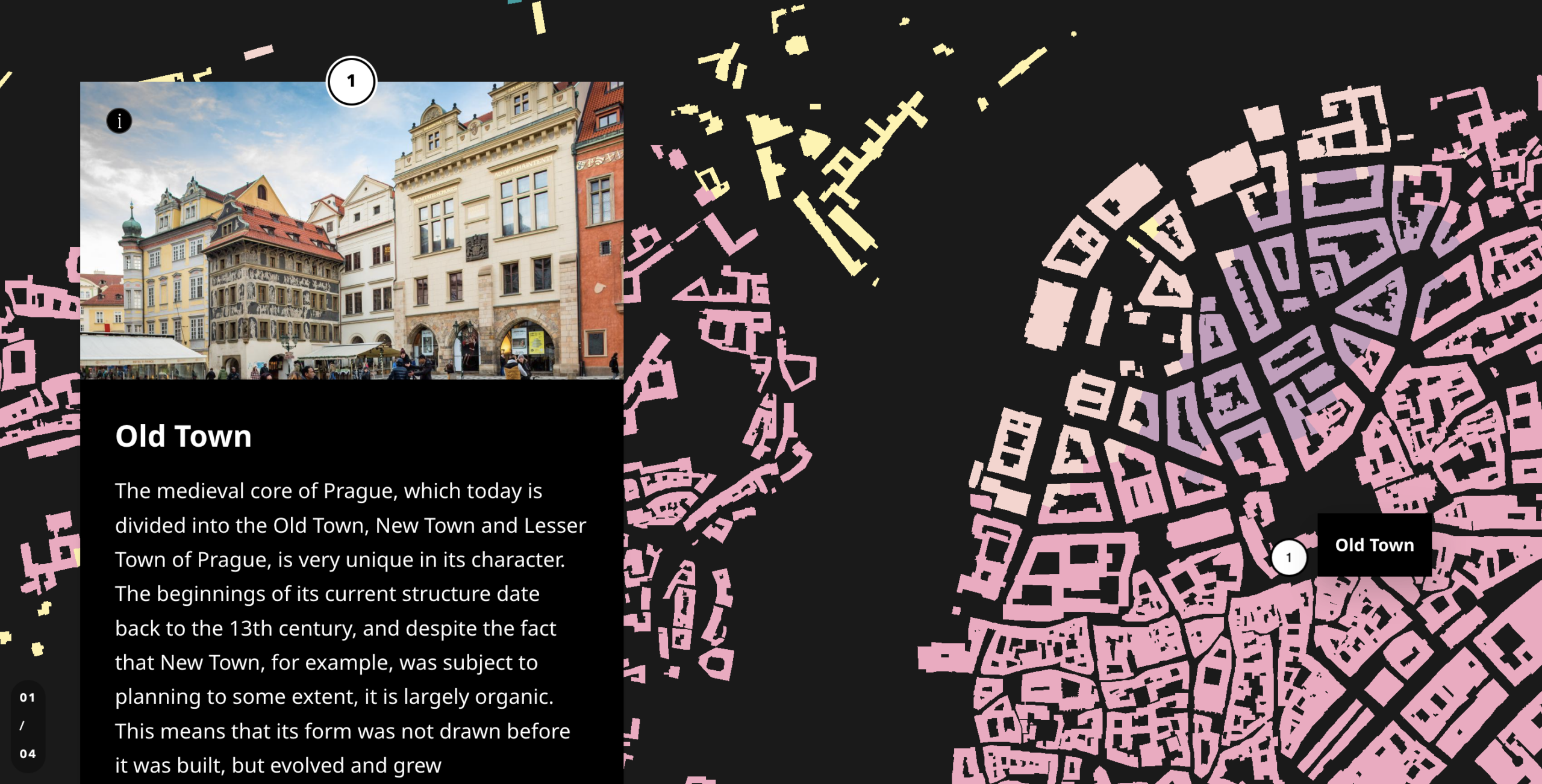
- Removing irrelevant details — There’s a LOT of information present on pretty much any basemap, and there are plenty of situations where you might not need all of it. The VTSE lets you govern exactly what gets shown on a basemap and at which scales. If things like every street name, point of interest labels, and so on are more distracting than useful alongside the information presented in your tour, you can turn those things off to give your map a cleaner feel.The basemaps used in the map tour in the story The Diverse Prague take this practice to the extreme — everything is hidden except for building outlines, which are color-coded to match different architectural and urban planning styles and vintages, because that’s the only information the tour is looking to relate.
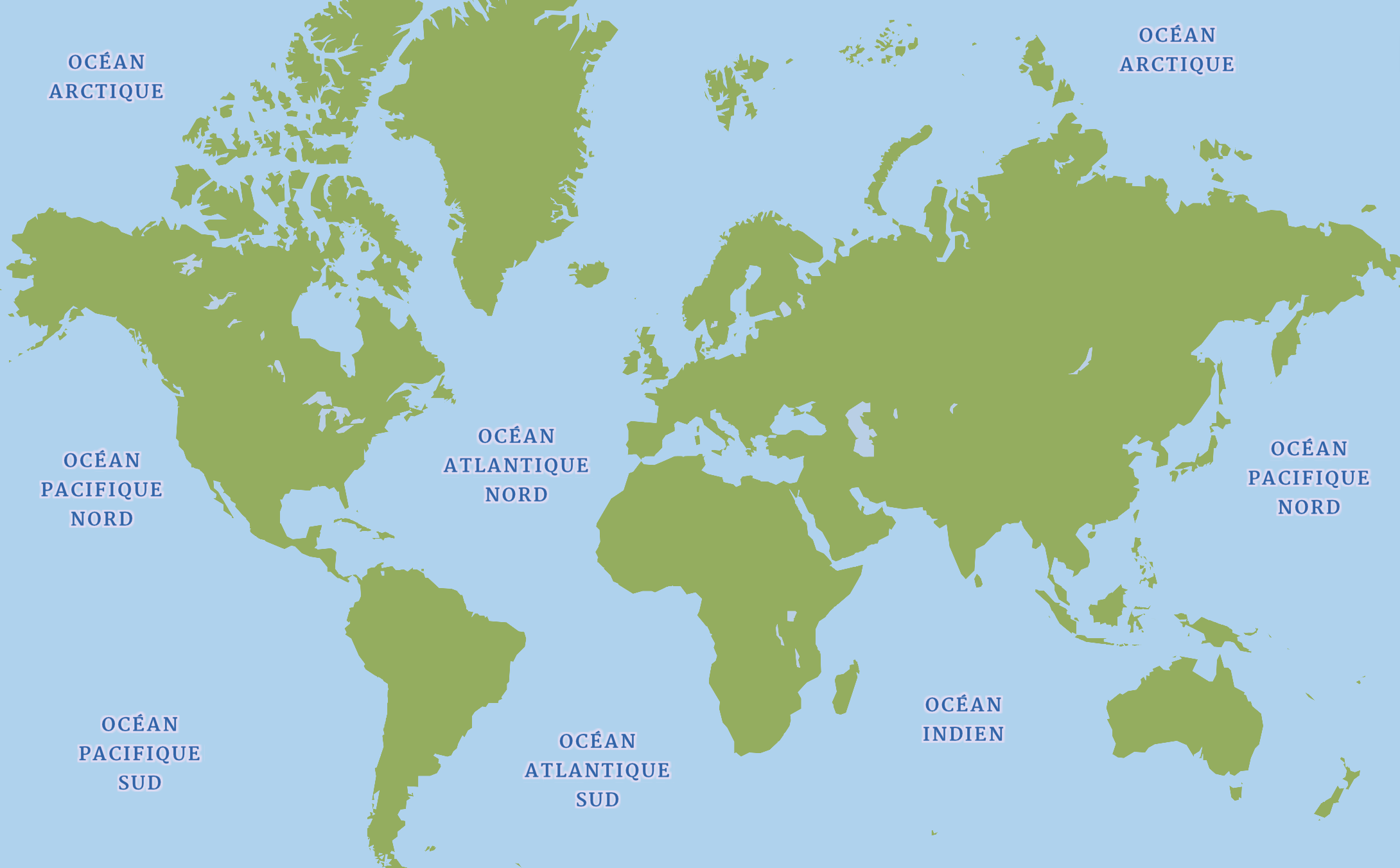
- Creating translated content for multilingual storytelling — There are many reasons to have versions of a story in multiple languages. The VTSE allows translation of place names and other map labels to make basemaps more accessible to the target audience in a given language. For the French language and Spanish language editions of the story Meet the Beaver, for instance, a modified version of Esri’s children’s basemap was used, with labels appearing in French or Spanish at the smaller scales displayed in the story.
Thinking beyond maps
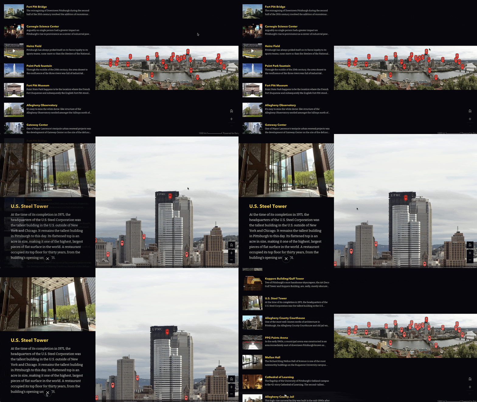
Finally, returning to media layers, let’s get really radical and talk about how they can even be used to replace the map entirely. Doing so means that anything you can do with a map in ArcGIS StoryMaps, you can do with an image, instead. When it comes to map tours, you can set up a tour of that particular image.
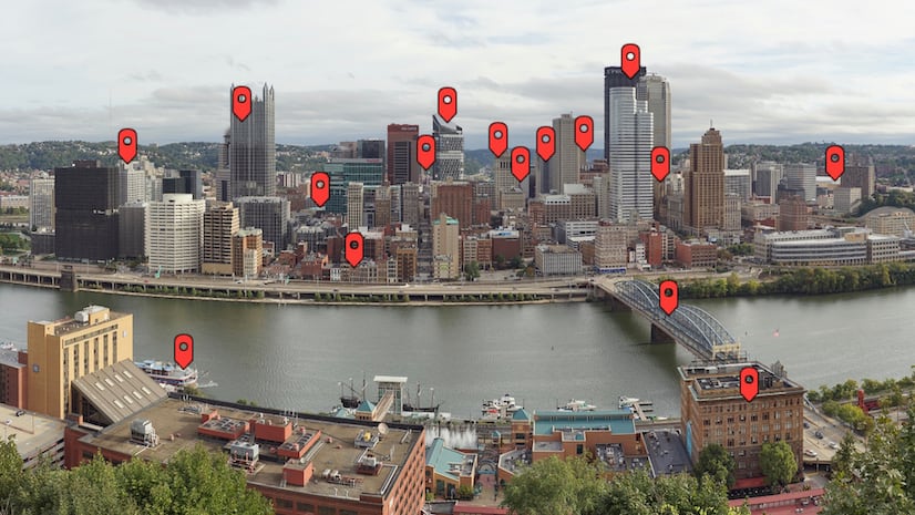
The story The golden view ends with an explorer tour of the city of Pittsburgh — but it’s actually a tour of the city’s skyline, via a panoramic photo that’s been plastered over an entire map as a media layer.
Another example of this treatment can be found in the story Answering the call, about mountain rescue teams and the situations that require them. In this story, an illustration of critical hiking gear is presented as a media layer in a guided tour. Readers can walk through each item of equipment and learn more about its importance.
____________________
We hope learning about some of these possibilities has started the gears turning in your head about creative ways to present your own content using map tours with custom basemaps. These techniques can also be combined, opening up even more creative possibilities. We’re excited to see all the innovative stories you come up with!
If you’re still relatively new to StoryMaps and would like to learn more about the map tour block and its functionality and capabilities, I’d recommend starting with these introductory blog posts about its two layouts, guided and explorer. Then get inspired with collections of some great examples of both guided and explorer map tours.
____________________
Cover image © Adobe Stock



Article Discussion: