
Real-time data is transforming how organizations detect, respond to, and manage critical events. ArcGIS Velocity extends ArcGIS into real time, enabling continuous ingestion, analysis, and actuation of streaming data from sensors, IoT devices, and other external intelligence platforms.
The June 2026 release of ArcGIS Velocity for ArcGIS Online introduces new feeds, analytics, and makes enhancement to the user experience for improved usability.
Here are several highlights of the June 2026 release:
Feeds
- Ingest real-time breaking event alerts from Dataminr, a platinum Esri partner, using the Dataminr feed to improve situational awareness and accelerate incident response.
- Receive artificial intelligence (AI)-powered real-time events, threats, and risk intelligence for public sector organizations from the Dataminr First Alert product using the Dataminr First Alert feed for emergency and first responder workflows.
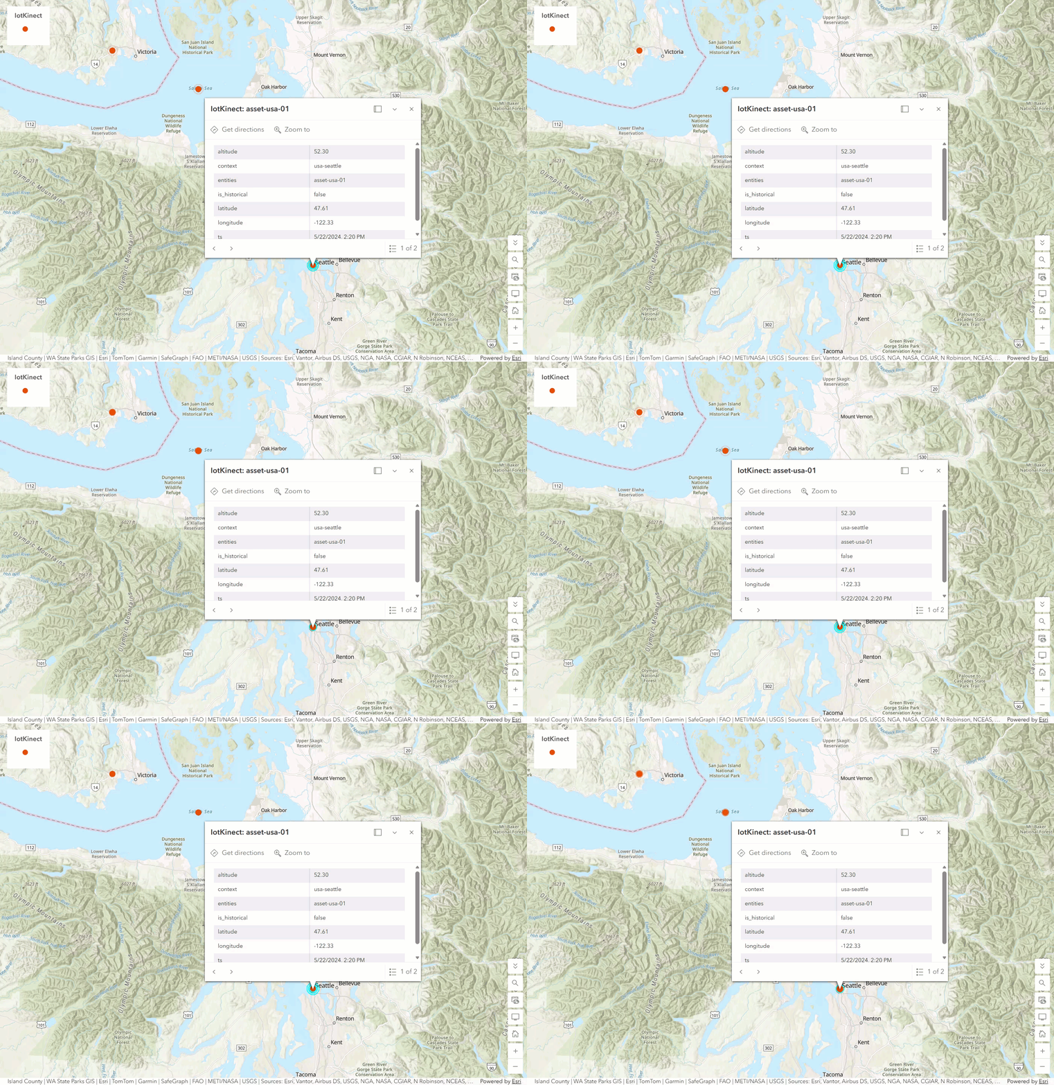
- Stream real-time industrial Internet of Things (IoT) and sensor telemetry from Long Range Wide Area Network (LoRaWAN) devices into ArcGIS Velocity using the IoTKinect feed for live spatial monitoring and alerting.
- Ingest real-time AVL and telematics data from CompassCom using the CompassCom feed for live tracking and analysis of vehicles, personnel, and field assets from any device, anywhere.
- Stream real-time telematics data and fleet intelligence from Raven Connected using the Raven Connected feed to gain insights into vehicle behavior and operational conditions for improved road safety and situational awareness.
- Capture real-time global crisis and event alerts from the Samdesk global event detection platform using the Samdesk feed to support operational awareness and decision-making.
Analytics
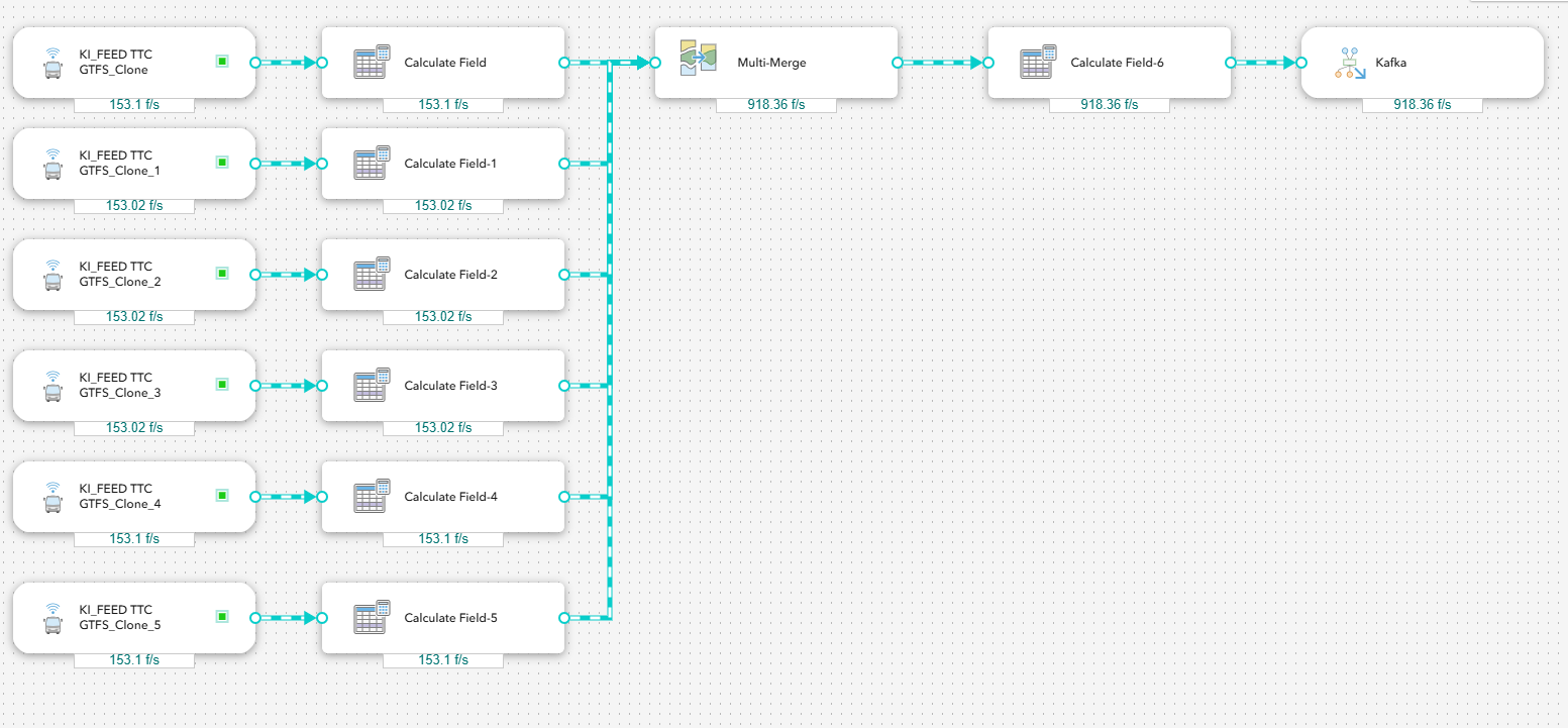
- Combine two to ten input pipelines with matching feature geometry types into a single schema using the Multi-Merge tool in both real-time and big data analytics.
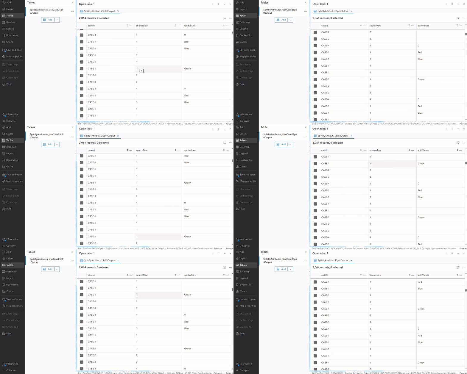
- Transform and analyze complex event data more efficiently by splitting delimited attribute values into individual records using the Split by Attributes tool.
General
- Explore the other enhancements and bug fixes in this release with a complete list of what’s new.
Now, let us take a deeper dive into each of these and other new capabilities and enhancements in this release!
Feeds
Dataminr
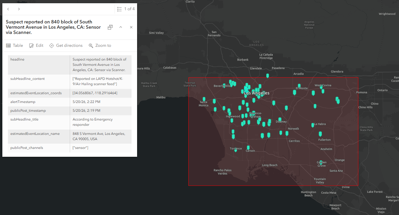
The Dataminr feed brings AI-powered, real-time event intelligence directly into ArcGIS Velocity, enabling organizations to detect emerging risks and respond faster. By ingesting alerts from Dataminr’s global event detection platform, you can visualize and analyze breaking events in real time within your existing ArcGIS maps, apps, and dashboards.
This integration connects real-time detection with real-time spatial analysis, helping close the gap between awareness and action. Organizations can monitor incidents as they unfold, filter for relevance using real-time analytics, and operationalize insights to support faster, more informed decision-making.
Dataminr’s real-time data is valuable for a wide range of use cases, including corporate security teams protecting people and facilities, supply chain and logistics operators monitoring disruptions, and public sector organizations maintaining regional situational awareness. All alert attributes are preserved during ingestion, providing a rich foundation for downstream analytics, dashboards, and operational applications.
Dataminr First Alert
For public sector and emergency response workflows, the Dataminr First Alert feed provides a purpose-built integration designed for rapid, time-sensitive decision-making. This feed delivers critical event information with reduced latency compared to traditional notification methods or feature layer ingestion. This enables emergency operations centers, first responders, and public safety agencies to receive and act on critical event information as quickly as possible, supporting faster coordination and response during evolving incidents. Dataminr First Alert operates similarly to the Dataminr feed but is designed for public-sector use cases.
Access to either Dataminr feed is purchased directly from Dataminr.
Note: After configuring a Dataminr or Dataminr First Alert feed, you need to send your feed username, password, and HTTP endpoint URL to Dataminr Customer Service to push data to your feed. If the username or password is unavailable, create new credentials and provide them to Dataminr Customer Support.
CompassCom
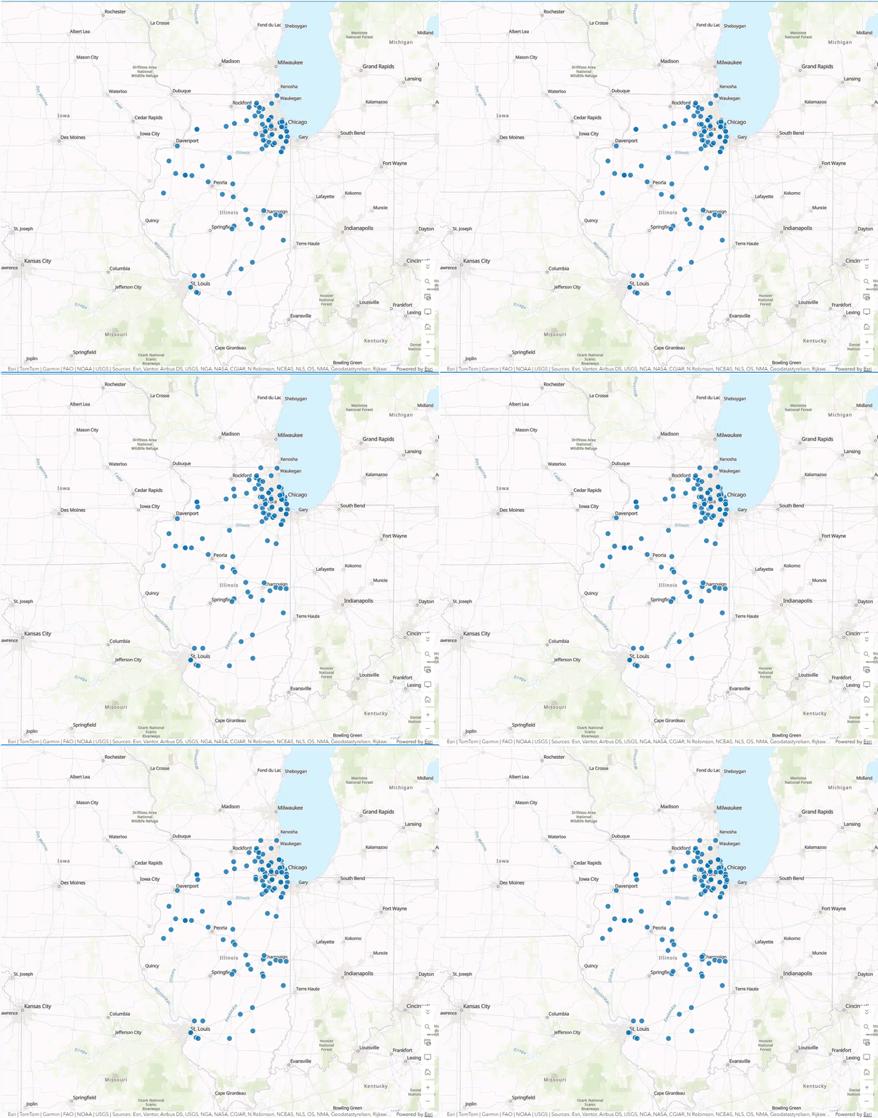
The CompassCom feed in ArcGIS Velocity delivers real-time location data from vehicles, land mobile radios, smartphones, and IoT devices through a single, continuous stream. CompassCom is a long-standing Esri partner providing Automatic Vehicle Location (AVL) and telematics solutions. The data that can be ingested through the feed enables the tracking of vehicles, land mobile radios (LMR), smartphones, and IoT devices deployed in the cloud or on-premises to meet cybersecurity and IT requirements, enabling reliable tracking across a diverse range of network environments. CompassCom supports GPS location from Motorola radios, providing live situational awareness.
By integrating this data into ArcGIS Velocity, organizations can monitor and analyze the movement of fleets and field personnel in real time, improving operational awareness and coordination. This is especially valuable for defense, federal, and public safety agencies in maintaining operational awareness of vehicles, personnel, and field assets from any device, anywhere.
For organizations migrating from ArcGIS GeoEvent Server, the CompassCom feed delivers a straightforward path to ingesting CompassCom GPS and Telemetry data in Velocity. Access to CompassCom solutions and data can be purchased directly from CompassCom.
Raven Connected
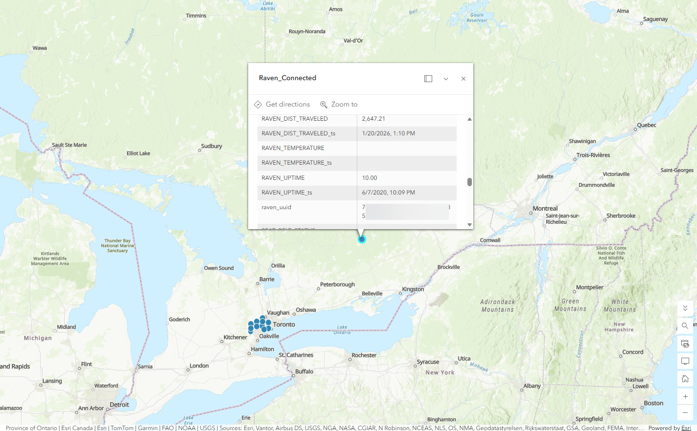
The Raven Connected feed simplifies ingesting data from Raven Connected, a provider of real-time fleet, roadway, and work zone intelligence. Through Velocity, users can process and analyze vehicle location and significant telematics data for operations. Access to Raven Connected is purchased through the Raven Connected platform.
Samdesk
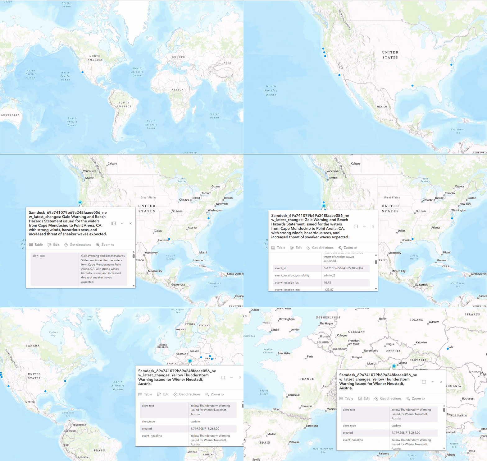
Monitoring emerging global events through manual tracking social media, media, news, and other sources often results in delayed awareness and limited visibility into incidents. The Samdesk feed simplifies ingesting real-time crisis and event alerts from Samdesk, an AI-powered global event detection platform that continuously scans social media, news, and other open sources to surface emerging incidents, including natural disasters, fires, threats, and other public safety events. These geolocated alerts are ingested into ArcGIS Velocity as events unfold, enabling organizations to visualize, analyze, and act on real-time information within their existing maps and applications. This improves situational awareness and supports faster, more confident decision-making across one or more geographic areas of interest.
The Samdesk feed is valuable across a range of workflows, including public safety agencies and emergency operations centers coordinating response efforts, logistics and supply chain teams monitoring disruptions near ports and distribution centers, defense and intelligence organizations maintaining regional awareness, and risk and insurance analysts tracking incidents that may impact assets. Access to Samdesk is purchased directly through the Samdesk platform.
IoTKinect
Connecting to diverse IoT devices and sensor networks can be complex, especially when data comes from multiple vendors, protocols, and formats. The IoTKinect feed in ArcGIS Velocity simplifies this process by providing access to real-time observations from a wide range of IoT devices and remote sensors through a single, unified integration. IoTKinect aggregates and normalizes data across multiple device types and communication protocols, including Long Range Wide Area Network (LoRaWAN) devices. With Velocity, you can focus more on creating analytics and less on preparing aggregating and preparing real-time data.
This feed supports monitoring of movement, occupancy, environmental conditions, and equipment activity, making it valuable for facilities and operations teams, environmental monitoring, asset and equipment tracking. The IoTKinect feed is especially valuable for facilities and operations teams, environmental monitoring initiatives, and asset tracking workflows. Access credentials are purchased through IoTKinect.
Analytics
Multi-Merge
Managing multiple real-time data feeds has traditionally required complex workflows, especially when combining similar data from different sources. In previous releases, users often relied on chaining multiple Merge tools, which are limited to only two inputs, resulting in analytics that were difficult to build, scale, and maintain.
Previously limited to real-time analytics, the Multi-Merge tool is now available for big data analytics. This tool enables users to consolidate multiple input layers into a single output layer. It expands upon the capability of the existing Merge tool. Multi-Merge combines two to ten input layers with identical feature geometry types (tabular, points, lines, or polygons) with at least one corresponding field name and type into a single schema.
By simplifying how multiple feeds are consolidated, Multi-Merge reduces workflow complexity and makes it easier to build and manage both real-time and big data analytics. This is particularly valuable for common scenarios such as combining multiple AVL or IoT feeds into a single layer for monitoring dashboards, operational applications, or downstream analysis.
For organizations transitioning from ArcGIS GeoEvent Server or expanding existing Velocity deployments, Multi-Merge provides a more efficient and scalable approach to handling multiple data sources
Split by Attributes
Real-time data can arrive with multiple values packed into a single field, making it difficult to properly configure analytics in Velocity. The Split by Attributes tool in ArcGIS Velocity simplifies this process by automatically parsing delimited values, such as comma-separated lists, semicolons, or forward slashes, into individual records at ingest. Each resulting record retains all original attributes, allowing every value to be independently analyzed, routed, or summarized.
This is especially valuable in common operational scenarios, such as emergency dispatch records referencing multiple response units (E12, L3, M5), utility events listing affected circuits (CIR-104; CIR-991; CIR-120), or weather alerts spanning multiple zones (ZoneA/ZoneB/ZoneC). By treating each value as its own event, real-time data is now ready for immediate analysis.
For organizations migrating from ArcGIS GeoEvent Server, this capability brings the Field Splitter processor functionality into ArcGIS Velocity.
Questions and feedback
Do you have questions or feature requests for ArcGIS Velocity? Be sure to post your questions and product ideas on the ArcGIS Velocity place in the Esri Community.


Article Discussion: