When fast turnaround is more important than maximizing detail, Rapid Quality helps you move from image capture to actionable mapping products in significantly less time.
Originally introduced in ArcGIS Reality Studio 2025.2 and ArcGIS Drone2Map 2026.1, Rapid Quality is now available in Site Scan for ArcGIS and will be added to ArcGIS Reality Pro 3.8.
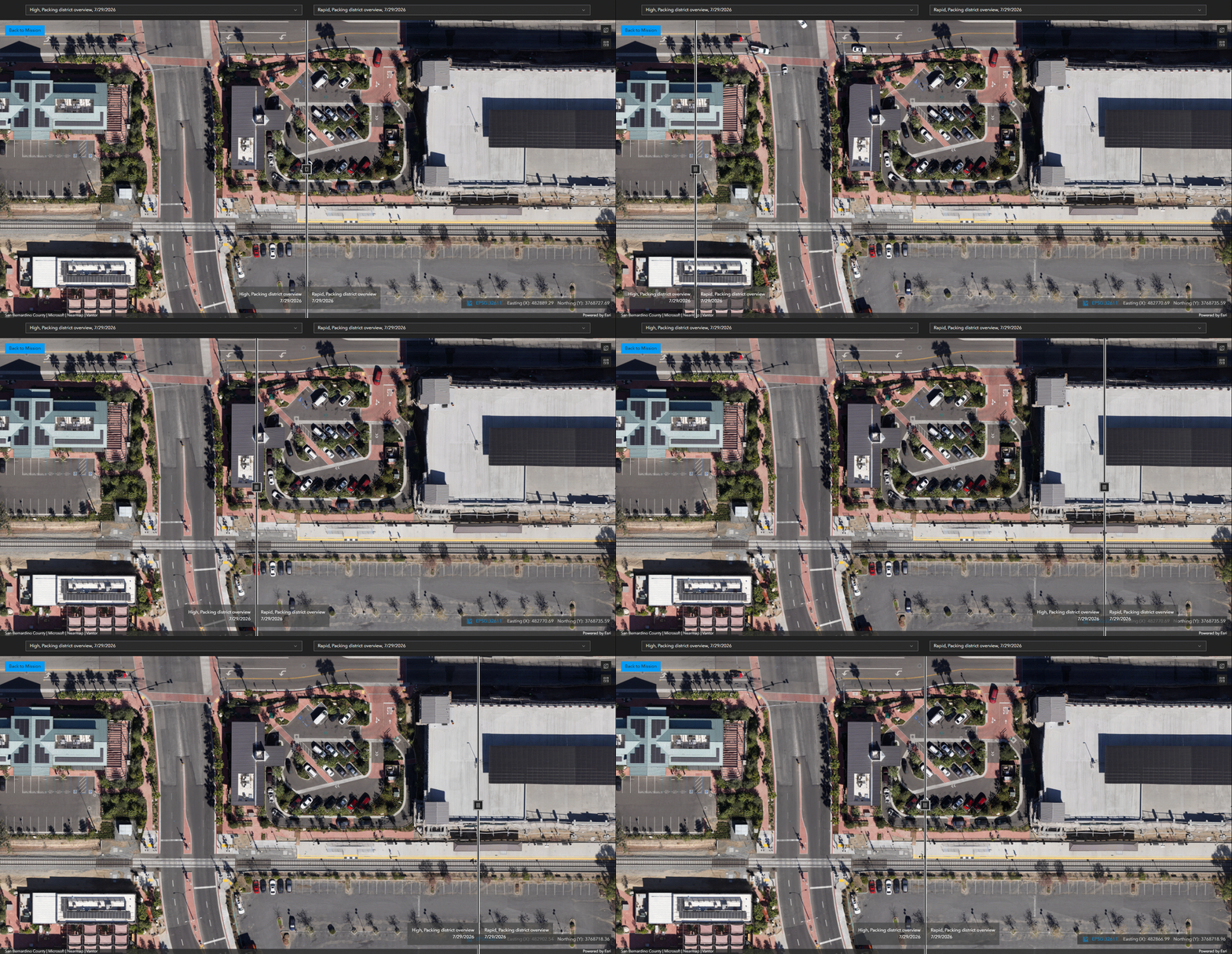
What Makes Rapid Quality Different?
Designed for rapid 2D product generation, Rapid Quality is a new processing mode that trades some reconstruction detail for significantly faster processing. Users can generally expect processing times that are three to four times faster than High Quality, although actual performance will vary based on mission characteristics and, for desktop products, available computing resources.
This tradeoff significantly reduces processing times while still producing True Orthos and DSMs suitable for workflows where timely results matter most, such as:
- Disaster response and damage assessment
- Environmental inspections
- Imagery validation and quality assurance workflows
Choose the Right Processing Mode
Rapid Quality joins High Quality and Ultra Quality as processing options across Esri’s reality mapping software.
- Rapid Quality prioritizes speed and efficient generation of 2D mapping products.
- High Quality balances processing time and reconstruction detail.
- Ultra Quality is intended for projects that require the highest level of detail and visual fidelity.
Projects processed using Rapid Quality can always be reprocessed later using High or Ultra Quality settings, allowing teams to quickly assess conditions and make decisions before investing additional processing time in higher-detail outputs.
For Best Results
Rapid Quality should be used with nadir or low-oblique imagery captured well above elevated features such as buildings and other structures.
It is generally not recommended for high-oblique image collections, such as perimeter scans, or for low-altitude flights where maximizing reconstruction detail is important. In these scenarios, High or Ultra Quality processing will typically produce better results.
Rapid Quality is optimized for generating 2D products. While ArcGIS Drone2Map and ArcGIS Reality Pro allow 3D product generation with Rapid Quality, High or Ultra Quality processing is generally recommended for 3D workflows.
Start Processing Faster
Rapid Quality provides another way to balance speed and detail across Esri’s reality mapping applications. By delivering 2D mapping products in less time, it helps organizations move from image capture to actionable results when time matters.

Article Discussion: