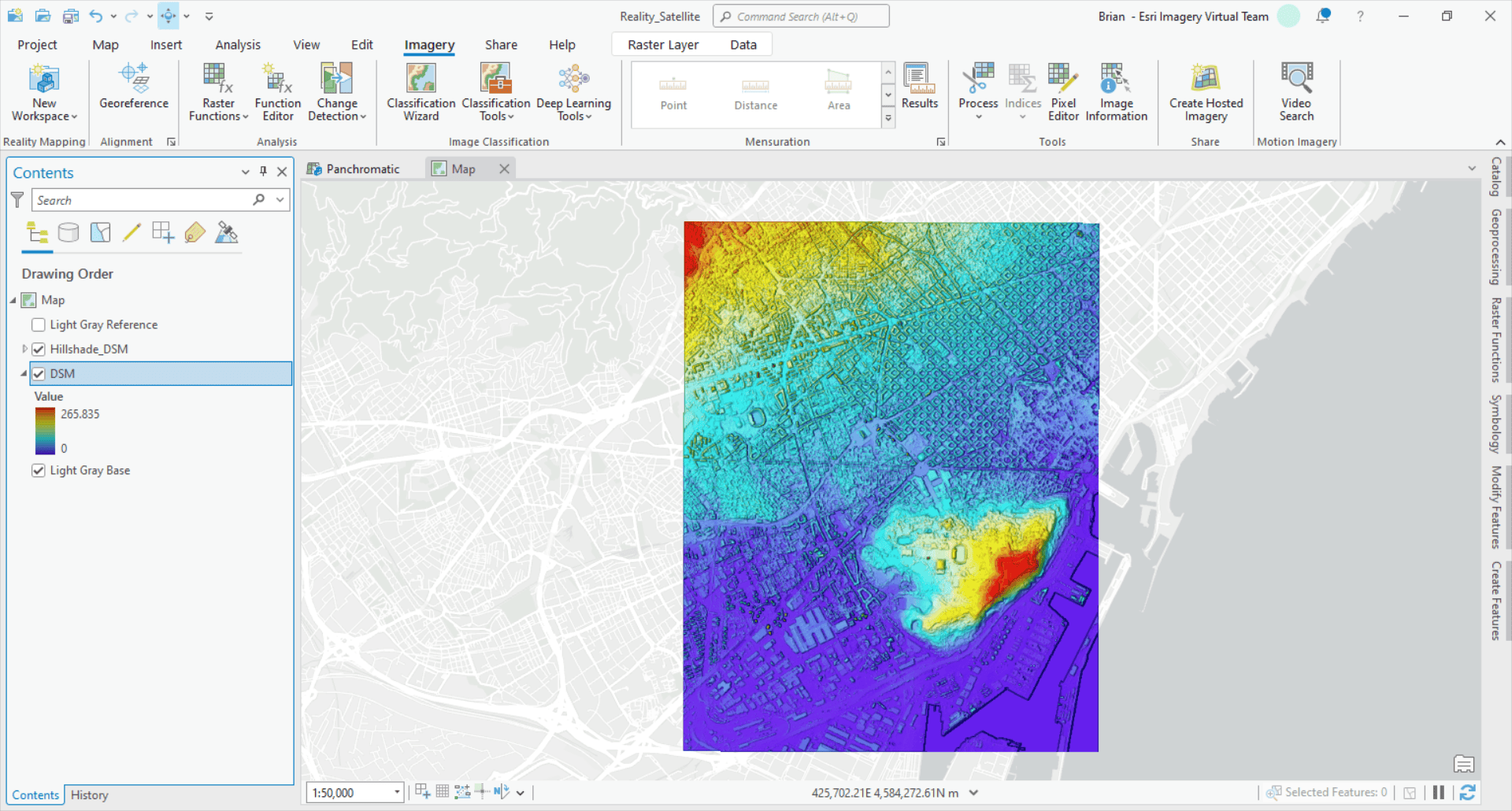
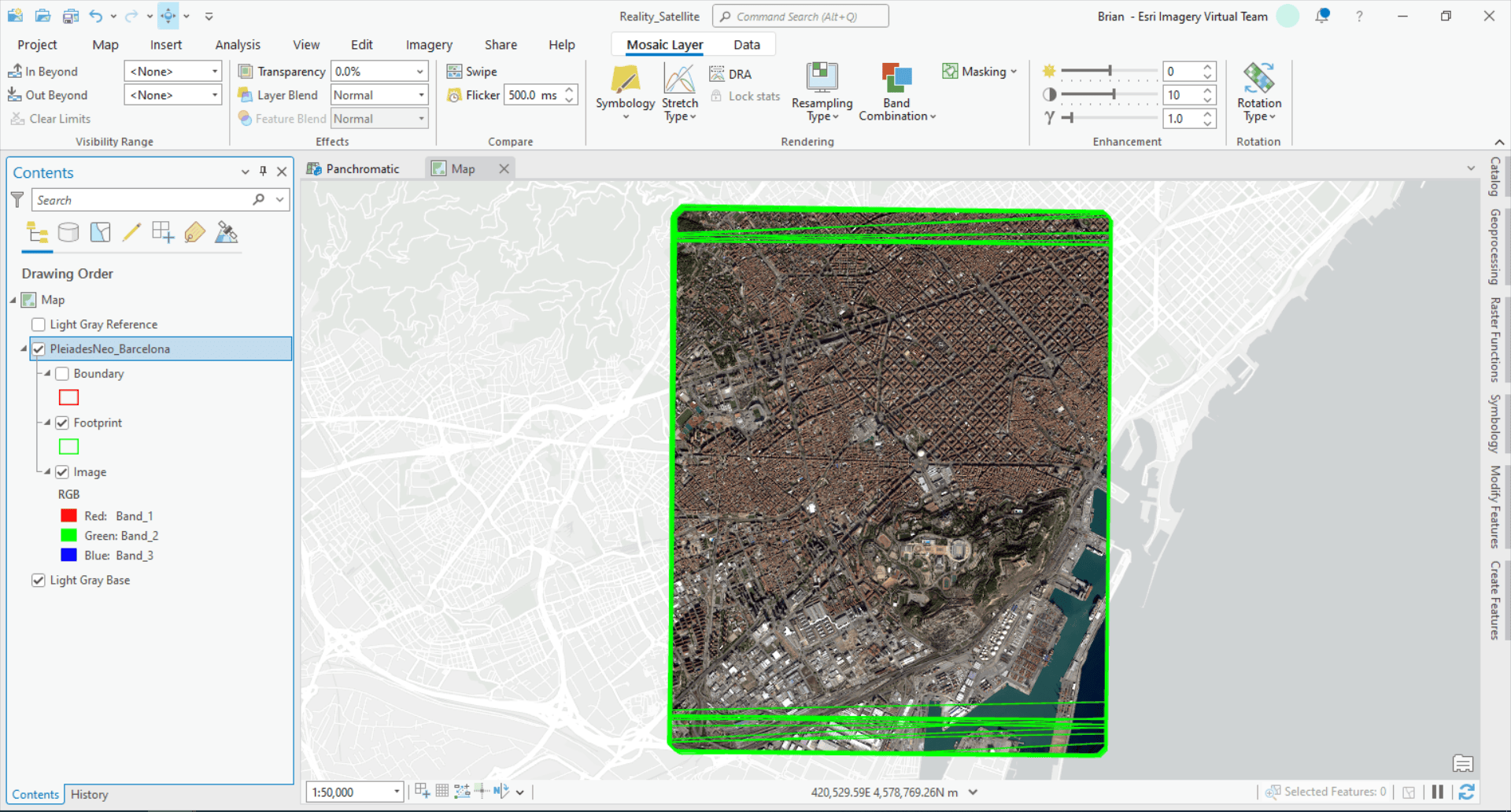
With the latest release of ArcGIS Reality for ArcGIS Pro, reality mapping just got bigger, and there are no limits on the scale – and possibilities – of your reality mapping projects. Now, you can use readily available RPC satellite imagery to create highly realistic representations of virtually anywhere on Earth, and within the familiar ArcGIS Pro environment. By incorporating readily available satellite imagery into your reality mapping workflow, you’ll gain insights and situational awareness of anywhere on the Earth’s surface. This allows you to unlock information that was once only accessible through physical presence.
Satellite imagery unlocks the potential of geospatial data on a global scale.
Satellite images are extremely valuable because they offer global coverage, consistent data collection over time, and a unique large-scale perspective. In addition to the context and insights provided by satellite imagery itself, the geospatial products generated by reality mapping enable you to extract additional insights and information. Reality mapping with RPC satellite imagery allows you to create digital representations that are incredibly true-to-life and accurate, providing a powerful tool for gaining deeper insights and understanding of any region of interest, regardless of its size or location. And, you can further enhance your ability to visualize, analyze, and understand large or remote regions of interest by leveraging the powerful analysis tools that already exist in ArcGIS, such as change detection, multidimensional analysis, line-of-sight tests, viewshed analysis, and other AI-powered functionalities.

Let’s explore the advantages of adding reality mapping to your GIS workflow and delve into specific scenarios where it will enhance your understanding of the world.
Gain insights of remote areas.
Satellite imagery is a valuable tool for observing and comprehending events in remote areas that are challenging or even impossible to access. Incorporating reality mapping into your GIS workflow allows you to see things as they really are, in places you can’t be. This bridge connecting the digital and real world empowers you to make informed decisions, whether they are related to emergency situations or non-emergency circumstances. For instance, it allows you to accurately assess the extent of damage caused by natural disasters, detect invasive species, or map deforestation even when you are physically distant from the location.
Make better decisions about large areas of interest, faster.
Before the addition of RPC satellite imagery support, ArcGIS Reality for ArcGIS Pro already empowered you to create 3D geospatial products using drone and aerial imagery. Drones can capture high-resolution imagery frequently and are highly effective when detailed site mapping is needed. Crewed aircraft are very efficient at capturing high-resolution images of entire cities and even countries. Now, with the support for satellite imagery, you can leverage the unique ability of satellites to quickly capture data of virtually any area of interest in the world. Leveraging satellite imagery for reality mapping extends its value by adding an additional dimension that enhances insights, awareness, and potential. This additional perspective enhances the analytical capabilities and provides valuable information for time-sensitive decision making in applications such as disaster response and management and security and defense.
Reduce your risk.
Reality mapping with RPC satellite imagery provides a safe and efficient alternative for data collection and analysis. By leveraging satellite imagery, valuable information can be obtained without the need for physical presence in hazardous or inaccessible areas. It allows for remote assessment of the environment, identification of potential risks, and informed decision-making, all while reducing the risk to human lives and expensive equipment.
This is particularly beneficial when dealing with active disaster zones and conflict areas or assessing recent conditions in remote regions with challenging terrain.

Easy accessibility amplifies the utility of satellite imagery.
The increasing availability of satellite imagery has revolutionized various fields. It has opened up new possibilities for mapping, environmental monitoring, urban planning, and disaster response. Commercial satellite providers like Maxar, Blacksky, and Airbus, who are valued partners of Esri, offer high-resolution images of almost any location on Earth. These images can be accessed through subscription services or on-demand purchases, allowing organizations to acquire satellite images quickly.
By integrating satellite imagery into reality mapping workflows, organizations can now create accurate and detailed representations of the real world. This integration facilitates better decision-making and understanding of our planet.
Learn more about reality mapping using satellite imagery
- Watch the demo video above from our recent webinar, Large Area Mapping with ArcGIS
- Follow a step-by-step tutorial: Create a digital surface model product from satellite imagery in ArcGIS Reality for ArcGIS Pro
- Contact sales and be sure to ask for a demo of the latest release and ask about our satellite imagery partners
All satellite imagery for this blog post is courtesy Airbus from the PleiadesNeo constellation and processed by Esri using ArcGIS Reality for ArcGIS Pro.
Beyond satellite support: More ways ArcGIS has enhanced reality mapping
Satellite support isn’t the only exciting new capability in ArcGIS Reality for ArcGIS Pro. The latest release not only introduces support for RPC satellite imagery but also enhances functionality to accommodate various data inputs and storage locations. These updates enable users to seamlessly integrate different types of data and work with their preferred data storage systems, providing a more flexible and efficient workflow for reality mapping.
Access your data in the cloud
Now, you can use imagery stored in AWS, Azure, and enterprise object stores for reality mapping thanks to the latest release of ArcGIS Reality for ArcGIS Pro. You’re no longer limited to the storage constraints of local disks or network folders. By leveraging the cloud, you can reduce the IT management overhead cost of standing up your own storage infrastructure or use your own cloud management environment to create easy access to the reality mapping inputs you need, when you need them.
Support for rolling shutter cameras
With the latest release of ArcGIS Reality for ArcGIS Pro,you can generate high-quality 3D meshes and other reality mapping products from drone images captured using rolling shutter cameras. You’ll now get more accurate alignment results for images captured using rolling shutter cameras. The higher quality alignment results increase the accuracy and overall correctness of the DSMs, True Orthos, Point Clouds, and 3D Meshes.


Article Discussion: