Enable ArcGIS workflows directly from the CAD desktop
ArcGIS for AutoCAD (AFA) is a free Esri plug-in that connects the CAD user to ArcGIS data and GIS workflows. CAD professionals can access and edit the same System of Record data as other ArcGIS web, desktop, and mobile applications. Now CAD users can be full participants in the GIS process. Enabling the CAD professional to author, access, and maintain GIS data right from their AutoCAD desktop expands the value of both the CAD and GIS data.
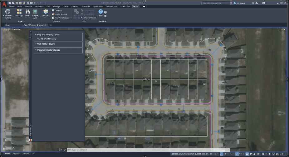
Version 410 of ArcGIS for AutoCAD was released in May 2022 and contains several enhanced capabilities, simplified workflows, and adds some powerful new functionality. These enhancements include the ability to dynamically connect labels and text with ArcGIS attributes, and Feature Class Templates to easily create industry-specific schema-based workflows for utilities, transportation, public safety, natural resources, and more. When AFA is installed, an ArcGIS tab is automatically created in the main ribbon of Autodesk’s AutoCAD or Civil 3D. You can add GIS content and context to your design project with a few clicks.
In minutes you can enable your CAD data to be leveraged and edited in field applications like ArcGIS Field Maps. Field workers can add new features, change attributes, and attach photos while on the worksite. When their field edits are complete, you synchronize those updates and see those changes directly in your CAD drawing. The first video example below demonstrates how this process can benefit your operations.
So, whether you are looking to add GIS data for base content and environmental constraints to your CAD project, or you need to publish and edit GIS data from the CAD desktop, ArcGIS for AutoCAD is now more powerful than ever in bringing the CAD and GIS environments together without having to leave your CAD desktop.
Core Values of ArcGIS for AutoCAD

ArcGIS for AutoCAD was created for the purpose of having the CAD professional become a direct participant in the GIS process without altering their familiar CAD workflows. This includes publishing, editing, and viewing of GIS data directly from within the Autodesk CAD desktop. That statement is a simplified view of the AFA functionality, but as you dig deeper the power, ease-of-use, and seamless integration become apparent. The core functionality includes adding, deleting, or modifying the GIS features and their attributes from within the CAD environment. The value of AFA goes beyond the powerful ability to connect to, publish, and update GIS data. It also incorporates many built-in tools to streamline processes like assigning an Esri coordinate system, adding base imagery, setting work area boundaries, labeling, attribution, assigning blocks, built-in GIS schema templates, and two-way synchronization of the CAD and GIS environments.
What about the Autodesk Connector for ArcGIS in Civil 3D?

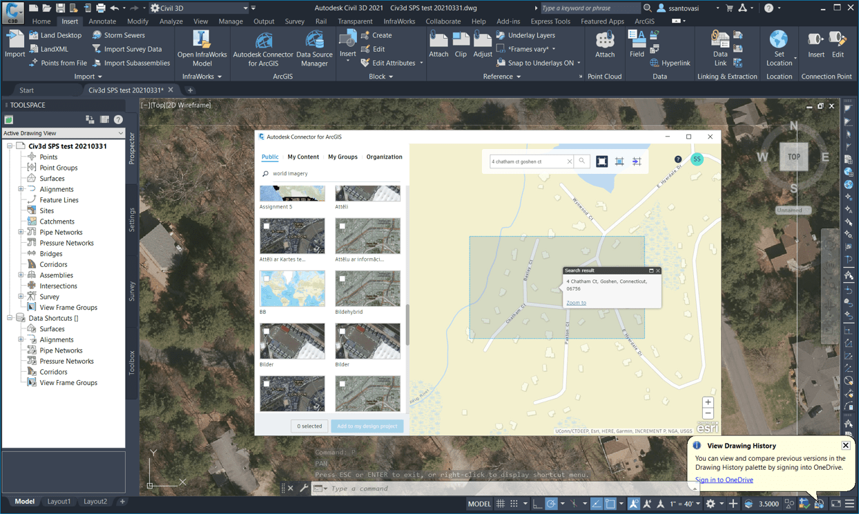
ArcGIS for AutoCAD supports versions 2018 to 2022 of Autodesk’s AutoCAD or Civil 3D. While there is a robust Connector for ArcGIS tool that comes with Civil 3D, the AFA plug-in can still work for those CAD operators that choose to use Civil 3D as their CAD desktop of choice. The Autodesk Connector for ArcGIS in Civil 3D is a great tool designed for the Civil Engineer that wants to add ArcGIS data as context for their civil project while leveraging the GIS data as advanced Civil 3D object types like cogo points, feature lines, and alignments. The ArcGIS for AutoCAD plugin is designed for CAD professionals that use AutoCAD, and sometimes Civil 3D, and need to participate in GIS workflows or to bring GIS data into AutoCAD projects. There are some functionality overlaps, and many customers use both depending on the need, but the main differences are in the professional and workflows that they target. Both ArcGIS for AutoCAD and Autodesk’s Connector for ArcGIS make it easier to integrate CAD and GIS data and provide meaningful benefits to the design and geospatial industries.
Getting Started
Get started today by following the link below to download and install version 410 of ArcGIS for AutoCAD.
https://www.esri.com/en-us/arcgis/products/arcgis-for-autocad
Links to Tips and Tricks videos to help you succeed:
- Setting a coordinate system and adding a map
- Adding a web feature layer
- Add subscription content from AGOL
- Edit web feature layers
- Browse enterprise portal for layers
- Working with document feature layers
- Organize CAD drawing with Industry Templates
- Create A Custom Template
- Share CAD data to a Hosted Feature layer
- Generate CAD labels from GIS Attributes
- Create feature – data creation tool in ArcGIS for AutoCAD
For future updates you can also join the Early Adopter Beta community for access to video tutorials, user forums, tips and tricks, and more:
https://earlyadopter.esri.com/key/arcgisforautocad

Industry Specific Templates Jumpstart your GIS workflows
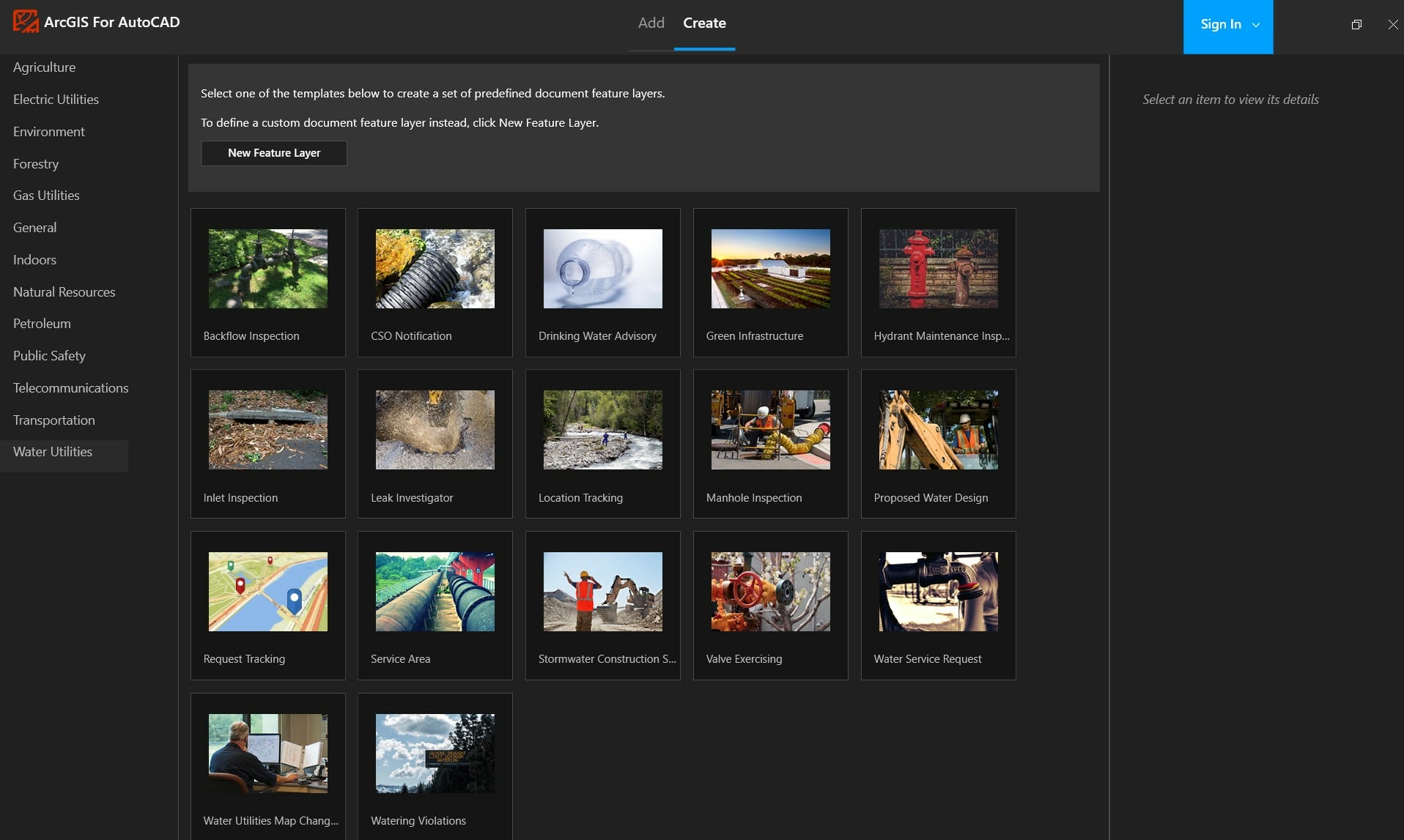
One of the most useful new features is the ability to easily create schema-based Feature Class Templates for industry-specific workflows like Water and Electric Utilities, Public Safety, and even ArcGIS Indoors. Select the template you want, and instantly the layers, schema, and attributes will be added to the CAD drawing. Those layers can then be published back to ArcGIS Online or Enterprise. Once the data is in a web map your field crews can leverage the data and update attributes, add image attachments, and even collect new features. When the field edits are saved, you can perform a sync on the AutoCAD desktop and all the field edits are refreshed on the desktop. This makes for a seamless round trip of your data from CAD to ArcGIS Online, to your field users, and back to the CAD desktop.
ArcGIS Indoors example of an industry specific workflow
In this example, you can see one of the more exciting advances in ArcGIS, the ability to take your GIS applications and workflows inside the building with ArcGIS Indoors and ArcGIS IPS for indoor positioning. The demonstration video shows how easy it is for AFA to help prepare your CAD drawing for use in ArcGIS Indoors by using the Indoors sample template. The ability to use the feature class template to create the appropriate document feature layers and associated schema takes all the guesswork out of preparation and can help jumpstart a building or campus indoor project.
CAD and GIS – The Bottom Line
Traditional views of spatial data from the CAD and GIS user’s viewpoint:
CAD User: Traditionally CAD users base their fundamental approach to geospatial data much differently than GIS users. The CAD user defines their data by the CAD layer it is drafted on, along with the color, linetype, thickness, and block representation of that CAD feature.
GIS User: The GIS user sees data as spatially referenced geometric features that can contain attributes, subtypes, relationships, and attachments.
These different paradigms have caused misunderstandings and resistance in collaboration between CAD and GIS users for many years. It was an ideological difference that needed to be overcome for the CAD and GIS worlds to come together. ArcGIS for AutoCAD solves this issue and allows the CAD user to continue to use familiar CAD tools while working with GIS data and without disrupting any of their CAD workflows or viewpoints on data. Now GIS data can be the source of truth for CAD data, and likewise CAD data can be published as meaningful GIS data.
ArcGIS for AutoCAD is a free tool that allows the Autodesk AutoCAD user to leverage GIS data as context and content in their drawings and enables the CAD user to become a direct participant in creating and maintaining GIS data through a seamless two-way integration of the ArcGIS and Autodesk environments.

Article Discussion: