Designs for the built environment demand spatial data and context. The synergy between geospatial tools and CAD engineering applications is vital to optimizing design workflows with GIS. Esri’s ArcGIS for AutoCAD bridges CAD and GIS to enable them to work better together.
Challenges associated with CAD and GIS integration
Although GIS managers want the CAD team to take advantage of their organization’s GIS platform, they are unsure of how to facilitate information sharing, direct editing, and data creation tasks. CAD technicians and civil engineers need to contextualize design content and make informed design decisions but may not be aware of how GIS can serve their needs.
How ArcGIS for AutoCAD addresses these challenges
ArcGIS for AutoCAD is a plug-in that brings together GIS and CAD professionals through creation, collaboration, and managed editing of ArcGIS data in Autodesk AutoCAD and Autodesk Civil 3D. It empowers CAD users to directly access ArcGIS content and participate in GIS. The ability to share GIS information with design professionals—such as civil engineers, surveyors, and CAD technicians—enriches and better informs design efforts. CAD and GIS interoperability boosts productivity by adding CAD users to workflows for creating and maintaining GIS data from within their familiar CAD editing tools.
Benefits of ArcGIS for AutoCAD for CAD and GIS workflows:
- Allows CAD professionals to find the right amount of the right data, in the right location, from GIS.
- Delivers GIS data as useful context to design.
- Provides the means to resolve the difficulties of location between GIS and CAD.
- Presents a standard pattern for encoding data in a structured CAD drawing that integrates with ArcGIS.
These capabilities in combination increase productivity, enable collaboration, allow for more informed design decision-making, and help avoid duplication of effort.
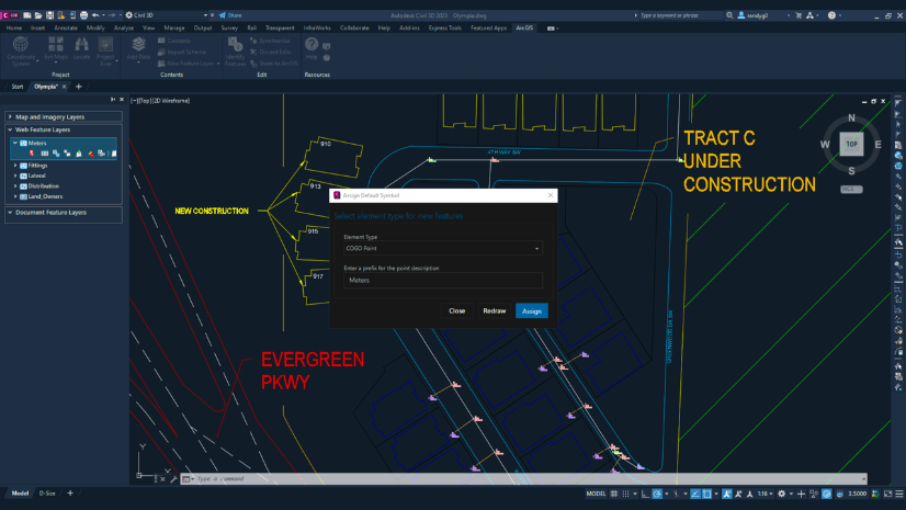
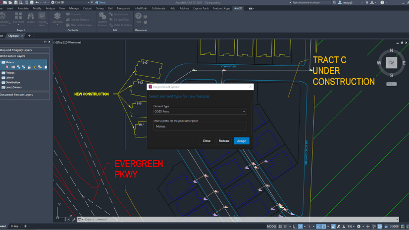
Adding GIS data to drawings
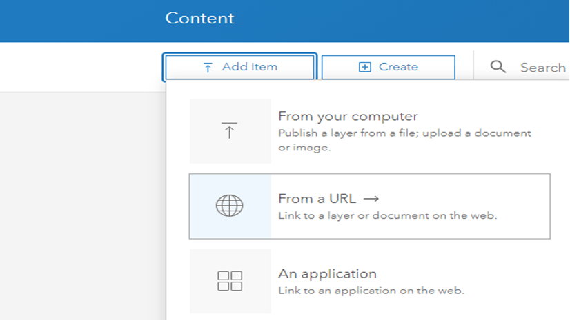
ArcGIS for AutoCAD provides various ways to create, access, and work with GIS data in the Autodesk AutoCAD and Civil 3D environments. Access GIS data by selecting layers from ArcGIS Enterprise or ArcGIS Online, or by adding a URL to an ArcGIS Server connection. ArcGIS for AutoCAD provides an interface to add map layers, imagery layers, and feature layers.
In this way, you can accomplish the following:
• Use feature layers to edit, modify, and query vector data within the CAD environment.
• Interact with map image layers to visualize and identify geographic features.
• Interact with imagery layers by overlaying raster and analyses published as imagery layers.
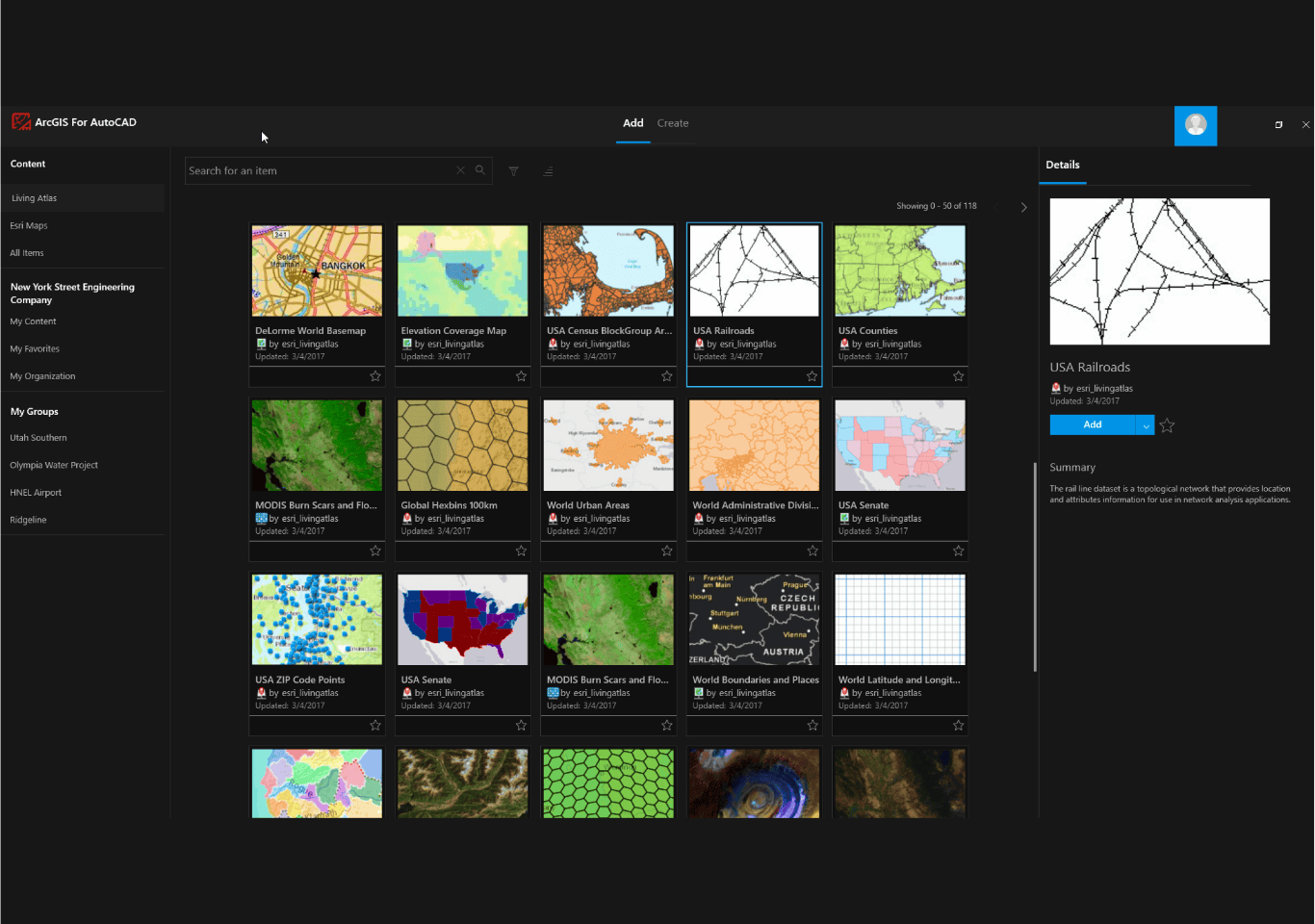
Informing design with the ArcGIS Living Atlas of the World
In addition to adding your organization’s own GIS content to your design drawings with ArcGIS Enterprise or ArcGIS Online, ArcGIS for AutoCAD also allows you to add map and feature layers from ArcGIS Living Atlas of the World. ArcGIS Living Atlas is the foremost collection of global geographic information. Curated by Esri with contributions from its partners and user communities, ArcGIS Living Atlas contains maps, data layers, tools, services, and apps for geographic analysis. For design professionals using ArcGIS for AutoCAD, this provides access to high-quality, authoritative datasets such as survey monuments, geology, and terrain that can add further context to CAD drawings.
Bring GIS to CAD workflows
Esri’s ArcGIS for AutoCAD is a free plug-in that integrates GIS and CAD by enabling collaboration, creation, and managed editing of ArcGIS data within Autodesk AutoCAD and Autodesk Civil 3D. It allows CAD professionals to access ArcGIS content and participate in GIS workflows, providing valuable context and enriching designs. Other benefits of ArcGIS for AutoCAD include positioning CAD data in the correct location, resolving location difficulties between GIS and CAD, and enhancing productivity and collaboration. The tool also allows you to add GIS data to drawings, including feature layers for editing vector data as well as map and imagery layers for visualizing geographic context. Additionally, ArcGIS for AutoCAD provides access to ArcGIS Living Atlas of the World, a comprehensive collection of authoritative datasets that can further enrich CAD drawings.
Integrate CAD and GIS workflows in the ways described in this blog article by downloading ArcGIS for AutoCAD today!

Article Discussion: