If you’ve ever needed a quick, visual way to display information using a map, then static maps might just be the perfect option for you. Static maps are appropriate for multiple scenarios. For example, a static map image on a fitness app can display a runner’s completed route with start and end points. Similarly, a rideshare app can show the path from pickup to drop-off on the passenger’s receipt, providing a visual record of the trip. Static maps could also be used to showcase fixed data such as the location of a restaurant on an online restaurant reservation and discovery application.
The ArcGIS Static Maps service is a new location service that makes the examples above possible. The service provides developers with the ability to create and embed map images from ArcGIS Basemaps into websites and various kinds of location-driven applications. It is ideal for scenarios where interactive maps aren’t necessary or practical.
How Does the ArcGIS Static Maps Service Work?
Developers building with the Static Maps service can make a call to the service with an area of interest in mind. They can specify their preferred map style and provide additional graphics to overlay on the map. The service will create the map image and return it to the developer when the request is made.
With the Static Maps service, users can embed map images on web pages, apps, emails or reports without the use of a mapping library or API. The service offers a lightweight and fast solution for presenting location-based information; no dynamic page loading required. The Static Maps service is currently only available via ArcGIS Location Platform.
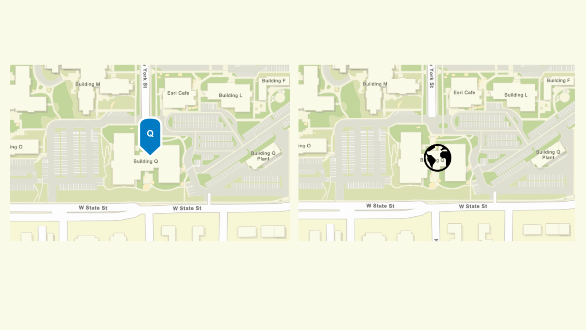
Here are some of the things users can do with the ArcGIS Static Maps Service
- Highlight a location in the center of a map
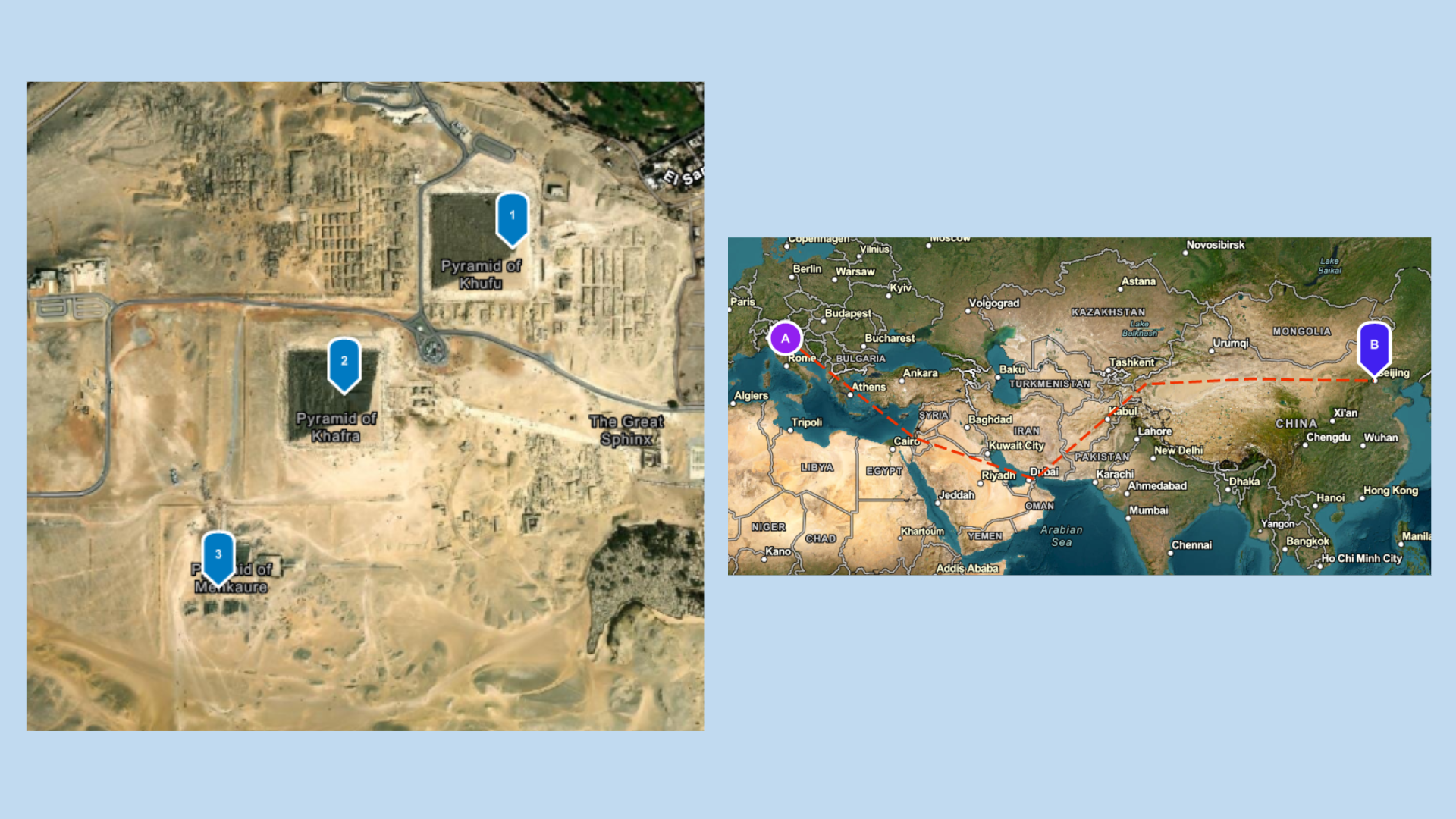
- Display and label locations on a map
- Choose from a list of ArcGIS Basemap styles
- Select the size of map image that meets your requirements
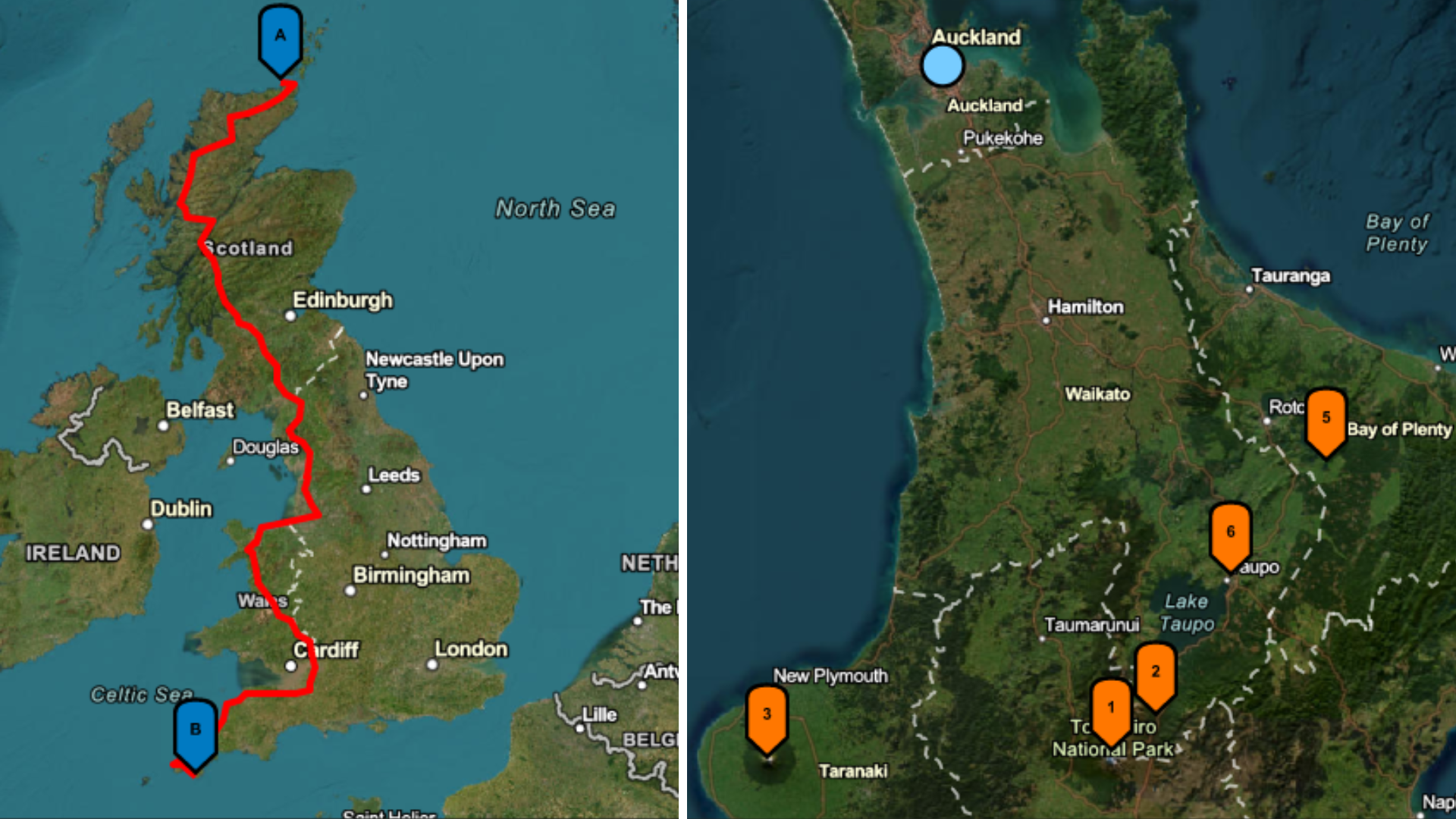
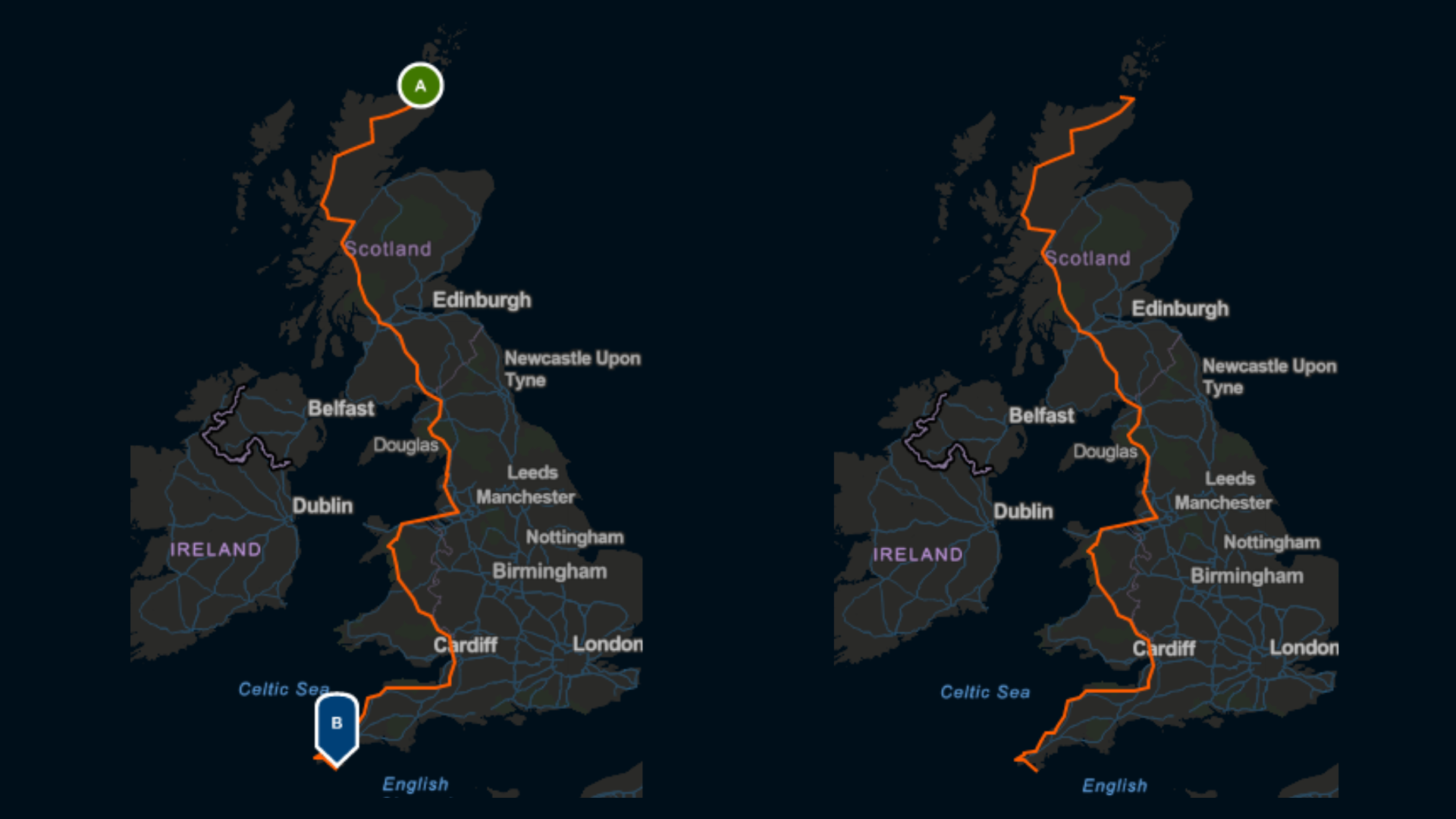
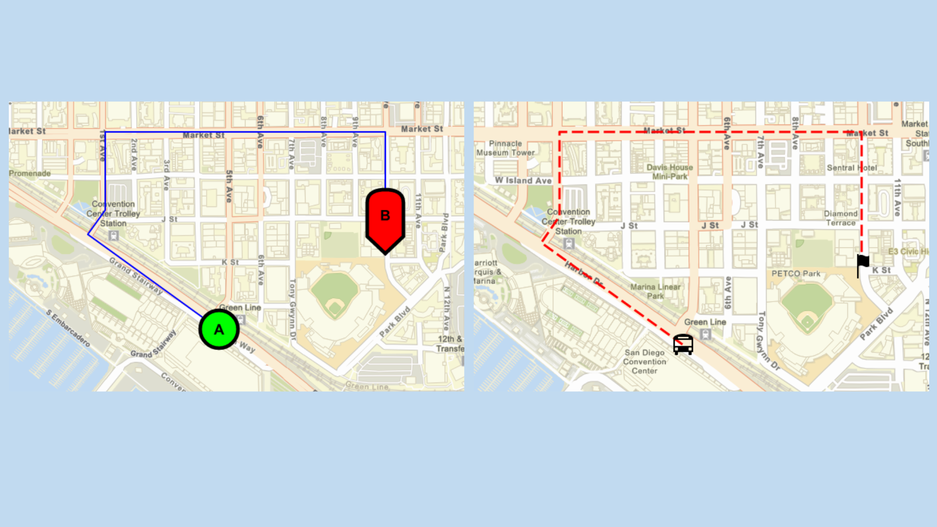
- Show a route or path on a map with start and end points
- Support end-users in using their own custom SVG symbols and working with custom symbols for branding efforts
- Integrate maps for marketing and informational purposes
- Show areas with polygons
- Support for a custom extent override for prioritizing the presentation of study area
- Define extent such as a city and then place your data on it with the view parameter

Beta Testing Updates
The Static Maps service went into beta last year, but the team took some time to work on improvements to the service. The ArcGIS Location Platform team has now provided users with yet another opportunity to test out the service and provide feedback through the Early Adopter Community.
Since the initial beta testing phase, the development team has responded to user feedback by making modifications that expand the service’s capabilities.


Requirements for the Beta Testing Phase
To test out the ArcGIS Static Maps service, you need:
- An ArcGIS Location Platform account
- An access token (you can obtain one by following the API Key authentication steps; make sure you enable beta access privileges)
It’s so easy to get started!
Your participation will help shape the future of the service. We can’t wait to hear your feedback!
To learn more about the ArcGIS Static Maps service, please visit the Developer Documentation page.
Subscribe to the Esri Developer Newsletter to discover more developer offerings and updates.

Article Discussion: