The newest version of ArcGIS Drone2Map has been released and we’re excited to share the newest features and enhancements you can look forward to. This blog contains just some highlights in this version; for a complete list of everything new or improved please check out our help documentation.
New Inspection Workflow
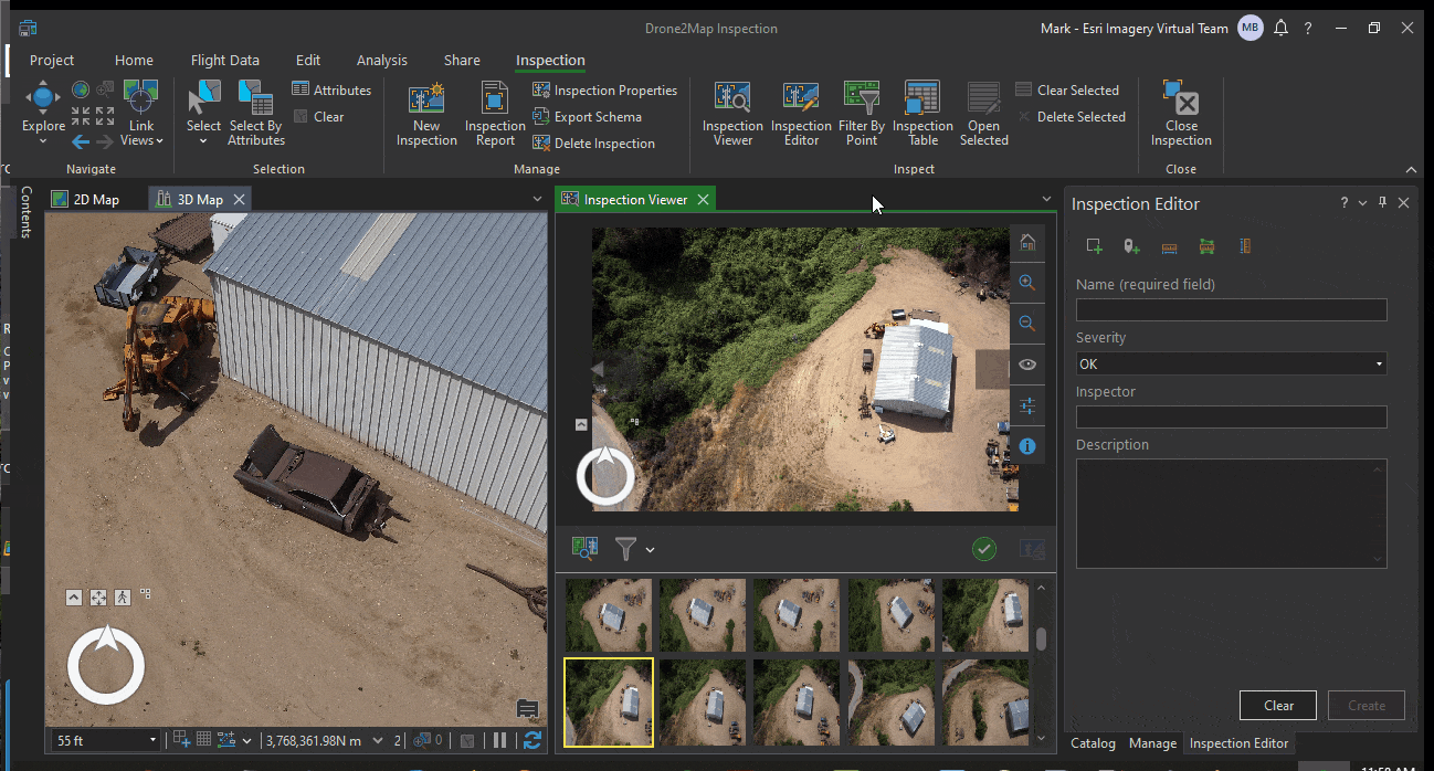
Since drones can reach areas that are difficult or dangerous for field crews, drone images are being used in many industries for inspection of assets. Now you can create an inspection workspace for any project and use the new inspection workflow to efficiently view multiple images for any object or region of interest in your project area. Inspections can be done in 3D, allowing you to mark points or polygons directly on the source images, and create 3D features for each observation. The inspection features are captured in a new feature class, and can be overlaid on 3D objects and referenced between all viewing that location.
Inspection reports can be generated and will display each inspection feature with any notes and snapshots that were saved during the inspection process. Snapshots can also be attached to inspection features so that they appear in pop-ups when sharing inspection layers online.
New Project Page and Updated Resources
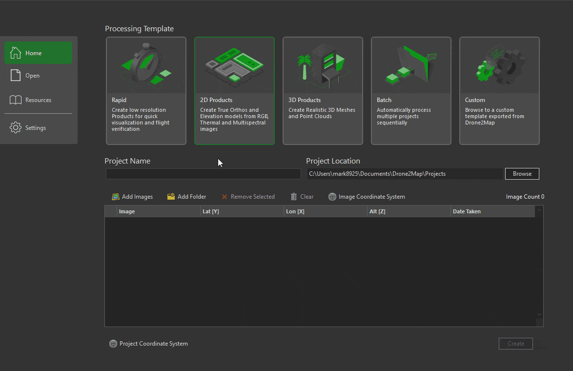
The New Project page has been redesigned to streamline project creation and put more focus on the type of products you can create. Projects are now created by defining the processing template you want to use, then choosing a product type if the sensor supports more than one.
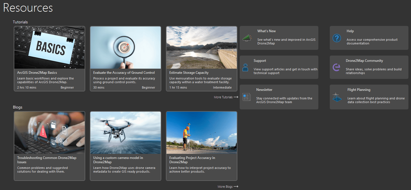
Additionally, the new Resources page provides a knowledge hub for learning how to use Drone2Map and staying up to date on product information. Tutorials and blogs are showcased on the Resources page along with links to Esri technical support, documentation, and the Drone2Map user community. You can also sign up for the Drone2Map newsletter and stay up to date on all things Drone2Map, link below.
Catalog Datasets
Catalog datasets are a new method of cataloging and referencing the products you create in Drone2Map. A catalog dataset is a container stored in a file geodatabase that allows you to add Drone2Map products into it from multiple Drone2Map projects using the Catalog Dataset pane. This means that you and your colleagues can share and view products generated from multiple projects in one location and display them in other projects, providing a powerful new method for managing multiple drone projects to cover large areas as well as sites that are captured repeatedly on multiple dates. Catalogs created in Drone2Map can also be used in ArcGIS Pro to further collaboration and make it easy to share throughout your organization.

Enhancements
Rolling Shutter Correction
A new rolling shutter correction setting has been added to the adjust options for drones using rolling shutters. This setting will reduce distortions and inaccuracies caused by the rolling shutter effect, resulting in more accurate and visually appealing products.
Enhanced Thermal Imagery Support
True ortho support has been extended to thermal imagery processing. The default for thermal imagery orthomosaics is now a true nadir viewpoint.
Stay Connected
If you have any questions or ideas, we’d love to hear from you! Visit the Esri Community page and let us know what you think. If you’d like to stay up-to-date on the latest product news and announcements for Drone2Map, make sure to sign up to be on our email list.


Article Discussion: