The first release of ArcGIS Field Maps launched in November of 2020 and we’ve been cranking out new updates to the product ever since. The initial release was a unification of 3 mobile apps (ArcGIS Collector, ArcGIS Explorer, and ArcGIS Tracker) and we leveraged an existing architecture to bring Field Maps to life.
Behind the scenes, we’ve been working hard to introduce powerful new capabilities and improve existing experiences inside of a new architecture built on top of the ArcGIS Maps SDK. We’ve had a number of preview builds, but today we’re excited to announce our first public beta release is now available via the ArcGIS Field Maps Early Adopter Program.
Please join our beta program and test drive the exciting new capabilities releasing later this year. We’d like you to exercise your existing workflows in this new architecture as well. You’ll be able to install beta iOS and Android builds side-by-side with the released version, access documentation on new capabilities that are coming, and engage in an active forum where you can provide feedback and receive answers directly from our development team!
To wet your appetite, let’s briefly highlight what’s inside…

What’s inside
Our biggest update since the 2020 launch, there’s a lot of exciting new features inside the beta for you to explore and test:
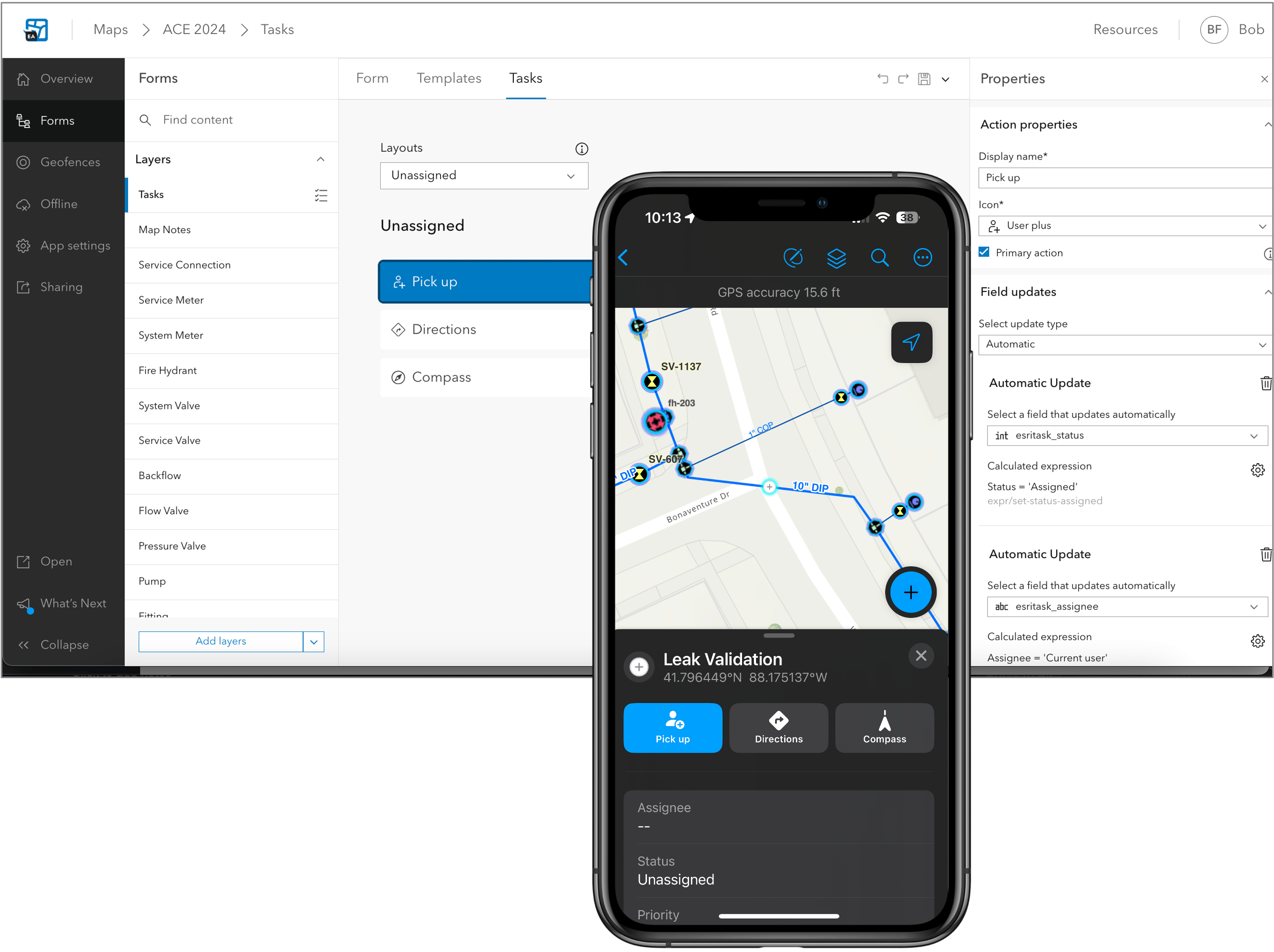
- We’re introducing an all new Task coordination capability that conceptually integrates the functionality of ArcGIS Workforce into Field Maps.
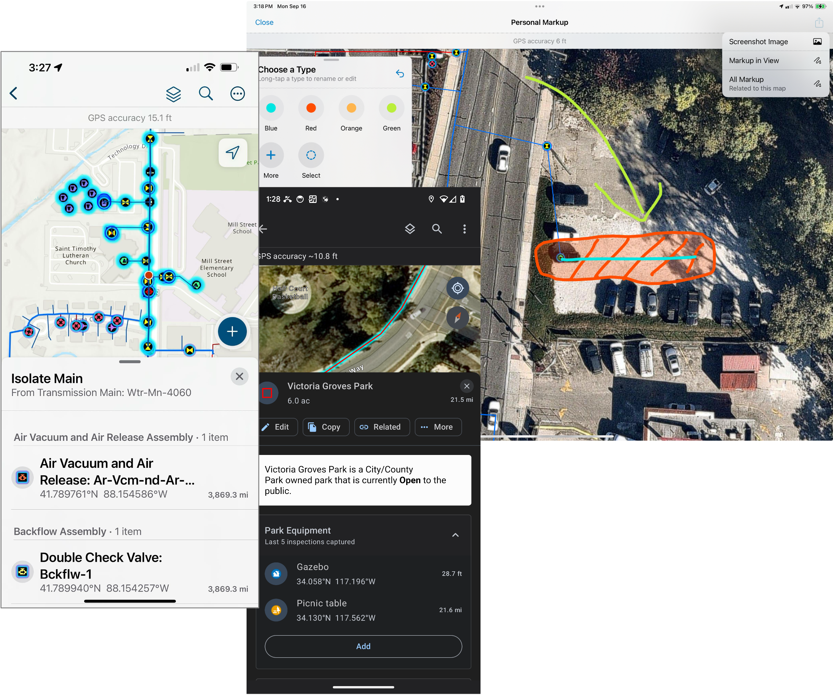
- Significant improvements to aid Situational awareness with offline support for utility networks, an all new personal markup experience, geofencing updates, and more.
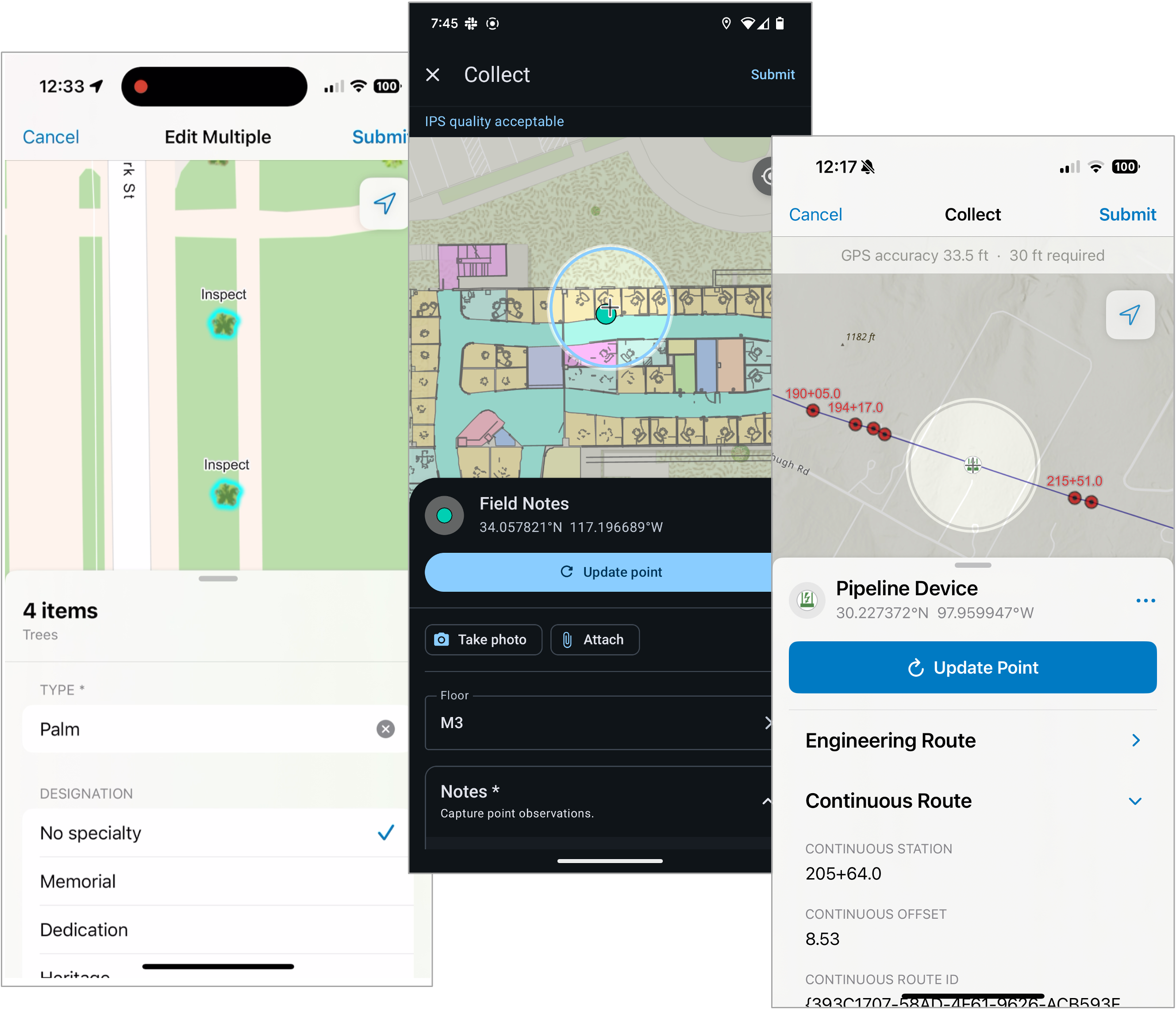
- We’ve supercharged Data capture and editing workflows with improvements to indoor and outdoor location capture, and you can do much more with forms than ever before.
Let’s take a quick look at what’s available for you to get your hands on now in each of these areas!
Task coordination
Tasks are designed to coordinate and manage work that needs to be completed in the field. Tasks are features that, when configured using Field Maps Designer, are presented in dynamic to-do lists for mobile workers, organizing and providing the information needed to complete the job.
Mobile workers will be able to:
- Sort and filter assigned work.
- View and access task details.
- Navigate to the job site.
- Complete tasks with configurable, context-driven task actions.
- Create and pick-up unassigned work in the field.
- Work with tasks online, offline, indoors and outdoors.
You’ll find that we’ve provided an Early Access version of Field Maps Designer in your ArcGIS Online organization. You’ll need to use the EA version to enable and configure tasks inside your maps.
Task coordination is highly configurable and while exploring these new capabilities, consider how you can integrate tasks with your Enterprise Asset Management (EAM) system to enhance efficiency and provide real-time insights into your field operations.

Situational awareness
There are significant improvements that boost situational awareness in this release. Organizations can take utility networks offline, sketch and share map markup with a completely new experience, streamline working with related records, and much more.
Situational awareness improvements include:
- View and trace utility networks offline.
- Improved experience working with related records via support for Related pop-up elements.
- Geofence location-alerts that update with edits to the underlying source features.
- New and improved personal markup experience.
- New collaboration experience for Apple devices.
- Snapping to features when using the Measure tool.
- Discover a dynamic scale bar when adjusting map scale.

Data capture and editing
Whether capturing new assets using high accuracy GNSS receivers, performing inspections or maintenance activities, or capturing observations with photos, there are many improvements to data capture workflows in this release.
Data capture improvements include:
- Forms support within the Edit Multiple tool.
- Connected branch versioning editing experience.
- An improved experience when using Trimble GPS receivers.
- Editing support for subtype group layers.
- Offline support for constraint and calculation attribute rules.
- Support for LADM workflows on the Android platform.
- Enhancements to the Indoor editing experience.
- Numerous Arcade enhancements that unlock new data capture capabilities like stationing and offsets and cut/fill.
Not yet available in the EA version of Field Maps Designer, but will be present in the ArcGIS Enterprise 11.5 release and the June release of ArcGIS Online, is the ability to set a specific branch version for layers in your map that are branch versioned. If present, when you open the online map, all edits will be stored in the branch version specified.

In addition to these changes, you’ll find a refresh in numerous areas of the mobile user experience, improvements to accessibility, and more.
As you can see from all that’s mentioned, there is A LOT of new functionality coming in the 25.2 release. We’ll be providing new capabilities in Field Maps Designer for both the ArcGIS Enterprise 11.5 release and the June update to ArcGIS Online ahead of our general availability. You can learn more about the timing of releases from Sarah’s blog post as well.
We’re excited to get your feedback so please join our beta program today!
Article Discussion: