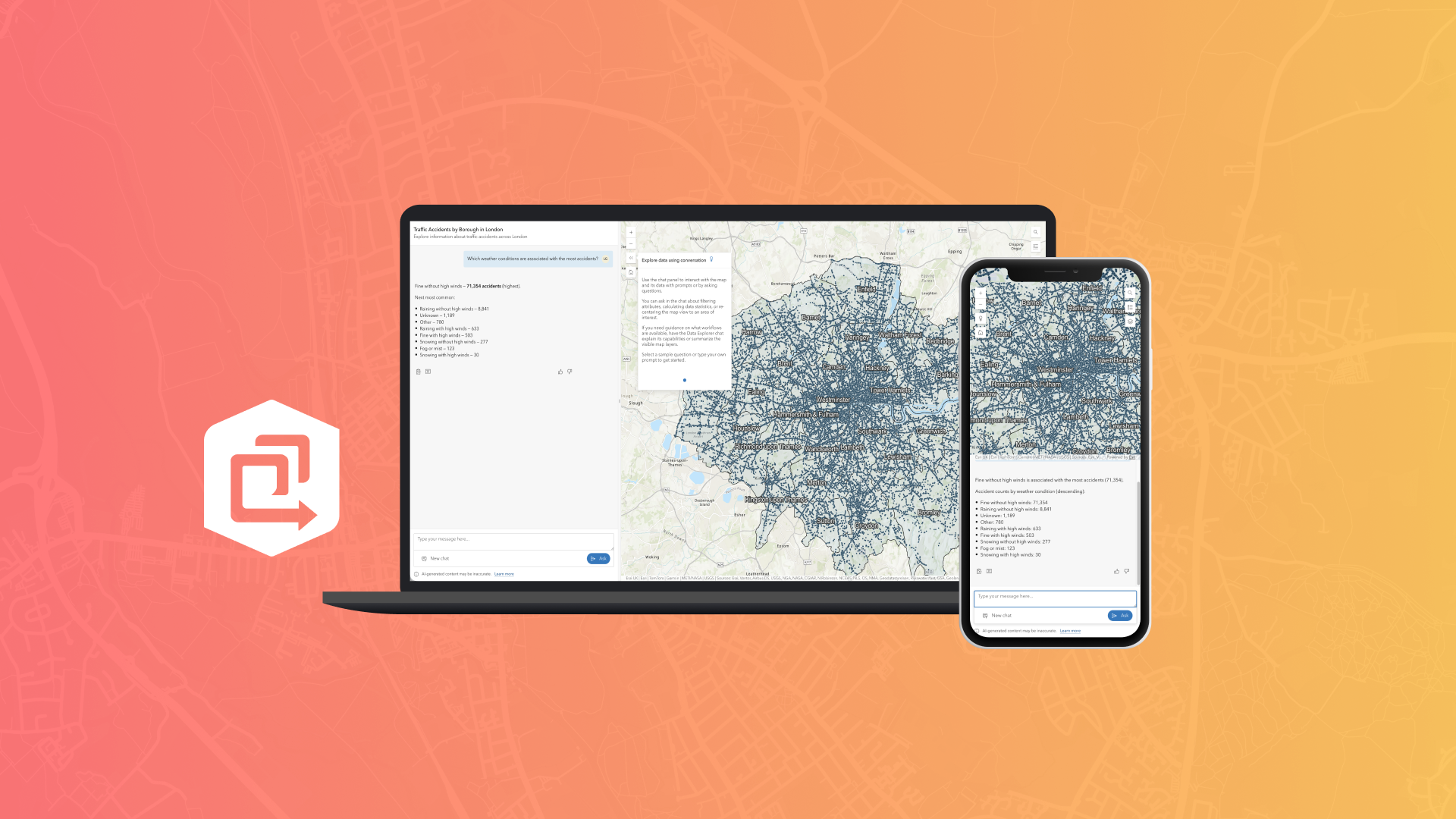
The ArcGIS Instant Apps Data Explorer template (beta) is a new way to create agentic mapping apps for map and data exploration. You can now interact with your map using an AI-powered a chat interface. Instead of navigating menus or building filters, Data Explorer (beta) lets you ask questions and explore your map in a more conversational way, like tapping someone on the shoulder and asking for directions.
Data Explorer (beta) leverages three agents that work together to support different parts of the app experience:
- The data exploration agent answers questions about the data in the map, including feature attributes, statistics, and spatial relationships, and it can filter features to support exploration.
- The navigation agent helps users search for locations and move around the map.
- The help agent provides guidance about the map and explains how to use the app and its capabilities.
All you have to do is ask a question in the chat using natural language. The agents are tasked behind the scenes, allowing you to focus on exploring your data.
Note: Data Explorer (beta) is designed to answer questions about the data in the map and does not use external data sources or the user’s location.
Prepare your data for better answers
The quality of your Data Explorer (beta) experience depends on how well the agents can understand your data. The agents rely on information such as layer names, fields names, and field descriptions to answer your questions. Taking the time to prepare your data helps the app provide better answers.
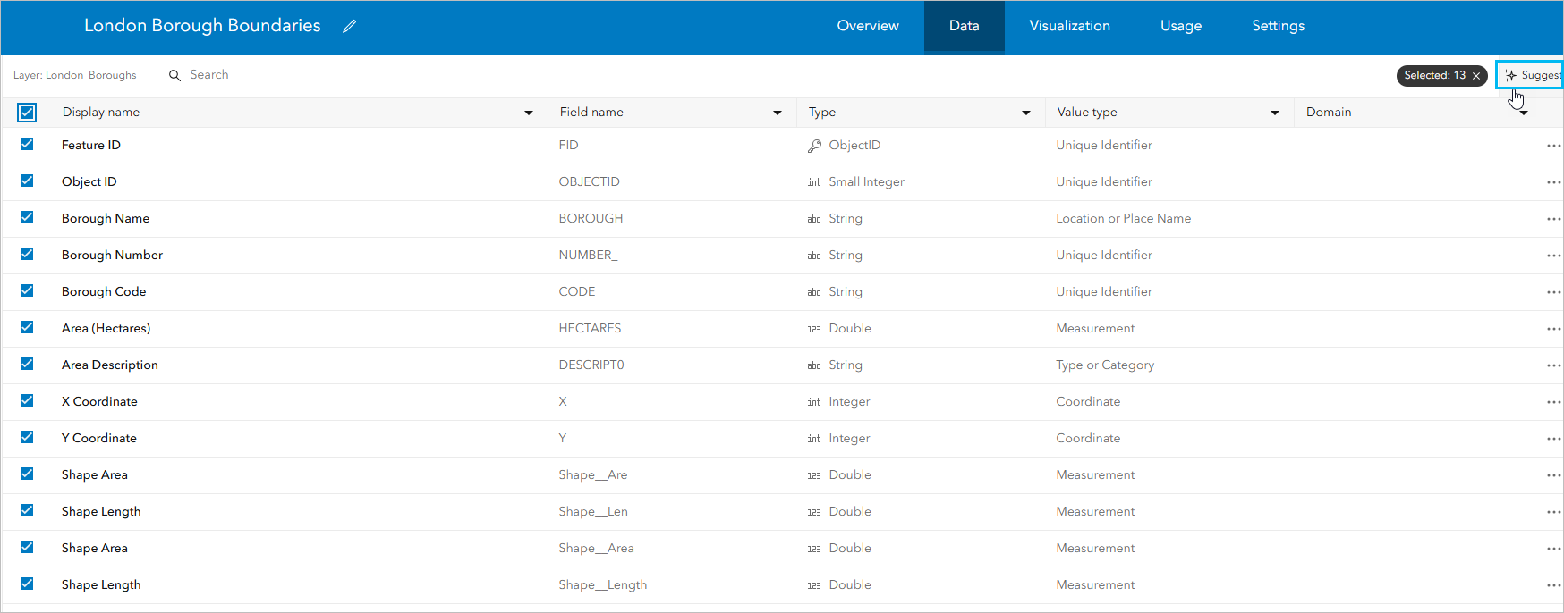
Let’s take a closer look at preparing your data to ensure the best experience of the app. You should start with feature layers, which are currently the only supported layer type for agents in ArcGIS. Layers should have thorough metadata with meaningful names to help the agents understand their purpose. Fields should also have descriptive aliases and field descriptions to provide additional context about the data.
Both requirements can be completed using the Item details assistant (beta), which can generate field and layer descriptions for you, saving time. On the item details page, click Suggest to use the Item details assistant (beta).
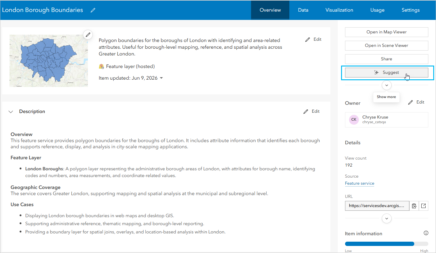
Once your feature layers are prepared, you can add them to a web map to use in the Data Explorer (beta) Instant Apps template. To launch the Instant Apps homepage and create a Data Explorer (beta) app directly from Map Viewer, click Create app > Instant Apps on the Contents toolbar. For additional recommendations and best practices for creating web map that works well with AI components, see Web map configuration in the Esri Developer documentation.
Generate embeddings and configure the app
The Data Explorer (beta) template follows the same configuration patterns as other Instant Apps templates. You can enable a cover page and introduction panel, organize widgets with the position manager, and apply theming to match your other apps.
What’s unique in the Data Explorer (beta) configuration is the Data Explorer tab. Here you’ll first see a message asking if embeddings have been generated on your map. Once you’ve prepared your data, the next step is generating embeddings. Web map embeddings are vector representations of the layer titles and field metadata for all feature layers in the web map that allow the language learning model to understand what’s in the map. Embeddings are essential for the functionality of the app. If you need to generate or regenerate embeddings, you can easily do so within the configuration. For more information on generating embeddings, see Set up your web map for agentic applications in the Esri Developer documentation.
On the Data Explorer tab, you can also customize the chat experience by adding a header, description, welcome message, and sample questions to help users get started.
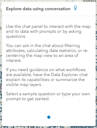
Additionally, upon launching a published app, a help panel is provided to guide app users on how to use the chat. While this text isn’t currently configurable, it can be turned off by the app author in the configuration.
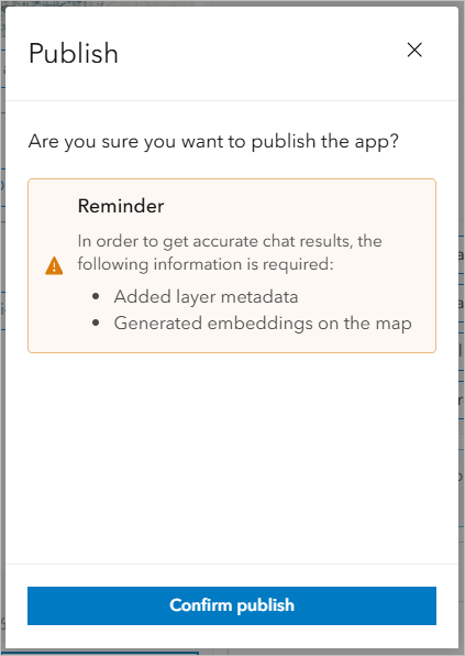
When you publish the app, a message appears to confirm you have thorough metadata and have generated embeddings:
Once the app is configured, you are ready to start exploring your data through natural language.
Note: At this time, Data Explorer (beta) apps cannot be shared publicly and that option is unavailable by design.
Use cases
Let’s walk through one example of how Data Explorer (beta) can be used. For example, you may have an app showing car accidents in London. The dataset is large, and finding information about how many crashes occurred, under what conditions, or in which areas can take a lot of manual effort.
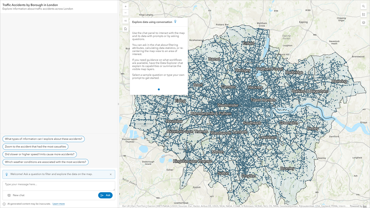
This is where Data Explorer (beta) lets you utilize the chat to pull out insights without needing to manually filter or analyze the data.
You can start by using a sample question provided by the app author in the configuration or type your own. If you’re not sure where to begin, you can even ask the chat for guidance. The chat provides high-level options of ways you can explore the data and the map.
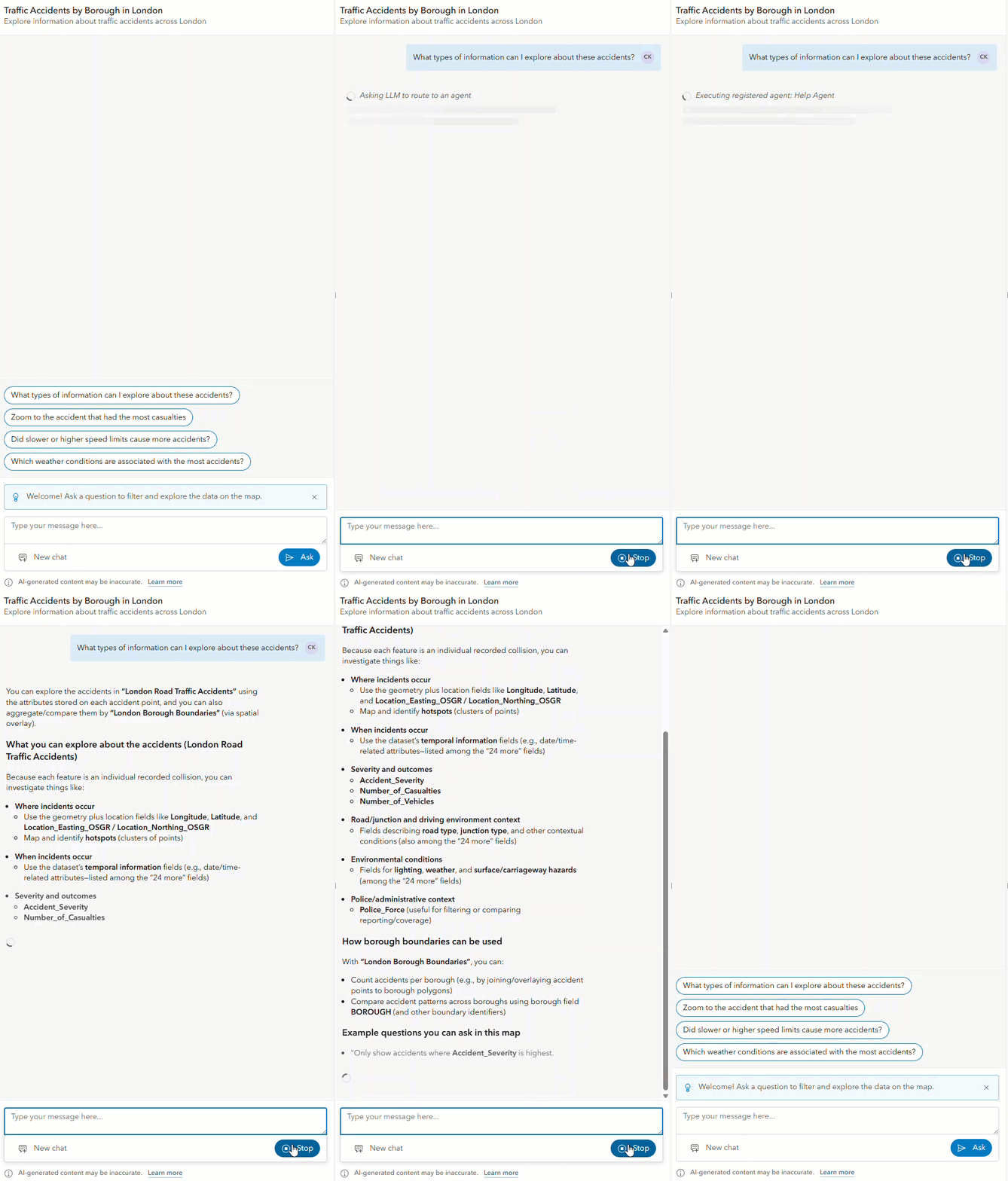
Behind the scenes, the help, navigation, and data exploration agents work together to answer questions, navigate the map, and guide the overall experience. You can ask a wide range of questions depending on what you want to explore. For example, you might ask about patterns in the data:
- Which areas have the most accidents?
- What time of day crashes are most common?
- How does accident severity vary across different road types?
You can also dig into road conditions—like showing accidents that occurred in poor weather, low light, or at junctions—or compare quantities like vehicle counts and casualty counts.
If you’re looking for something more specific, you can filter the map by asking for accidents that meet certain criteria, like those involving multiple vehicles or on weekends. In addition to exploring the data, you can also navigate the map by searching for a location or asking to zoom to areas with high activity. Alternatively, ask for help understanding what kinds of questions you can ask about navigating the app.
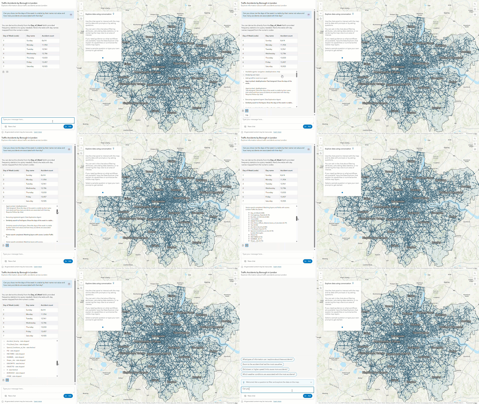
Once you receive a chat response, you can view a log of how the request was handled, including which agent was used and what actions were taken. These logs can then be copied directly from the chat.
The ArcGIS Instant Apps Data Explorer template (beta) enables you to build agentic mapping applications that enhance how you and your users interact with maps. Whether you’re looking for patterns, comparing conditions, or generally trying to understand your data better, Data Explorer (beta) is designed to be quick to set up and user friendly. Try Data Explorer (beta) with your own data and see what your users can explore. Please share your experience and feedback on the ArcGIS Instant App Esri Community page; the team is looking forward to hearing from you!


Article Discussion: