Version 5.2 of the ArcGIS Maps SDK for JavaScript introduces new keyboard accessibility capabilities allowing keyboards users more flexibility in navigating and exploring map features without the use of a mouse. Using the focus region, Map, Scene, and Link Chart components now offer an adjustable spatial selector that supports moving the map and opening the Popup component to explore feature attributes and available actions.
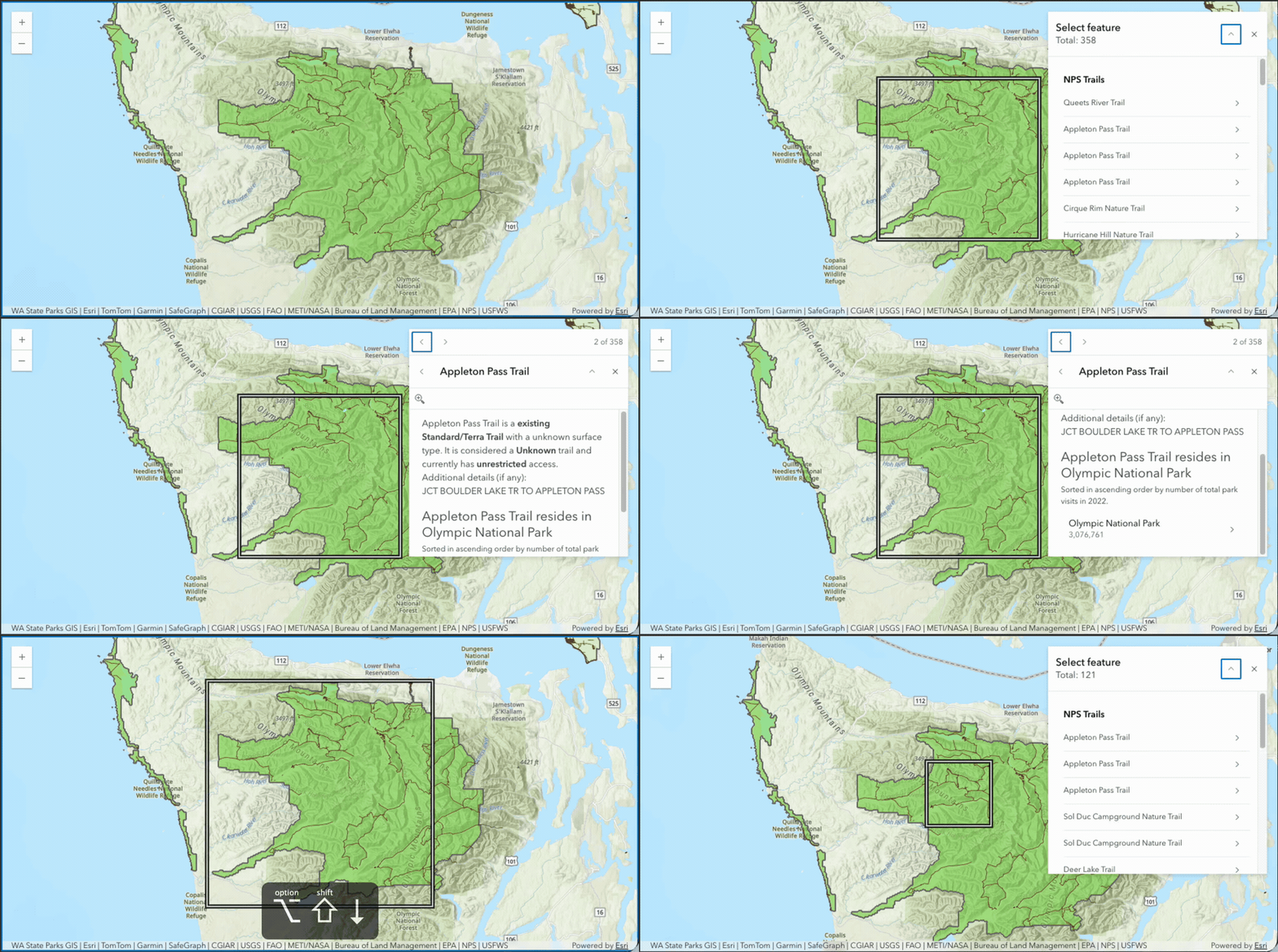
Explore these new capabilities and how you can use them to provide more accessible keyboard experiences in your applications, including:
- Use keyboard shortcuts
- Enable keyboard feature exploration
- Handle large result sets
- Communicate dynamic changes
- Manage keyboard focus
- Synchronize selections across components
- Customize the focus region
- Accessibility across ArcGIS applications
Use keyboard shortcuts
Keyboard navigation of map features is active when the Map, Scene, or Link Chart component has focus and the Popup component is slotted or enabled using the following keyboard shortcuts:
| Map action | Keyboard shortcut |
|---|---|
| Enables or disables the focus region |
|
| Moves the focus region area |
|
| Increases the focus region area |
|
| Decreases the focus region area |
|
| Activates more precise movements of the focus region |
|
| Activates larger movements of the focus region |
|
| Features in the focus region area are displayed in a popup |
|
Enable keyboard feature exploration
To support keyboard navigation of map features, enable the Popup using one of the following methods.
Slot the Popup component
Add the Popup component to the "popup" slot of the Map, Scene, or Link Chart component:
<!-- Slot the Popup component -->
<arcgis-map basemap="gray">
  <arcgis-popup slot="popup"></arcgis-popup>
</arcgis-map>
Enable the Popup component
Alternatively, set the popupComponentEnabled property on the Map, Scene, or Link Chart component:
<!-- Specify the popupComponentEnabled property -->
<arcgis-map
  basemap="gray"
  popup-component-enabled>
</arcgis-map>
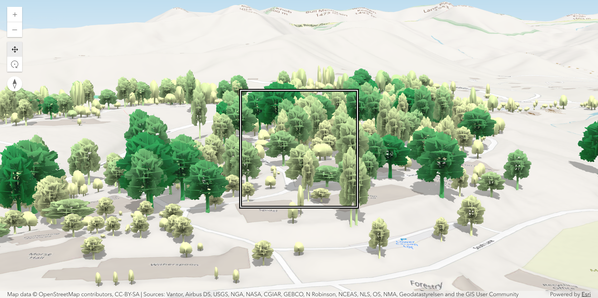
Focus region visibility
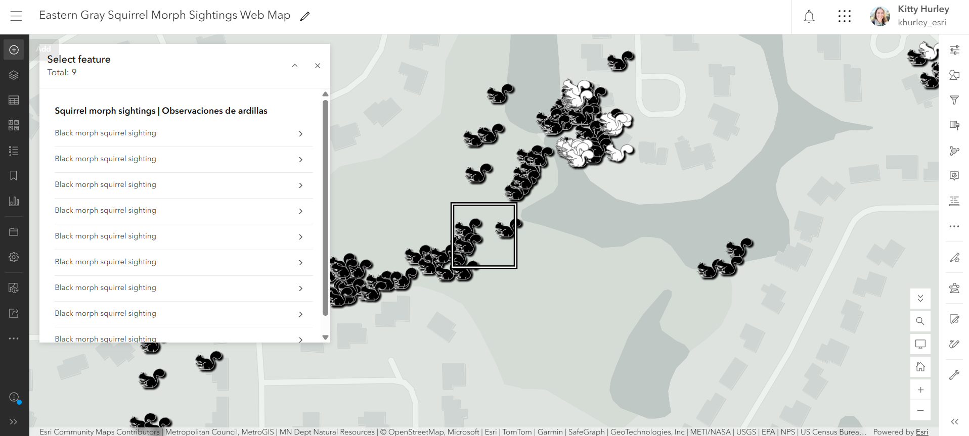
The focus region is not visible by default, but can be set as visible on the Map, Scene, or Link Chart using the focusRegionVisible property. Additional keyboard shortcuts are available when the focus region is enabled and the map has focus.
<arcgis-scene
  basemap="osm"
  ground="world-elevation"
  focus-region-visible>
</arcgis-scene>
Handle large result sets
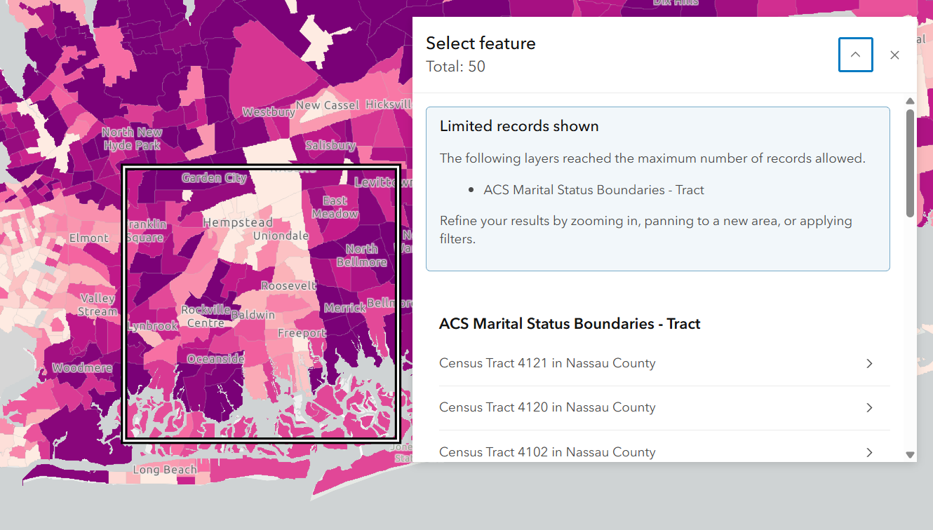
When a Feature Service or multiple Feature Services restricts the number of queried records using the maxRecordCount property, a limited records notice will display in the Popup if the popup query exceeds its limit. The notice indicates which layers have reached the maximum number of records allowed. Visible results are adjusted through zooming, panning, and/or decreasing the focus region.
Communicate dynamic changes
When interacting with the Bookmarks, Locate, and Search components, dynamic changes provide more meaningful context to assistive technologies regardless of language. For example, assistive technologies will announce:
- The name of the Bookmark when selected, and
- The name of the selected result from the Search component
Manage keyboard focus
Focus management improvements have been added to provide a consistent experience when interacting between map components, including:
- The Map, Scene, or Link Chart components now offer a focus method to initialize or set focus on-demand.
- The Popup component is automatically opened and focus is trapped within the component, locking focus in the component until it closes. Focus trapping in the Popup ensures individuals can access features keeping attention on the results.
- The Search component moves focus from the selected search result to the result displayed in the Popup, then returns focus to Search when the Popup is closed, providing a consistent experience for more users.
// Wait for the view to be ready
// When ready, set focus on the map
await mapElement.viewOnReady();
mapElement.focus();
Synchronize selections across components
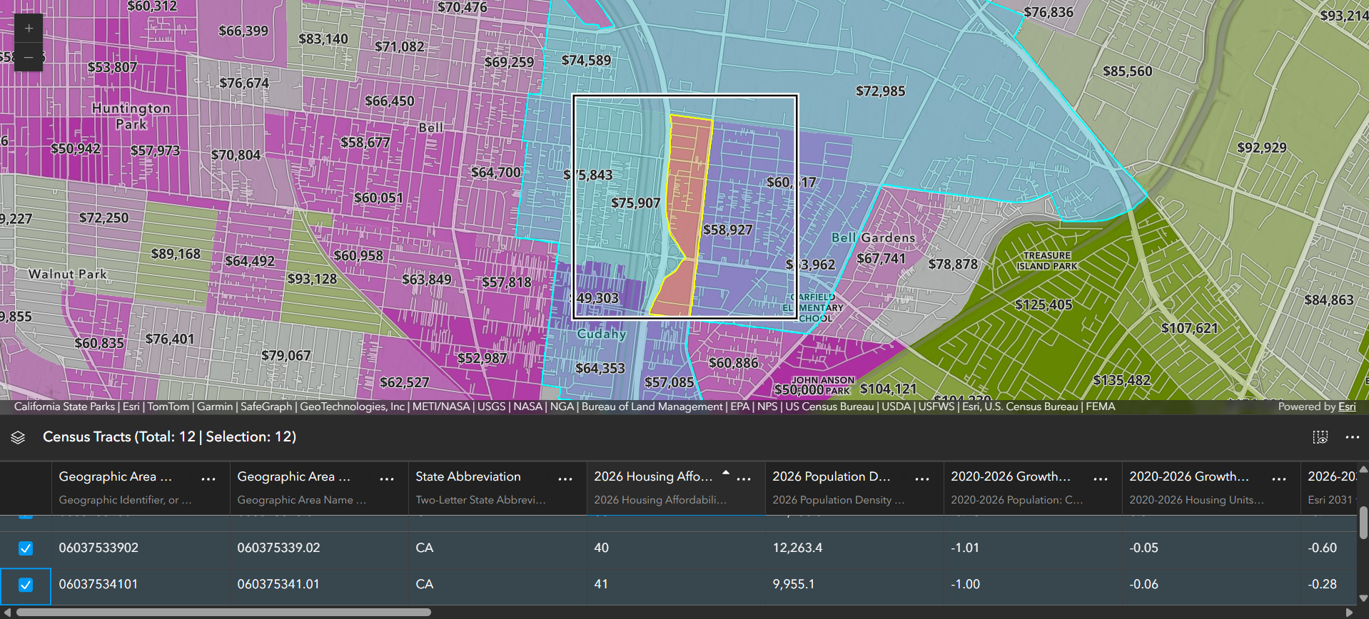
Feature Table and Editor offer a syncViewSection boolean property that when set, can allow the coordination of the focus region selection to be synced with other selectable components within an app. For full code references and examples on how to use this, refer to the selection table application code or selection editor application code samples on GitHub.
Customize the focus region
The focus region supports both light and dark modes by using a black and white border. The focus region also supports CSS variables, allowing customization of the border color and border stroke to complement a map’s features and colors to further contrast and increase access for a broader audience.

Accessibility across ArcGIS applications
ArcGIS Online products that are integrated with the focus region include Map Viewer, ArcGIS Dashboards, ArcGIS Experience Builder, and select ArcGIS Instant Apps templates. All apps using the focus region use the same keyboard shortcuts to provide a consistent and predictable user experience.
Further exploration
To learn more about accessibility, including the focus region and keyboard support:
- Watch the Building Inclusive Web Maps presentation at the 2026 NACIS conference
- Visit ArcGIS Maps SDK for JavaScript’s 5.2 release notes
- Explore sample applications in the GitHub repository
- Join us live next month on December 17 for a live training seminar on Accessibility in ArcGIS
On the horizon
We’re continuing to make data and maps easier for everyone to access and use. For the focus region, we’re exploring improvements such as summaries of key features and statistics, along with ways AI could help create useful and accessible descriptions.
Please share your experiences, challenges, and suggestions in the Esri Community discussion around the JavaScript Maps SDK accessibility.


Commenting is not enabled for this article.