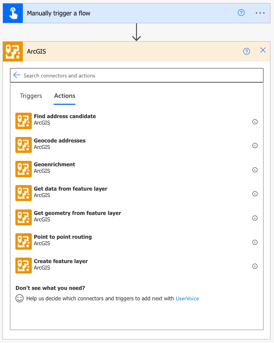
We are happy to announce that as of December 16, 2021, you can now leverage ArcGIS to perform some central functions within your Microsoft Power Automate flows. These new ArcGIS for Power Automate connectors will allow you to use your ArcGIS Identity or an ArcGIS Platform API Key to geocode addresses, enrich data with demographic variables, perform point-to-point routing, or get data and geometry from feature layers, plus a little bit more.

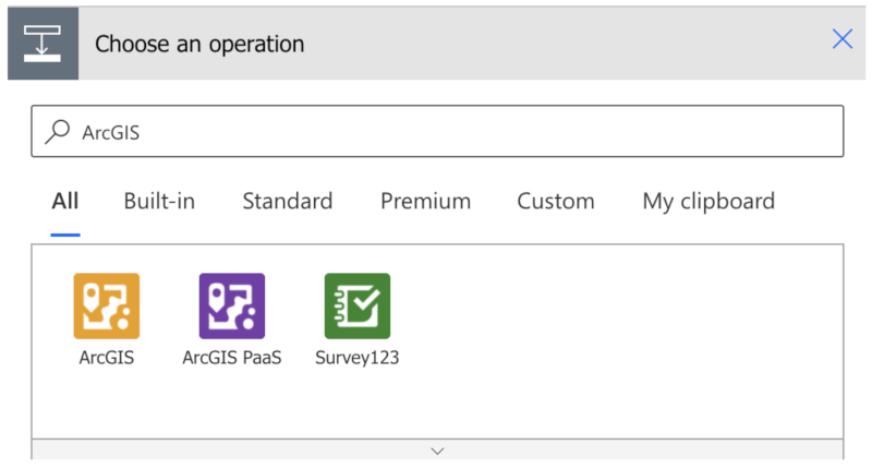
When building your flow, you can search for ArcGIS when adding a new step and the following 3 options appear. The ArcGIS connector will allow you to use your ArcGIS Online account to perform actions against location services or use your content within the system. The ArcGIS PaaS connector allows you to leverage an ArcGIS API key to use location services in your flows. Last but not least, there is the popular connector for Survey 123, which you can learn more about here.
If you are new to Power Automate, it is a no code/low code environment that allows you to chain together different triggers and actions to perform a task. While it is a no/low code environment, you still need a basic understanding of elementary coding concepts. If you feel ready for Power Automate, check out Microsoft’s help documentation, or if you want to learn more about coding concepts before you jump in, here are a few lessons from code.org where you’ll guide Steve or Alex on some adventures in the world of Minecraft.

Our main goal in providing the ArcGIS connector for Power Automate is to support our many customers who have asked about expanding functionality across the ArcGIS for Microsoft 365 products that integrate with Office, SharePoint, Power BI, and Teams. Here are a few examples of customer requests that demonstrate ways you can use the connector now in your everyday workflows.
Office
“I have an Excel spreadsheet that I keep up to date with a list of addresses. I want to automatically geocode them and then append new columns to the sheet by enriching each record based on its location. Using the Geoenrichment action, I choose from 3,000 variables such as Average House Hold Income, Population, or even more detailed fields like shopping habits, insurance coverage, food choices, and health care. You can explore all the variables that are available here. Once the flow is run, I can now see the demographic makeup and behavior of each address in my Excel document.”
SharePoint
“My organization stores a lot of documents that can be related to many or one location. As someone places a new document in a folder, I want to use Power Automate to send a Teams message to notify me to geotag (geotag: an electronic tag that assigns a geographical location) the document. This would allow team members the ability to search our document library using a map, where they can spatially search for PDFs, Word Documents, PowerPoint Presentations, and more.”
Power BI
“One of the most popular requests we have at my organization is to use ArcGIS for spatial analysis and to enrich data with variables critical to decision makers. While I could always do this in ArcGIS, the new Power Automate connector would allow me to bring data from my Feature Services hosted in ArcGIS Online directly into Power BI so I can build reports with that data. I can even include the geometry that allows me to best present my data in a format my executives are familiar with.“
When bringing data into Power BI you need to be mindful of a few things.
- This workflow is not intended for large datasets over 50,000 records.
- If you are working with more than 150 records, you need to loop through them as described here.
- Geometry can be BIG, so you need to simplify it to stay under the 32,677-character limits of Power BI.
- You can run flows frequently, but this is not ideal for real time data streams.
The vision for ArcGIS for Power Automate is to continue to enable you to build the flows you need, blending ArcGIS spatial capabilities with Microsoft 365 productivity tools. In this introduction, we are releasing some basic actions that meet some current needs for our own ArcGIS for Microsoft 365 products.

In many ways, we view the Actions provided in this Connector as Lego pieces that will enable builders to do amazing things. We are starting with some very basic yet powerful actions, and have plans to expand the available actions over the next year. While we have plans for the next actions we will release, we sincerely look forward to hearing from you about this and future releases, as we continue to expand our footprint printing Lego pieces in this no code / low code environment!

Article Discussion: