The anisotropic nature of meandering river morphology poses unique challenges in analyzing and modeling river channel data using GIS. Standard GIS tools that use Cartesian (x,y) coordinates are not appropriate for dealing with river channels because of their inability to handle river anisotropy – the unequal physical properties along different axes. However, researchers at Purdue University have created custom tools to handle river channel related data in ArcGIS. Those tools compute river attributes, perform spatial analysis and communicate with external hydraulic models. A few examples of the capabilities of Purdue’s river channel tools are given below.
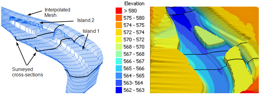
Interpolating Cross-sections to Create a 3D Mesh
The figure below shows how cross-section (black) lines are interpolated to create a 3D (blue) mesh, and then this mesh is converted to a surface through interpolation.
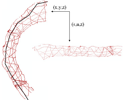
Coordinate Transformation
The figure below shows how river channel bathymetry points are converted from Cartesian coordinates to orthogonal coordinates by using the channel centerline as the reference. The s-coordinate gives the distance along the centerline, and the n-coordinate gives the perpendicular distance from the centerline.
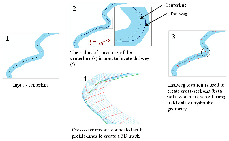
Creating 3D Channels from River Centerline
The figure below shows how to get a 3D river channel mesh starting from a channel centerline using the River Channel Morphology Model.
These are just few examples of the river channel tools available from Purdue University, and they can be found by following this link: http://web.ics.purdue.edu/~vmerwade/research.html#river
Special thanks to Dr. Venkatesh Merwade for providing this post. Questions for Dr. Merwade: vmerwade@purdue.edu

Article Discussion: