What’s new in ArcGIS QuickCapture
Here it comes, one more update before the end of the year! Download ArcGIS QuickCapture version 1.18 into your mobile device and discover many new features, including:
- Field calculations with Arcade
- Better (more) button user inputs
- Oriented imagery layer support
- Other enhancements
About ArcGIS QuickCapture
ArcGIS QuickCapture is Esri’s rapid mobile data collection app. Configure it to enable field data collection through a simple big button user experience. Collect lines, polygons and point observations; all at once and with the single tap of a button!
Not familiar with ArcGIS QuickCapture? Watch this 2-minute video for an overview:
What’s new in November 2023
Arcade expression support
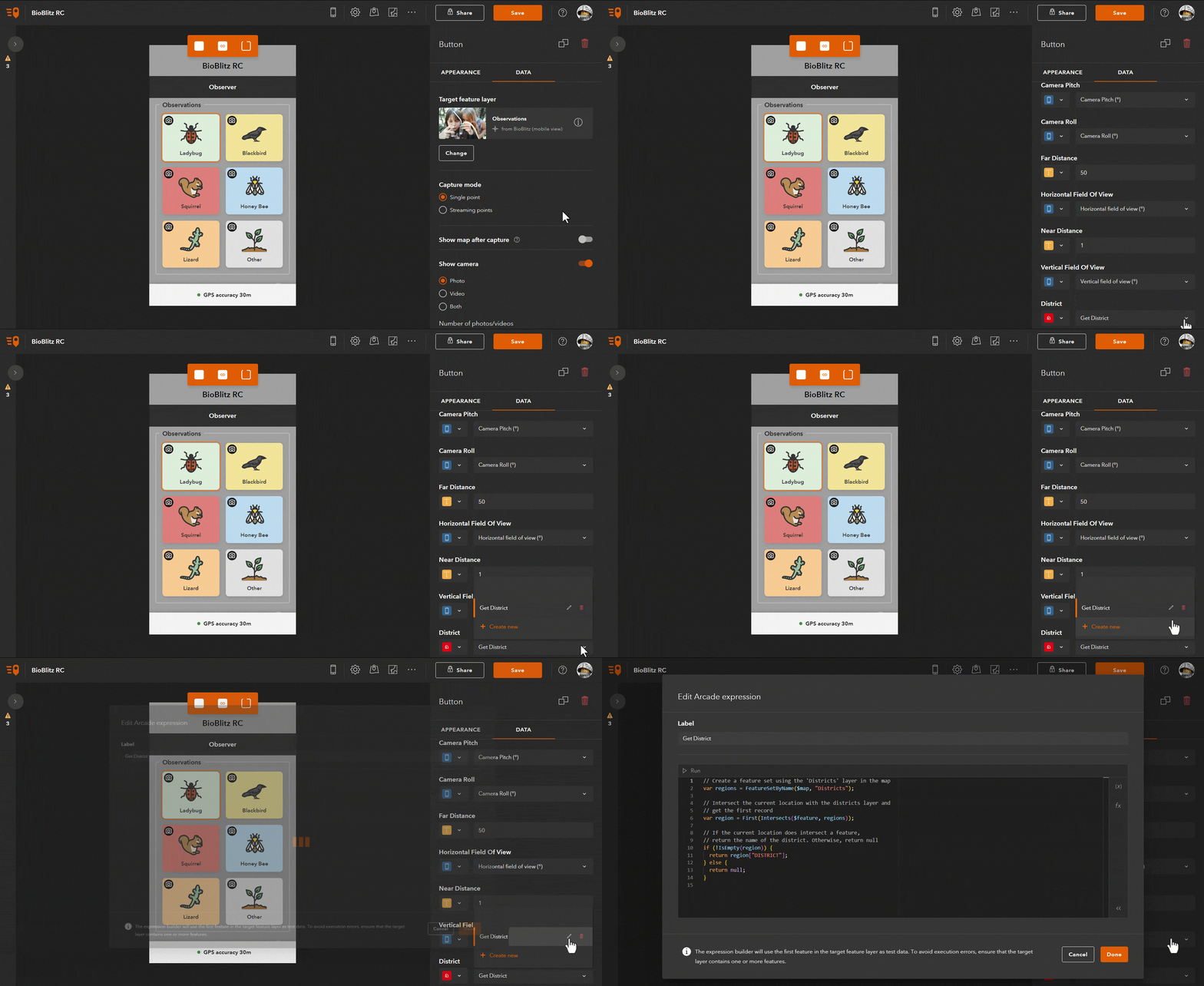
In the QuickCapture designer you will now find a new Arcade editor. Use it to automatically calculate attributes using your own Arcade expressions! The animation below shows how to open the editor and a simple expression to perform a point-in-polygon calculation.

End users of the mobile app will not even notice: Tap a button and QuickCapture will transparently run Arcade to enrich collected data. Working offline? No problem: Arcade will run against any data you collect while disconnected.
Learn with this step-by-step tutorial how to create your own Arcade expressions in QuickCapture. Read this Esri Community blog post to find a handful of common Arcade examples.
Better (more) user inputs
User inputs are a powerful feature in QuickCapture: Use them to let field users add extra attributes using dialogs specifically designed for fast-data-entry. The animation below shows an example where user inputs are shown to define the material, owner and condition of an asset.

What’s new? In the past, user inputs were limited to a maximum of three per button. Now you can configure up to ten!
You will also notice that with this release, the order in which button user inputs appear has changed. Prior to version 1.18, user inputs were presented following the order of fields in your feature layer. With version 1.18 and above, the order is defined by the author of the QuickCapture project. For now, you will need to set the order of your user inputs by manually editing your QuickCapture’s project JSON. With our next update in early 2024, we plan to let you change the order visually, through the QuickCapture designer.
Oriented imagery layers
With ArcGIS QuickCapture you can easily collect terrestrial oriented imagery and take advantage of it in ArcGIS. Check the Oriented Imagery meets field data collection blog post if not familiar with this concept.
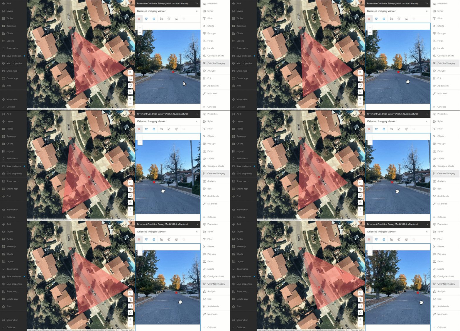
Oriented imagery is now getting more and more integrated within ArcGIS: ArcGIS Online recently added support for Oriented Imagery layers and the Map Viewer introduced an oriented imagery widget.
Use this update, to easily upgrade your existing oriented imagery catalogs into the new oriented imagery layer and leverage all your data from the new Map Viewer and ArcGIS Pro oriented imagery widgets.

Other enhancements
- SXblue series high-accuracy GNSS support
- Manage the visibility of layers in your QuickCapture map
- Configure the order in which user inputs appear (JSON only)
- New workflow for data recovery
To learn more about what’s new in this and previous releases, check the What’s new help topic.


Article Discussion: