Note: This blog article covers the classic Esri Story Maps which are in mature support and scheduled to be retired in late 2025. Story authors are strongly encouraged to use the new ArcGIS StoryMaps to create stories.
For more information about transitioning to the new StoryMaps, see ArcGIS StoryMaps resources. For more information about the transition from classic Esri Story Maps to the new ArcGIS StoryMaps, see Esri Story Maps: Now in mature support.

Story Map Tour is a popular story map, presenting a set of photos or videos along with captions, linked to an interactive map. It’s ideal for creating virtual tours, or any collection of places you’d like users to follow in sequence. View examples in the Story Map Tour gallery.
Using a little bit of HTML you can easily add a link to the caption or description at each tour stop. Here’s how.
About captions
The picture caption appears underneath each photo in the photo and text panel, as shown below.
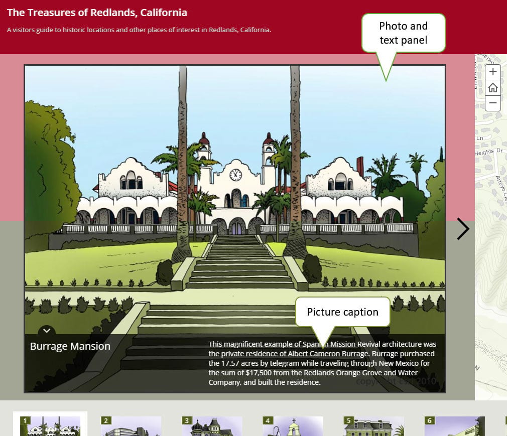
The caption should be short and concise. Too much text, and the caption will overlap the photo, requiring the viewer to dismiss the caption to see the photo. By adding a link, you can provide additional context or information without the caption becoming too verbose.
Add a link to the caption
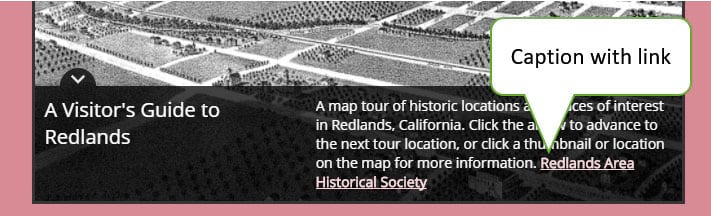
To add a link to the caption, use the <a> tag and href attribute. This can be added to your CSV file you use to create your Map Tour, the Flickr caption if you are using Flickr as a source for your photos, or simply add it via the Story Map Tour builder.
Use target=”_blank” to open the link in a new tab or window, rather than opening the link in the same tab and leaving the current stop in the Map Tour. You can also apply formatting such as font size and color to your link. Here’s an example caption which creates a pink link and opens it in a new tab or window.
The Treasures of Redlands Map Tour uses the caption above. Note the link in the photo caption text.
You can also add links to your title or subtitle using similar markup.
More information
For more information and examples, see the Story Map Tour Overview.
For more information about the new StoryMaps, see ArcGIS StoryMaps resources.
This post was originally published on September 20, 2015, and has been updated.

Commenting is not enabled for this article.