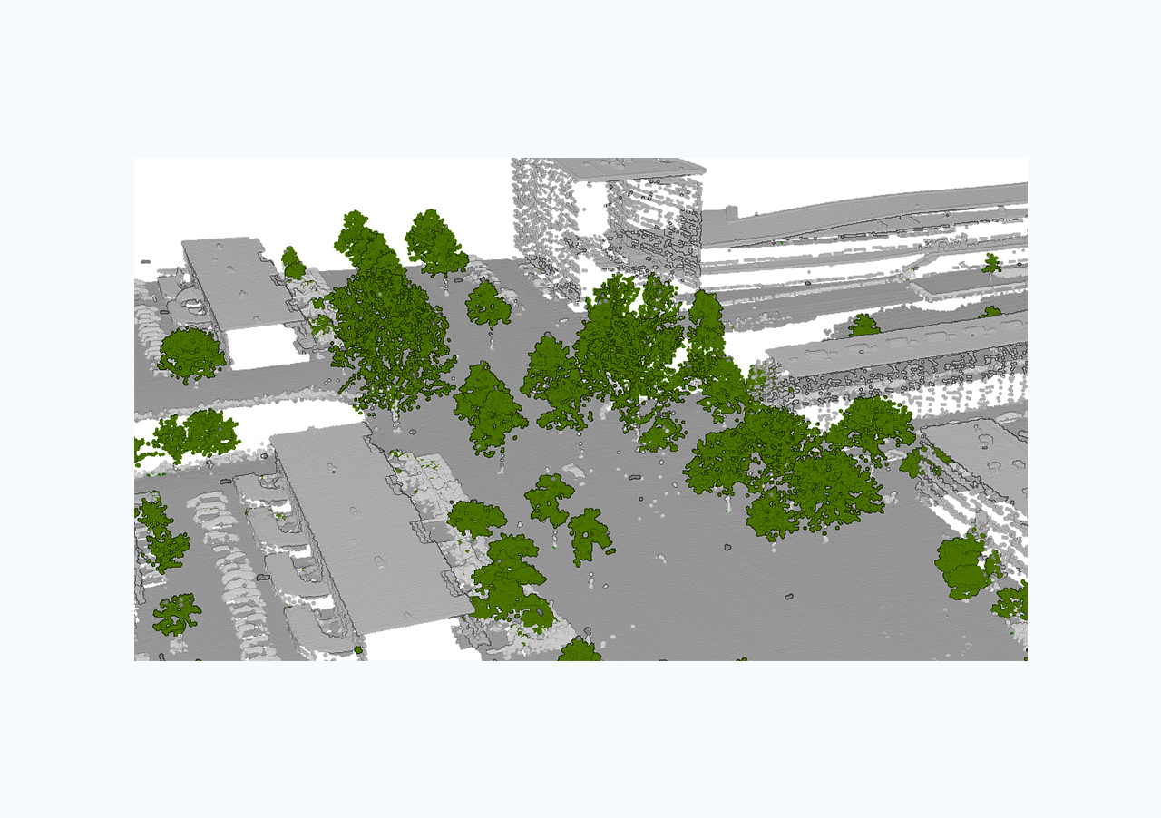
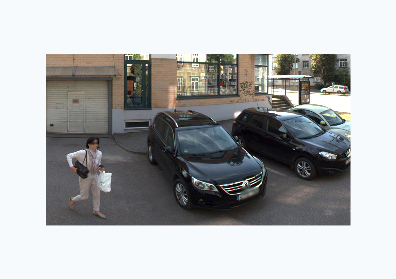
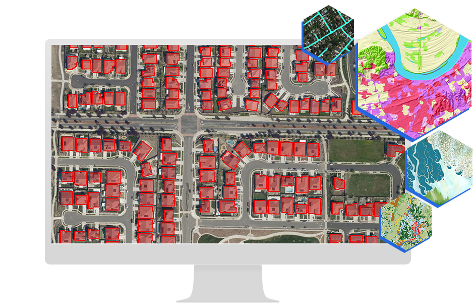
Skip to Content

Pretrained Deep Learning Models

A map of a neighborhood with houses outlined in red that uses pretrained deep learning models to identify homes

What are pretrained deep learning models?

ArcGIS pretrained deep learning models eliminate the need for huge volumes of training data, massive compute resources, and extensive artificial intelligence (AI) knowledge. Accelerate your geospatial workflows with built-in expertise and resources designed specifically for image feature extraction, land-cover classification, image redaction, and detecting objects. Automate the way you extract meaningful insights from imagery, point clouds, and video. 

What can pretrained models do for you?

Previous
Next

Types of models

Pretrained deep learning models perform tasks, such as feature extraction, classification, redaction, detection, and tracking, to derive meaningful insights from large amounts of imagery. Solve problems for infrastructure planning and a variety of other applications.

How it works

Aerial view of a parking lot filled with vehicles representing object detection being applied

Choose your tool

Open your ArcGIS client application and launch your tool of choice (e.g., detect objects, classify objects, classify pixels).

Select your input

Point to the imagery you want to extract information from.

Extract

Browse for your desired pretrained deep learning model and run your analysis.

Video

Extracting railway assets from lidar from L&T

View Esri’s pretrained models at work with a demonstration of railway asset data extraction using LIDAR data and GeoAI from Larsen & Toubro (L&T).

Find your ArcGIS product

Pretrained models are designed to support and enhance your workflows regardless of your ArcGIS deployment. To run these models, you will need an ArcGIS Online, ArcGIS Pro, or ArcGIS Enterprise license along with the relevant extensions.

Previous
Next

Explore all of our pretrained deep learning models

Browse models