How ArcGIS Works

With a comprehensive set of capabilities, multiple deployment options, and a well-architected framework as its foundation, ArcGIS fits seamlessly into enterprise tech stacks.

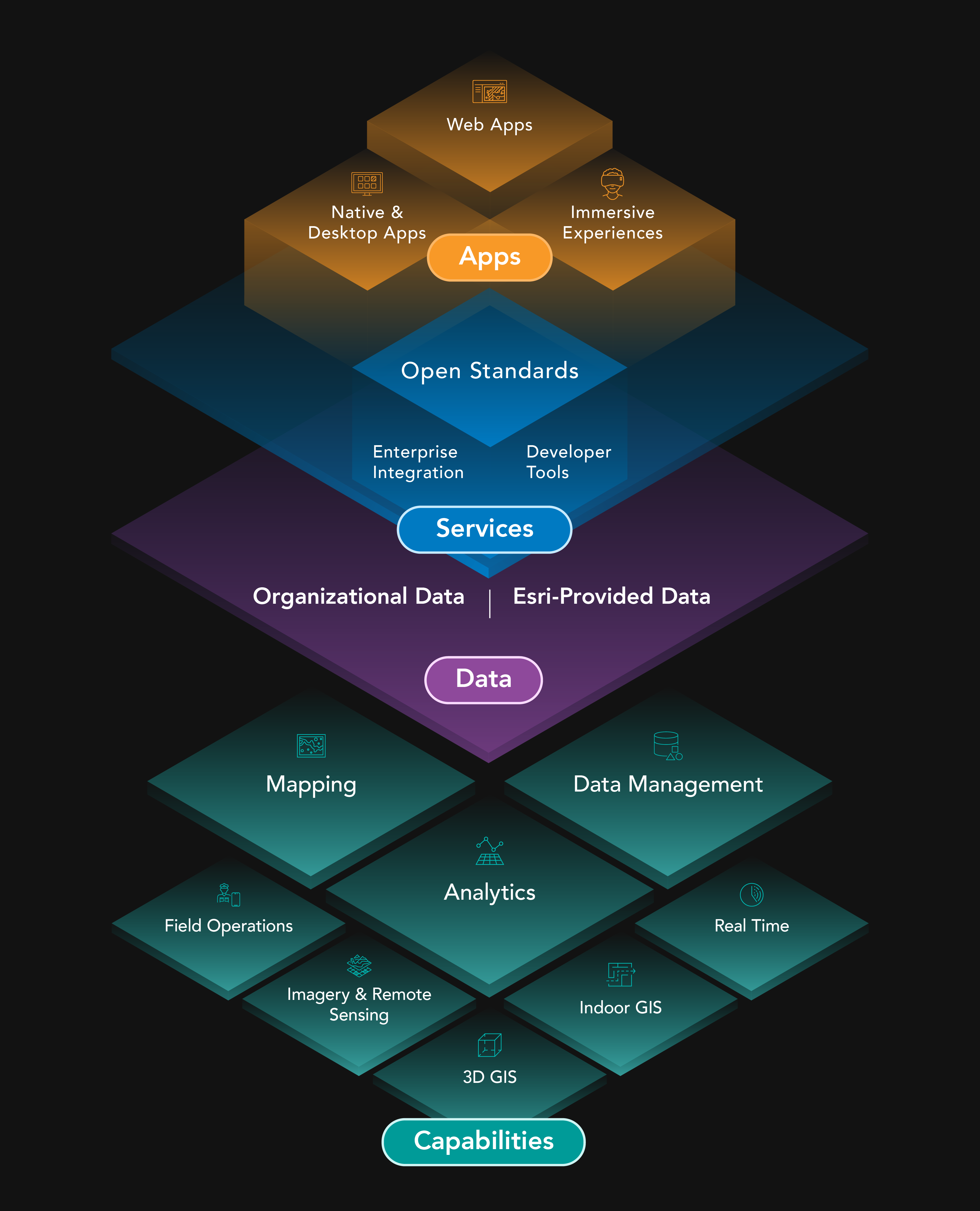
ArcGIS is proven technology

Esri develops ArcGIS based on insights from customers who have experienced transformational impact. Continual advancement of the technology and capabilities is influenced directly by customers’ evolving needs. 

On this foundation, organizations can support extensive business and mission systems across the enterprise.

A woman in a yellow sweater uses a computer mouse and keyboard to navigate a 3D map displayed on a computer screen.

ArcGIS is architected for the enterprise

ArcGIS meets all modern criteria for enterprise-ready technology. It is cloud-based, with a reliable development life cycle, support for standards and specifications, and integration with common IT systems and infrastructure.

Previous
Next

ArcGIS elements

ArcGIS is a comprehensive geospatial platform on which organizations can configure an array of systems to serve diverse purposes. Access is granted via user types, supporting people across the enterprise such as analysts, data scientists, technical professionals, and executives.

ArcGIS System Diagram
How to build systems with ArcGIS

ArcGIS comes with data, apps, and tools

ArcGIS is the most complete geospatial platform available. Capabilities are complemented by ready-to-use apps, tools, and content.

Previous
Next

Contact sales

Talk to someone on our sales team

1-877-228-1724

7:00 a.m.–5:00 p.m., Monday through Friday (PT)

Chat online

Start a chat

Contact the sales team

Fill out the contact form