data-pipelines logo

ArcGIS Data Pipelines

Included with ArcGIS user types

Streamline data integration in ArcGIS Online

Get started
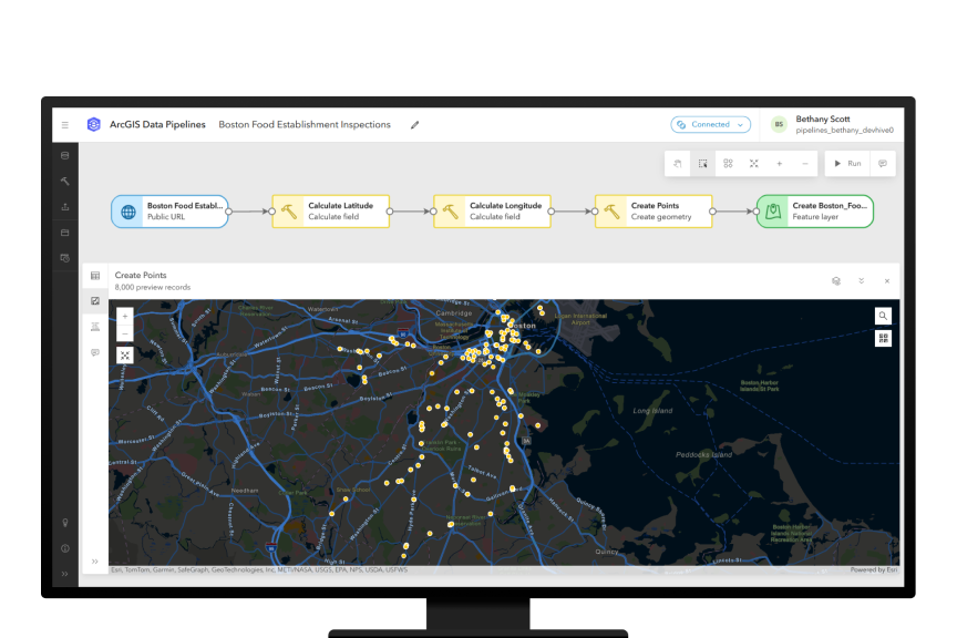
Computer monitor showing the ArcGIS Data Pipelines app with a map and connected boxes with text representing a data pipeline

ArcGIS Data Pipelines streamlines data integration in ArcGIS Online, offering a fast and efficient way to ingest, prepare, and maintain data. It provides an intuitive drag-and-drop interface that minimizes the need for coding skills, reducing the time to produce outputs. Data Pipelines also supports automation via task scheduling functionality to ensure your data remains current.

What can you do with ArcGIS Data Pipelines?

By simplifying data integration and preparation, Data Pipelines helps you prioritize mapping and analysis, leading to improved outcomes and enhanced value from your geospatial data.

Previous
Next

How it works

ArcGIS Data Pipelines provides a seamless integration of data with ArcGIS Online, enabling connections to diverse data sources and extraction of vector and tabular data. With its comprehensive engineering toolset, you can easily transform, clean, combine, and preview data for a wide range of workflows, while also automating data updates to ensure its accuracy.

Connect to data

Data Pipelines helps you seamlessly integrate your data with ArcGIS Online, providing connectivity and extraction of vector and tabular data from a range of sources such as Amazon S3, Google BigQuery, and Snowflake.

Transform and clean data

Once connected, Data Pipelines enables you to blend, build, and integrate datasets using structured toolsets like clean, construct, integrate, and format.

Combine disparate datasets

Data Pipelines lets you combine disparate datasets into a unified feature layer, ready for use across the ArcGIS system.

Preview data as you engineer it

With interactive previews, you can visualize and fine-tune your datasets to ensure accuracy and quality before finalizing the results.

Keep data up-to-date

Automate recurring updates for your ArcGIS Online feature layers with the scheduling feature of Data Pipelines and reduce the need for manual intervention.

CASE STUDY

KBC Advisors automates data integration

The real estate advisory firm used ArcGIS Data Pipelines to connect systems, enhance data accuracy, and ensure information is up to date.

Read the case study

This app is included with ArcGIS user types

ArcGIS provides a comprehensive set of capabilities for creating, managing, analyzing, and mapping geographic information. Gain access to the capabilities of this application, included in ArcGIS, with user types. Match user types to roles within your organization.

Learn more about user types
Learn more about ArcGIS
The Earth covered in a network of connected lines and icons overlaid with the ArcGIS Data Pipelines logo

Get started with ArcGIS Data Pipelines

Go to ArcGIS Online pricing

Talk to someone on our sales team

1-800-447-9778

7:00 a.m.–5:00 p.m., Monday through Friday (PT)

Chat online

Start a chat

Contact the sales team

Fill out the contact form