Chat online
Start chat

Part of the ArcGIS Reality suite of products
Drone reality mapping on a desktop

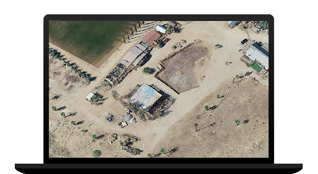
Use any modern drone to capture high-resolution imagery where and when you need it for your GIS drone mapping workflow. Esri recommends the ArcGIS Flight application to plan your flight and fly your drone, but other flight apps and nearly all drones are supported for processing in Drone2Map.

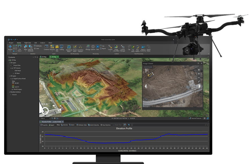
As Drone2Map is a desktop app, you can download Drone2Map on your machine and process images immediately after a flight instead of waiting for an internet connection. After returning to the office, you can generate high-quality imagery products to use in your GIS or publish to share with others.


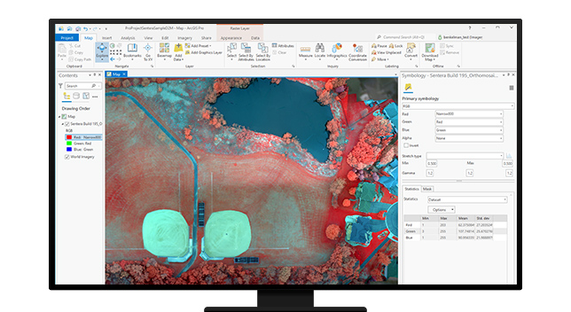
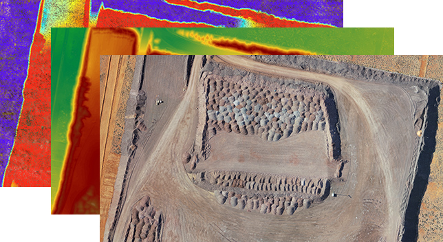
Use the built-in capabilities of Drone2Map to visualize your natural-color, thermal infrared, or multispectral datasets. Perform 2D and 3D measurements—including distances and areas, terrain profiles and volumetric calculations, or spectral profiles—to analyze your drone data quickly.

As part of the ArcGIS system, Drone2Map provides access to a range of tools and capabilities for accurate mapping and geospatial analysis. Projects can be opened easily in ArcGIS Pro for integrated management, and imagery data products can be published in ArcGIS Online or ArcGIS Enterprise, including full support for multispectral, thermal, and elevation datasets.

ArcGIS Drone2Map enables users to easily process overlapping nadir images to create accurate 2D true orthos, orthomosaics, digital surface models (DSMs), and digital terrain models (DTMs). These outputs, referred to as ortho mapping products, integrate seamlessly into ArcGIS Online, ArcGIS Enterprise, or ArcGIS Pro and provide great value due to their timeliness, resolution, and accuracy.

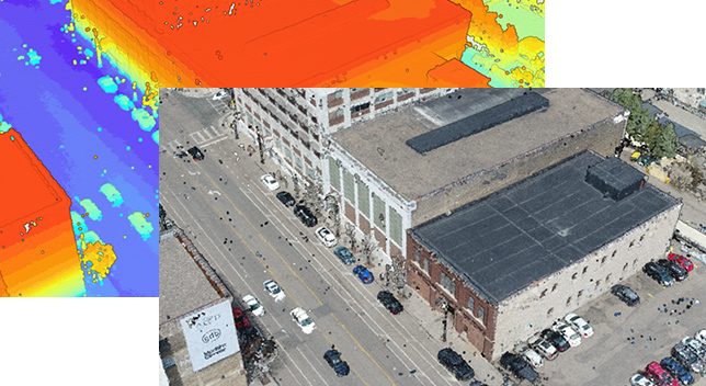
Create high quality 3D reality mapping products such as point clouds and photo-realistic textured meshes from nadir and oblique images. Drone2Map also enables the creation of DSM orthomosaics with sharp building edges and all aboveground features in their correct horizontal location.

Collect drone data using Site Scan Flight LE or any third-party drone data collection app.
After the completed flight, create a project to download your drone imagery. Add ground control and automatically process to create 2D and 3D outputs.
View 2D and 3D outputs. Make measurements, track changes, and perform other analyses within Drone2Map.
Open your project easily in ArcGIS Pro to use a range of tools such as advanced spatial, temporal, and spectral analysis and data management.
Share your imagery outputs within your organization or with the public as feature layers, web maps, imagery layers, and more.
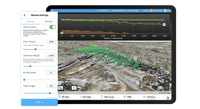
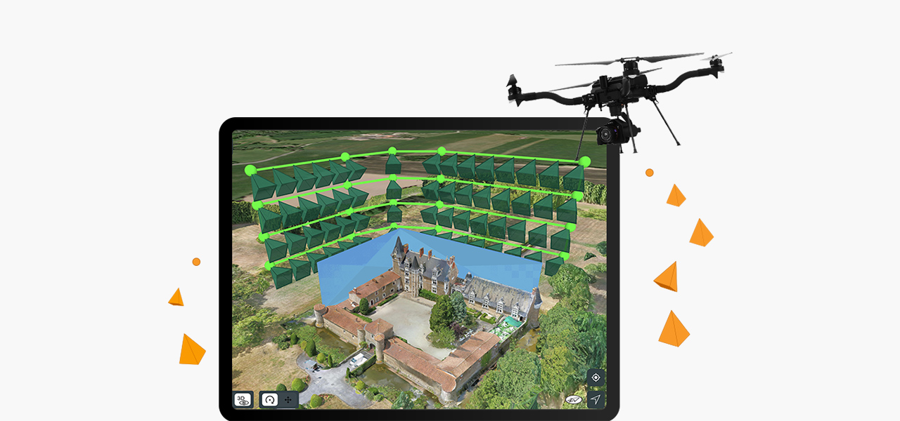
ArcGIS Flight makes it easy to plan and execute automated drone flights in order to collect imagery for reality mapping and inspection or record geospatial video. Upload your data for processing in Drone2Map to be used across your ArcGIS organization.
Choose from a variety of flight modes tailored to the type of asset being captured, and the app will automatically define the optimal flight path and allow you to preview it in 2D or 3D.
Drone Pilots can use Terrain Follow, which enhances imagery quality by adjusting the drone's height to follow the terrain.
Explore the software applications that are a part of ArcGIS Reality. Find the reality mapping software that fits the size of your projects and the sensors you work with.
Use this extension to generate large-scale true DSMs, true orthos, DSM meshes, point clouds, and 3D meshes from satellite, aerial, and drone imagery.
Explore this scalable, stand-alone application for citywide and countrywide reality mapping to create an important piece of 3D digital twins.
Process large volumes of drone imagery faster with cloud-based data processing and create 2D and 3D maps and models that you can quickly share across your organization.
Digital twins are representations of real-world objects and their processes and relationships. With ArcGIS Reality, users create highly accurate 3D meshes, true orthos, and point clouds to use as an important piece when developing 3D digital twins of social, natural, and built environments. Learn more about Esri’s 3D capabilities and how they relate to a comprehensive digital twin.


7:00 a.m.–5:00 p.m., Monday through Friday (PT)