ArcGIS for Autodesk Forma

Integrating location for inspired design

Enhance pre-design workflows by bringing essential spatial context into Autodesk Forma Site Design software.

3D map titled Redlands Mall Renovation showing FEMA flood zones and walking times with an open ArcGIS for Autodesk Forma window

Envision, design, and build together

Connect designs to authoritative location data

ArcGIS for Autodesk Forma integrates with Autodesk Forma Site Design’s cloud platform. Connect your organization’s authoritative ArcGIS data directly into your Forma designs.

Elevate designs with ArcGIS content

Integrate environmental data and spatial context into preliminary and architectural conceptual design phases within Autodesk Forma Site Design software. Streamline workflows, assess environmental impacts, and visualize real-world scenarios to improve the quality and fidelity of pre-design work.

Work within Autodesk Forma

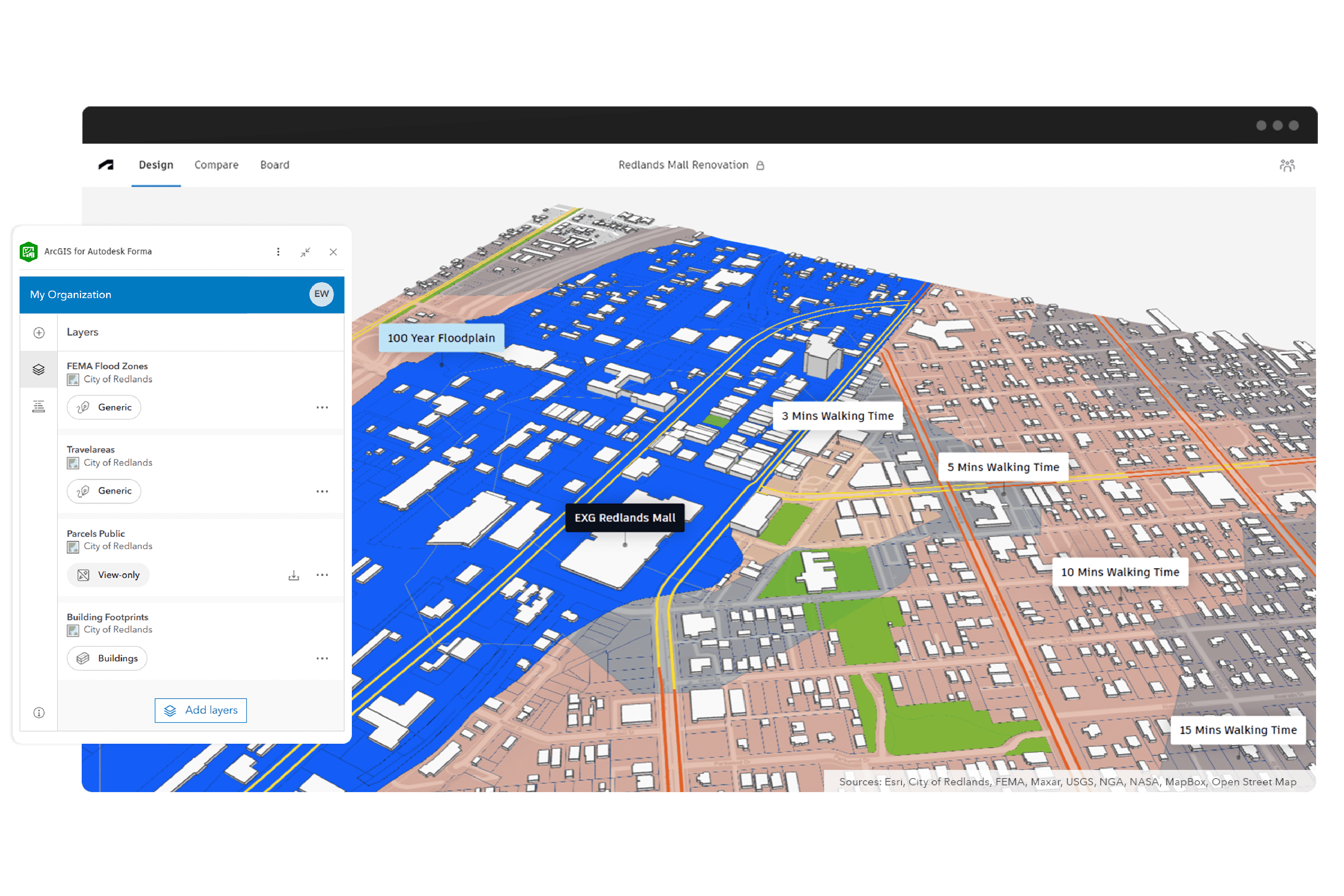
Seamlessly connecting to ArcGIS from within Autodesk Forma Site Design allows you to work within your existing design environment without switching between platforms.

3D model of a building in an urban area with the ArcGIS for Autodesk Forma window showing building attributes and site information

Enrich Forma with global geographic content

Gain access to ArcGIS Living Atlas of the World—the world’s foremost collection of geographic information.

Available data layers include:

  • Environmental features, such as soils and hydrology
  • Built infrastructure
  • Imagery
  • Real-time feeds

3D model of potential flood zones in Redlands and the ArcGIS for Aurodesk Forma window showing selected data layers

Access up-to-date and accurate GIS data

Instantly integrate your organization’s authoritative ArcGIS data with Autodesk Forma Site Design’s cloud platform, ensuring the most up-to-date, accurate information is available in your design environment.

3D model with the ArcGIS for Autodesk Forma panel on the left displaying organizational layers titled Parcels Public, Building Footprints, and Zoning

Share ArcGIS enhanced designs into Autodesk Revit

Seamlessly share your geographically enhanced designs from Autodesk Forma Site Design to Autodesk Revit.

Green 3D model of a city rendered in Autodesk Revit showing buildings and terrain with contour lines

How it works

Previous
Next

ArcGIS connects data to support urban development

Get the tools to plan, build, analyze, and visualize urban environments by integrating geospatial data, building information, and 3D visualizations from ArcGIS. Better support your project goals and enhance efficiency throughout the urban development process.

Previous
Next

Purchasing options for ArcGIS

Esri-hosted software as a service

Go to ArcGIS Online pricing

Self-hosted geospatial infrastructure

Go to ArcGIS Enterprise pricing

Talk to someone on our sales team

800-447-9778

7:00 a.m.–5:00 p.m., Monday through Friday (PT)

Chat online

Start chat

Contact the sales team

Fill out the contact form