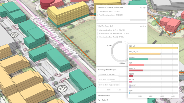
Skip to Content

Specific Plans

Combine a concrete vision with short-term action on neighborhood plan areas with ArcGIS Urban. Achieve urban transformation through a more analytical and parametric-driven process that is both dynamic and creative.

Manage a digital zoning code

Establish a GIS-based zoning map to test proposals and conduct zoning revisions. Empower the real estate community to easily calibrate projects.

Design what-if scenarios

Explore zoning changes by comparing current and proposed buildable volumes. Test the allocation of plausible building forms to evaluate impact.

Customize building types

Create your own custom building and space use parameters, or apply the easy-to-use library and test what is possible using the zoning overlays and variances provided.

Validate proposed changes

Give planning teams two-way validation designed to manage land use and zoning coordination across all plans.

Schedule a demo

Buy ArcGIS Urban

Buy now