Pay as you go
Pay for the tools you need, when you need them.
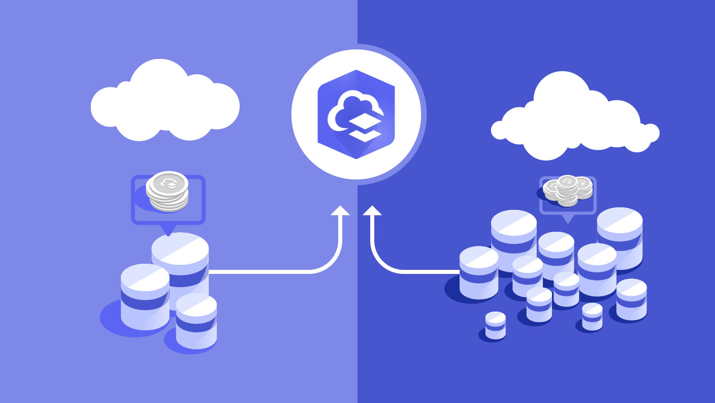
All ArcGIS Online subscriptions come with credits to help you complete your workflows

ArcGIS Online credits are a form of currency for specific cloud-based services. Credits enable members of an organization to execute various workflows such as performing analytics, storing content in the cloud, and using premium content. Every ArcGIS Online subscription includes a pool of credits that can be shared by members of the organization. To learn about your organization's credit balance, contact your administrator.

The user types in your subscription determine the quantity of credits you start with and have replenished at subscription renewal annually.
For example, a subscription with a Creator user type and a Contributor user type would have 750 shared credits.
Additional credits are available for purchase in blocks of 1,000 and are valid for 24 months before expiration.

Many of the valuable capabilities in ArcGIS Online are included with your user type. For specific examples of each type of storage and the transaction-based tools that consume credits, as well as their credit consumption rates, visit the ArcGIS Online credit usage page.
Use available tools to monitor and manage your credit usage.

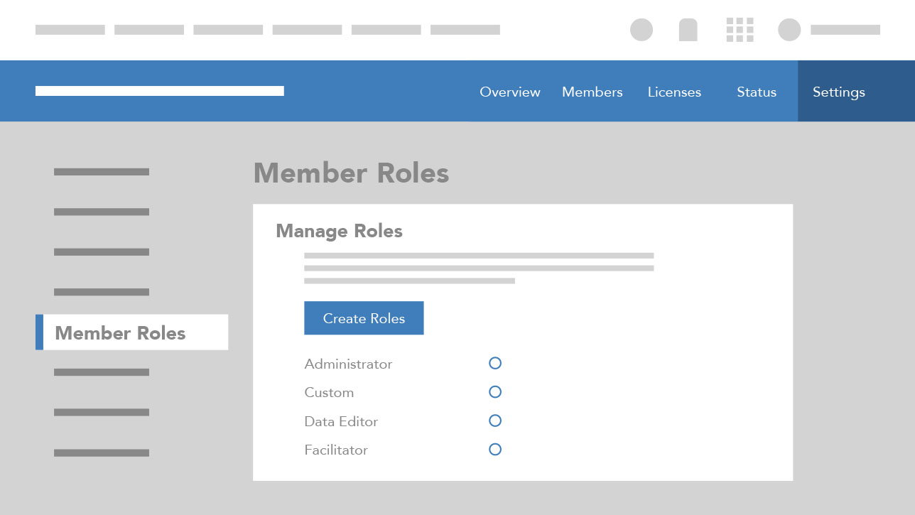
Administrators can allocate a specific quantity of credits to individual users by turning on credit budgeting.

When administrators know which tools members need, they can create and assign custom member roles with privileges to limit access to credit-consuming tools.
Administrators can monitor their members' credit usage through tools on the Organization page, including the Overview and Status tabs, which enable them to do the following:

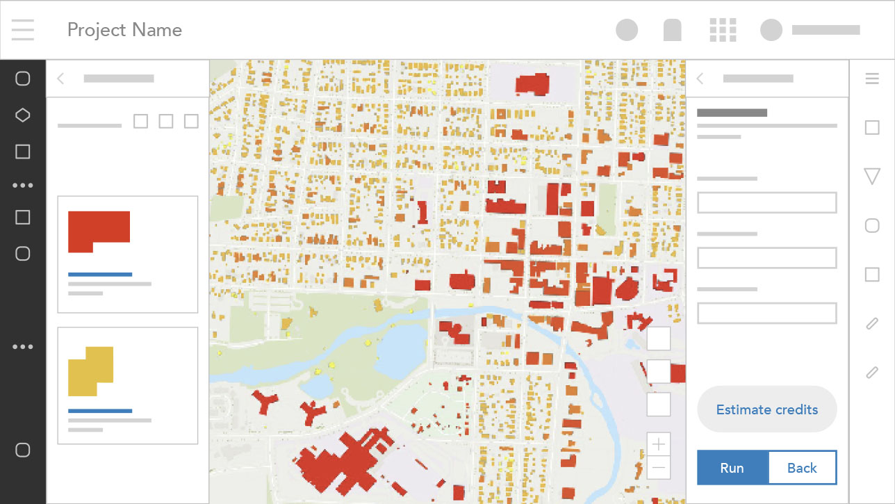
Before running an analysis tool in ArcGIS Online, you can use the credit estimator to calculate the expected number of credits you will use in the transaction.
Different organizations use credits for different things. Some organizations use their credits for geocoding or storing features, while others run analyses. The use cases for ArcGIS are incredibly diverse, and we only want to charge users for the portion of ArcGIS they use. Credits enable us to do that.
Searching for addresses does not consume credits. Credits are only consumed when geocoded points are saved. For example, when you drag and drop a CSV file of addresses into a web map and geocode them into points.
When data is collected by mobile users, it is added to a feature layer. Storing the features consumes credits. The size and complexity of the feature layer will determine how many credits are consumed storing it. Feature data may also be stored at a fixed cost by using Premium Feature Data Store.
You can store photos, PDFs, and videos as items or with features as attachments. In both scenarios, the media files will be charged as file storage, which is more economical than feature storage.
When a user submits a transaction in Map Viewer that exceeds their budget, they will receive an error message informing them that they do not have enough credits to perform the operation. The transaction will not start if there are not enough credits. The user can ask their administrator for additional credits for the transaction.
Once your organization has depleted its credits, the subscription will be placed on Restricted Status. At this point, certain capabilities—such as consuming premium content, batch geocoding, and uploading new items—will no longer be available to your users.
7:00 a.m.–5:00 p.m., Monday through Friday (PT)