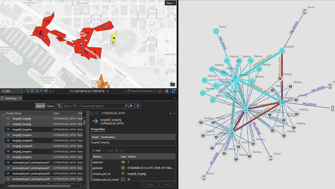
Skip to Content
A dark grey map visualizing data with overlaid nesting green hexagons containing glowing pink dots

Advanced Analytics to Support Defense and Intelligence

ArcGIS offers scalable, sophisticated analysis tools for Department of Defense (DoD) and intelligence community (IC) organizations.

Contact Esri

Discover insights with location intelligence

As data collection continues to grow, there is a developing need for interoperability, seamless access, and integration between multiple organizations across the DoD and IC. ArcGIS provides these capabilities and scales with your organization’s needs and requirements using existing information technology (IT) infrastructure.

A person in green military fatigues accessing a map dashboard on an open laptop in a shady green forest

Empowering defense and intelligence with scalable spatial insights

Previous
Next

Webinar

Spatial Analysis and Data Science

Learn how to discover patterns and trends in your data with capabilities across the ArcGIS system.

Contact us

Advanced analytics are critical to your mission and offer seamless data access and integration from multiple organizations that scale with your needs and requirements. Make Esri a part of your mission.