Seasonal mowing plan optimization
Manage and visualize mowing areas and service agreements. Increase your organization’s understanding of mowing coverage and efficiently plan for upcoming mowing seasons.


Maintaining well-kept parks, open spaces, and roadsides ensures that communities are welcoming, safe, and compliant with local ordinances. Esri’s Mowing Operations solution helps you improve mowing plans, track real-time progress, and quickly address performance issues.
This solution uses ArcGIS Velocity, a software as a service (SaaS) Internet of Things (IoT) application that allows you to ingest, visualize, and analyze streaming data in real time to make informed operational decisions.

Learn how governments and organizations plan and conduct real-time mapping of mowing operations in their communities.
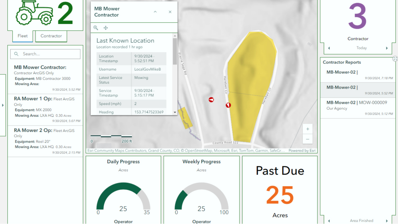
Mowing Operations

ArcGIS Solutions

ArcGIS Velocity
Fill out the form and an Esri expert will contact you to discuss how a real-time mapping solution can optimize your mowing operations.