Esri’s program for K–12 (primary and secondary) schools launched in 1992, and pioneers numbered only a handful. Interactive online mapping appeared in the mid-1990s as the coevolution of hardware, operating systems, software, and the internet fed explosive growth. The arrival of ArcGIS Online in 2011 and ArcGIS Online for organizations in 2012–13 led Esri to join the Obama administration’s ConnectED Initiative in May 2014. Esri president Jack Dangermond offered $1 billion in software and instructional support for any US school (public and private), homeschoolers, and youth club to get an ArcGIS Online organizational subscription for free for instructional use.
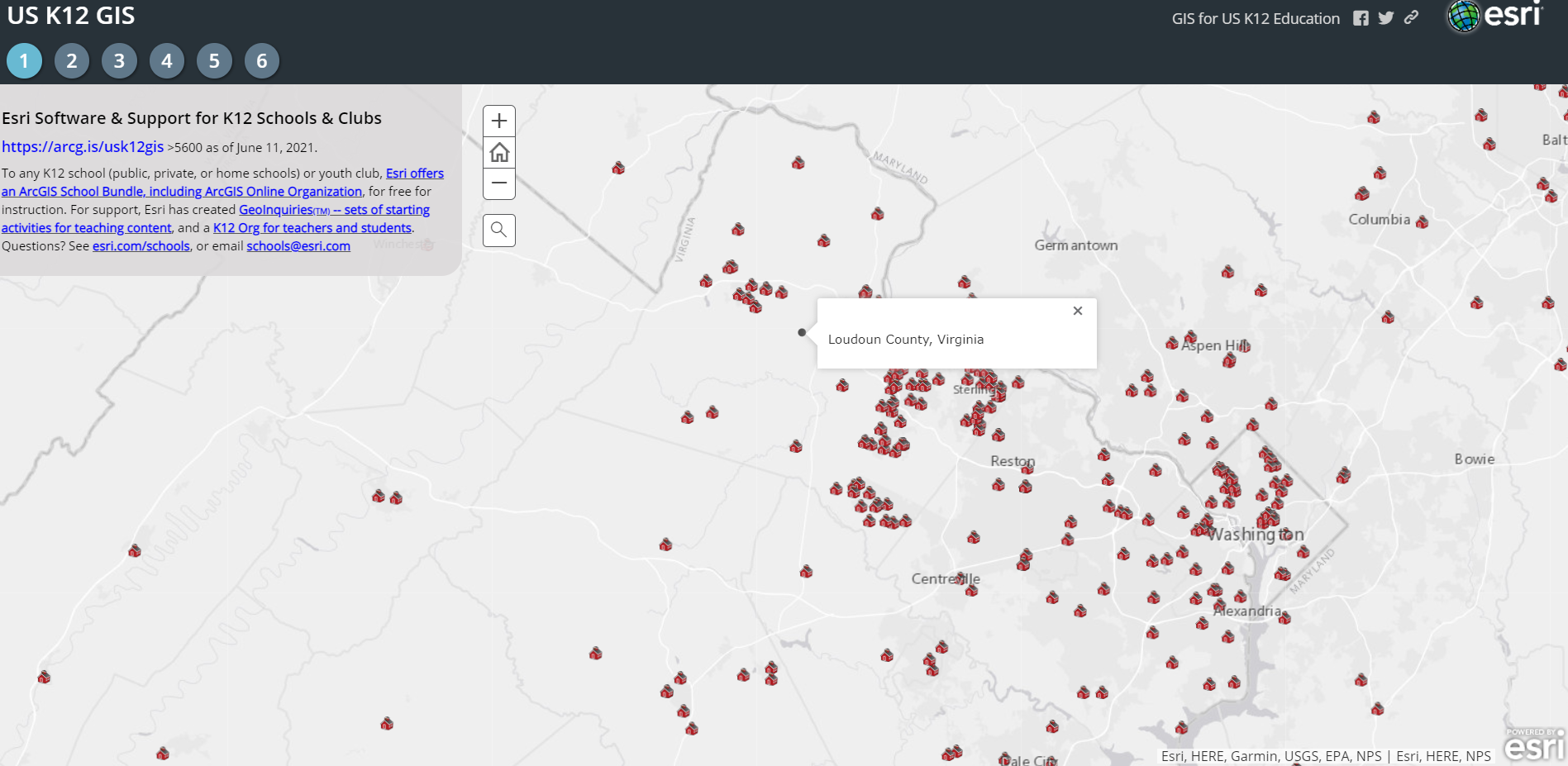
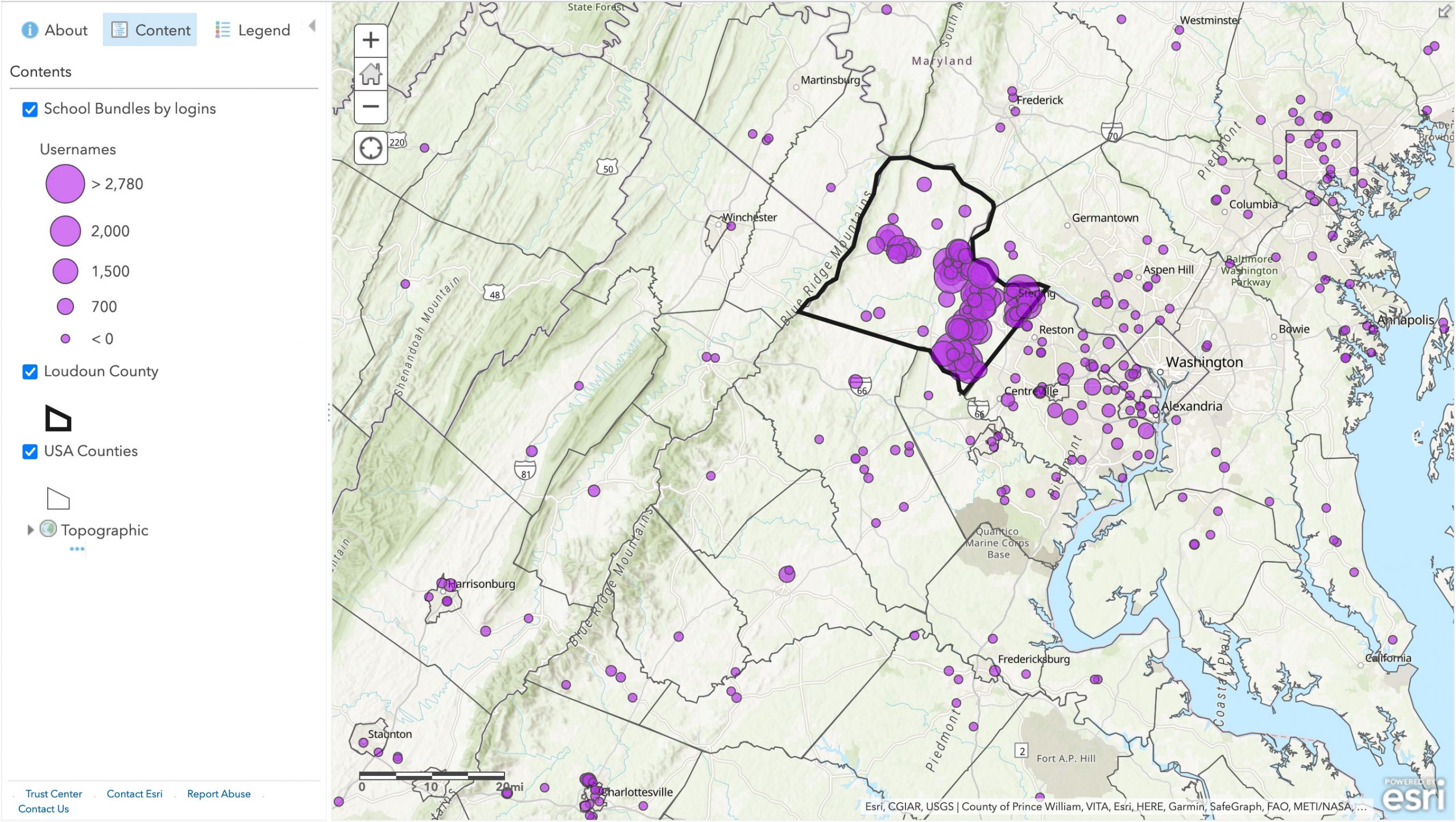
In 2014, Loudoun County Public Schools (LCPS), in Virginia, just west of Washington, DC, embraced geographic information system (GIS) in all 85 of its schools. Today, all 95 LCPS schools have an ArcGIS Online organizational account, and each of the more than 80,000 students has a unique login. Every school, at each level, does something with GIS each year. Most high school students do some GIS work under their login, as do many in middle school and even some in elementary school. Why is this district such a hotbed of GIS?
“Right place at the right time,” said LCPS teacher Michael Wagner. “I started teaching in 2002, heard about GIS in 2005 because of a new program called the Virginia Geospatial Semester led by James Madison University, and immediately wanted in. LCPS science supervisor Odette Scovel understood the power of GIS, so I started teaching it in 2006, and we built it out to all high schools in 2008. We tried to expand GIS beyond this class, but the learning curve for desktop tools was just too steep.” But ArcGIS Online would allow all schools to engage much more easily. In 2013, Scovel and Wagner refreshed their ideas for expansion.
LCPS planned to start in high school science first, moving slowly to other subjects, and then into lower grades. And Esri’s announcement of providing software for any interested school accelerated everything. “We were all in, right away. I went from full-time teaching at Heritage High School to part-time, with the rest of the time helping schools launch their organizational accounts. The way we taught was more individualistic then, so it was just easier for us to begin with individual organizations and individual logins.”
So now, seven years in, given that schools typically change slowly, what’s it like? Wagner paused. “This region has a lot of people using GIS, but they do it behind the scenes in so many places that people don’t associate it with one particular prominent use. But the release of new standards in 2018 has helped us integrate GIS into high school, middle school, and even elementary school. Sciences were the avenue in, but it’s used in social studies too, and some English classes are building story maps to accompany literature they are reading. And remote programs and Career and Technical Education (CTE) programs are using it. The groundwork is laid. The administration knows its importance for careers. Here, look at the district’s stated mission: ‘Empowering all students to make meaningful contributions to the world.’ And our #1 strategic goal: ‘Develop knowledgeable critical thinkers, communicators, collaborators, creators, and contributors.’ GIS fits this well.”

Does it fit even for young learners? “We have this book for young students—Bird, Butterfly, Eel—that looks at three creatures we have in the county: barn swallows, monarch butterflies, and eels. They all migrate. The classes use GIS to look at other places where these creatures go—looking at the migration patterns, the connections and characteristics, the differences even in our region, like urban and agricultural landscape—so the students learn to use the technology while focusing on the content. A story map is a great avenue for lessons.”
Since Wagner has been teaching GIS for 15 years, and every school has had software for the last seven, could he see any impact in the capacities of incoming students? He paused again, contemplating. “I can’t stay on top of what every school is doing. And it’s hard to say if what I see in students I’m first encountering is because of GIS exposure. We don’t have a longitudinal study about each student, looking at what they have done in each subject and grade. But now that you mention it, I think I will make an ArcGIS Survey123 form and ask at least my Geospatial Semester students to say in which school, grade, and subject they remember doing some GIS activities … I can do that! But, meanwhile, I can say that we know a lot of students who have had GIS training here have gone on to engage GIS in college, in the military, and in jobs. There have even been students able to go into GIS internships and jobs right out of high school.”
But any program has to be concerned about sustainability, so how is the district prepared for that? He picked his words carefully. “Sometimes, if administrators change, there can be some broad shifts. Odette [Scovel] has supported this from the beginning, and while some leaders were a little slower to get behind it back then, newer ones see the value today. We have a new high school that doesn’t have seniors yet, but they’re already planning on having the Geospatial Semester class. I think people see the value. And, you saw this article in ArcNews, about the Geospatial Semester? The teacher, Taryn Langmead, was one of my original students in the Geospatial Semester. She has an education degree plus earth science and a GIS background.” Wagner paused, “This has really come full circle. You know you’re doing something right when one of your students is following the same path.”
Every state, district, school, and formal youth club can engage GIS for K–12 instruction for free. And in 2018, Esri expanded this to the world. Access to the technology is key, but not sufficient. It takes vision, planning, commitment, persistence, creativity, and adaptability to make a broad-spectrum change. But even just one or two people can map a path by which thousands can make meaningful contributions to the world.
To learn more about the Esri Schools program, please view our Schools page.