As much as I was looking forward to extremely awkward attempts at virtual socials, I must admit that an in-person conference felt great to attend. I think the hallmark of a good conference really boils down to this one thing: Were people inspired? I can report that for the National Association of Environmental Professionals (NAEP) Conference and Training Symposium, people certainly seemed inspired. I know I was. I think this feeling of inspiration comes from the fact that right now it’s a very interesting and exciting time to be an environmental professional. That really comes through as the zeitgeist; the spirit of the times we’re in and the mood of the conference.
This year, I was honored to be selected as a keynote speaker. While not my first time speaking, it was my first keynote. The challenge with keynotes is that you can speak about anything, but don’t have time for everything. So, I focused on this “zeitgeist” and tried to break down exactly why it’s such an exciting time, but also identify the challenges we’re facing as environmental professionals and how GIS can help us achieve some big, innovative dreams.
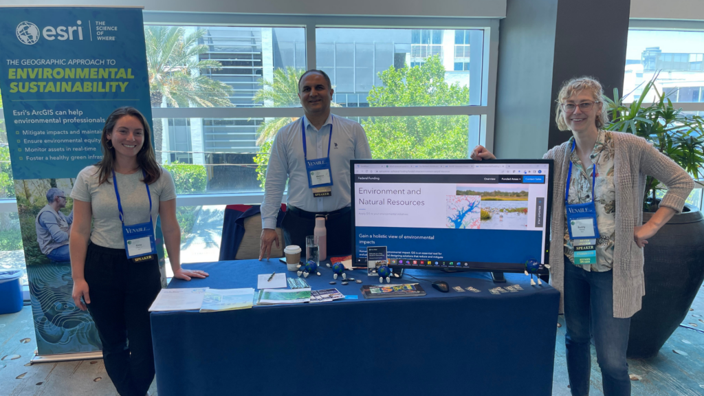
From left to right: Dr. Gina O’Neil (Esri Professional Services – Water), Mehmet Secilmis (Esri Global Business Development – Sr. Account Manager for AEC Environmental) and Sunny Fleming (Esri Industry Lead – Environment) at our booth at the NAEP Conference in Ft. Lauderdale, FL.
The Geographic Approach to Environmental Sustainability
With the visceral impacts of climate change now on our doorsteps, applied environmental knowledge is in demand more now than it ever has been. Globally, this is being expressed through personal choices and activism, corporate strategies and government policy. Domestically, I see one of the strongest expressions of this through the Infrastructure Investments and Jobs Act (IIJA). I previously wrote about how the IIJA is not just another stimulus bill; it recognizes the interconnectedness between the economy, our society and our environment. This is driving a demand for sound application of the environmental sciences to understand risks, mitigate impacts and design a more sustainable and equitable future.
This same demand also presents our industry with some challenges. Communities are being asked to prioritize projects through the lens of social equity and environmental sensitivity. Constituents are demanding more accountability and transparency around how funds are spent. Governments are seeking more innovative and effective ways to bring these opportunities to communities that may lack the technical resources to take advantage of them. Ultimately, these challenges and rising demand lead to bottlenecks in our industry… and opportunity.
The job market for environmental professionals is hot right now, but hiring is not the only tool at our disposal to help us capitalize on this opportunity! We can also look to streamline our operational efficiency by embracing a geographic approach with the application of GIS technology.
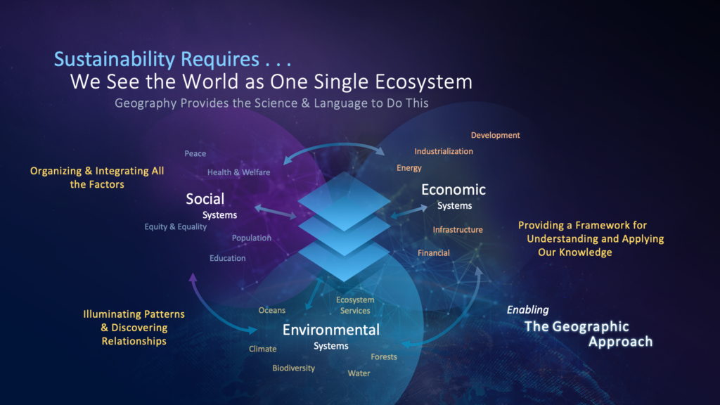
The Geographic Approach integrates knowledge about our economic, social and environmental systems to gain new insights.
GIS and the National Environmental Policy Act
Much of the NAEP Conference focuses on training and presentations related to the National Environmental Policy Act (NEPA.) Taking NEPA as our example, we can really bring the concept of the geographic approach to life.
In brief, NEPA is a review of a given project’s impacts on the environment. Hypothetically, a thorough NEPA review can answer many of the technical environmental questions that would need to be included in downstream permit applications required by federal agencies. Any project that receives federal funding may be subject to NEPA; meaning much of the funding authorized in the IIJA would go to projects subject to NEPA review. The problem is, NEPA can be lengthy and complex and the data required to assess environmental impacts is not always up to date, easy to access or recognized as authoritative. This can lead to downstream impacts that slows a project’s progress down… and ultimately presents a bottleneck in our ability to execute on opportunities presented by the IIJA.
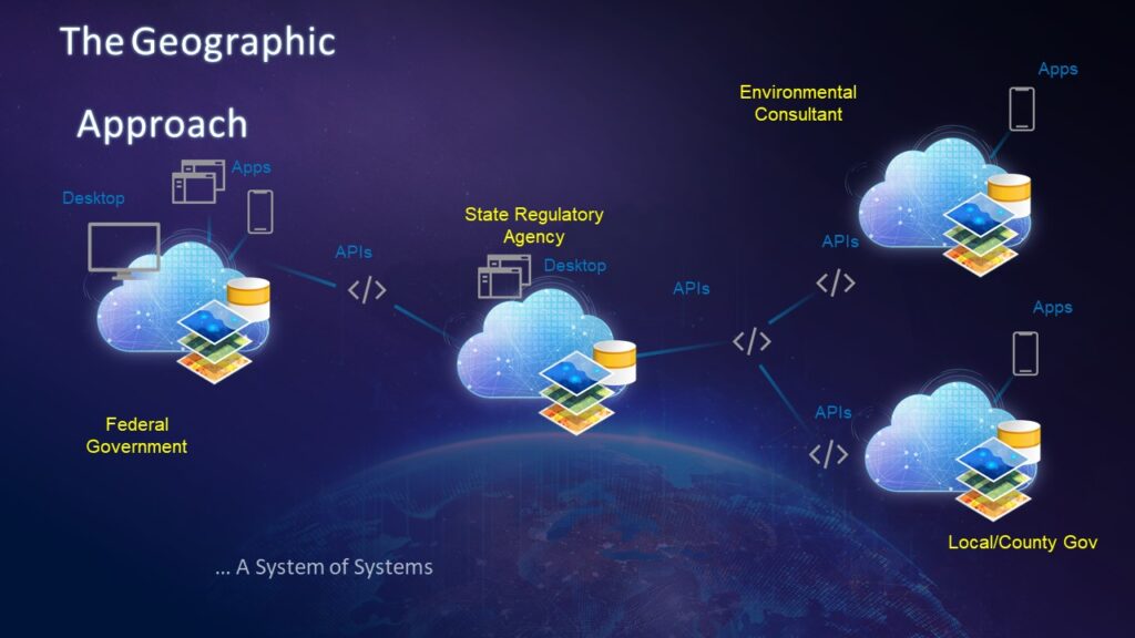
The IIJA and NEPA provide us with a fantastic scenario to examine ways in which the geographic approach can help our industry. My colleague Dr. Gina O’Neil and I presented a scenario that applied the geographic approach to wetland delineation. In this example, we illustrated the relationship between environmental consulting firms, state and local regulators and federal agencies and how our industry is primed with the tools to implement a geographic approach that allows us all to collaborate more closely. The data is all inherently geographic, and all sectors involved are using geographic tools, but we have an opportunity to take it a step further.
These tools, such as ArcGIS Online and ArcGIS Enterprise, are designed to integrate. Biologists with environmental consulting firms can submit their spatial wetland data to the spatial databases owned and managed by local and state regulators. These regulators are interfacing with federal agencies who also require these datasets and can easily share these spatial databases directly to their spatial databases. In turn, these same databases can easily train models that tell us where else these natural phenomenon may occur. Ultimately, both the raw data and predicted data can be quickly leveraged to inform easy-to-configure tools. These tools can inform things such as NEPA reviews that environmental consultants are writing. We can bring together all the necessary data into a single space, while implementing standards, defining authority, providing transparency and benefiting all parties involved.
This “system of systems” model is at our fingertips and this was the heart of my message during the keynote. This message, reiterated in our wetland presentation, resonated with the audience.
How to Make This a Reality?
I low-key fangirled during the lunch plenary which featured a presentation from Brenda Mallory, the Chair of the Council on Environmental Quality. What really got me though, was when my keynote was referenced multiple times by her staff who were in person to answer the Q&A session! Nothing says “on point” like being referenced by a White House office!
This is part of what makes the NAEP Conference so great – in addition to numerous federal staff being present, it also brings together several private sector environmental consultants and many state regulators. This means that the core industry of environmental professionals impacted by processes like NEPA is present and it’s the prime opportunity to start breaking down the silos, broaching real discussions and setting forth real solutions. If we want to achieve this grand vision of a geographic approach, then we can start by using the NAEP organization and our involvement with it as the platform to discuss the challenge, the need and the path forward.
The conversations that followed throughout the week let me know that the industry is very motivated to tackle this and that the organization itself is interested in helping facilitate and be at the forefront of this conversation. This is what inspired me the most – that when Esri develops meaningful partnerships with professional organizations, we can really progress our industry forward. It is a very exciting time to be an environmental professional and the time is now to come together as an industry and innovate! With a geographic approach, I am optimistic we can achieve our vision of a more sustainable future.
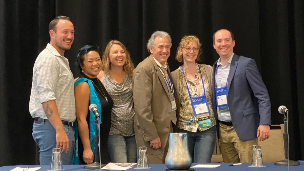
Esri’s Sunny Fleming participated in a live recording of the Environmental Professionals Radio Podcast at the NAEP Conference. From left to right: JD Reinbott, Tiffany Duong, Laura Thorne, Fred Wagner, Sunny Fleming and Nic Frederick.