The 12th Annual Esri Public Sector CIO Summit was perhaps one of the most exciting and inspirational events to date.
Each year we have hosted the CIO Summit, themes have emerged as we develop the agenda. In the past, we have seen an emphasis on topics such as the rise of the Chief Innovation Officer, Gov2.0, civic hackathons, incubators for startups, rapid application development, citizen engagement, data-driven decisions and much more. Some themes have had real staying power and others… well, they have come and gone.
The themes that came to light at this year’s event revolved around GIS as an enterprise system, the need to support equity efforts across departments, cybersecurity, machine learning and artificial intelligence, and emerging disciplines CIOs could introduce GIS to in their information technology planning.

Sharing a Vision for Governments
The two-day event focuses on the current state of GIS and IT integration, legislative and technology trends, and patterns that are emerging across the government IT landscape.
Esri founder and president, Jack Dangermond, presented his vision of an enterprise GIS. He shared that GIS is a tool for working in a digital twin and can expand opportunities for artificial intelligence. In an eye-opening session Microsoft’s James Collins, Public Sector Leader of the Americas, presented an update of the current development activities between the Esri and Microsoft. He demonstrated Microsoft’s dedication to the Esri GIS platform. James shared examples of integration with Azure, Microsoft Office, Microsoft Teams, Microsoft Power BI as well as a sneak peek of Microsoft Fabric.
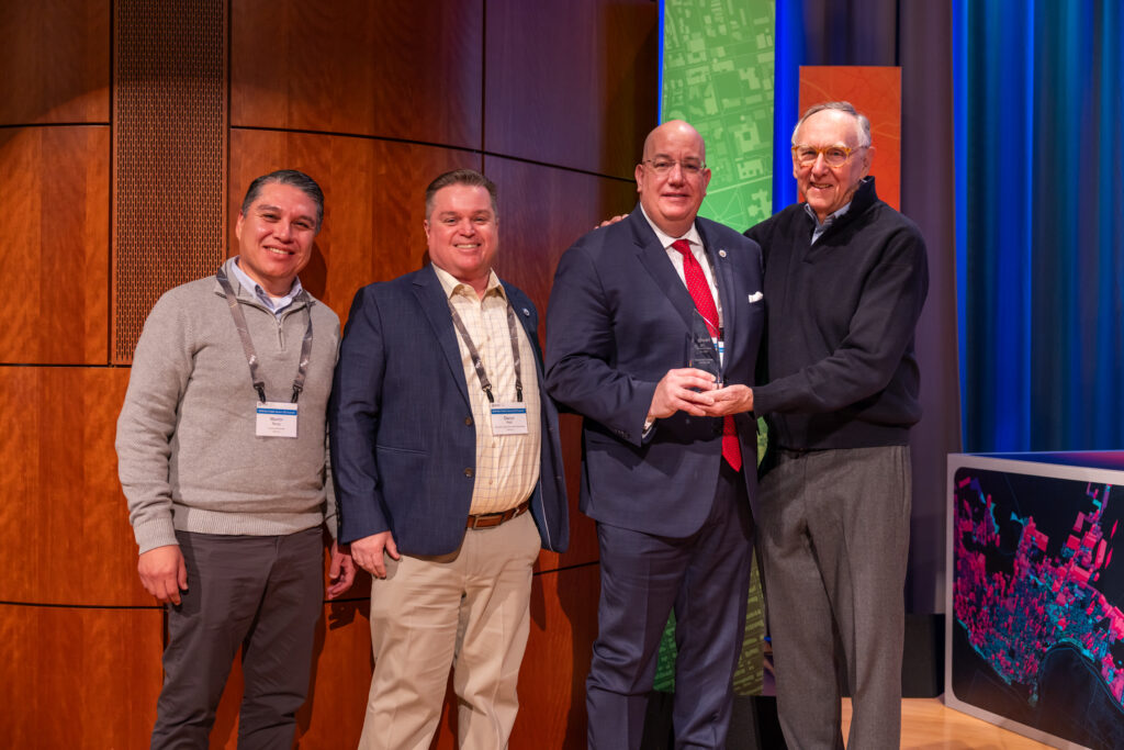
An overarching goal of the event is to showcase the best state and local government implementations to the CIOs in attendance. This year we chose to highlight the work of Keith Durbin, CIO and Colleen Herndon, ITS Assistant Director from the Metropolitan Government of Nashville & Davidson County, TN. Their presentation discussed their dedication to creating a “culture of GIS”—an environment where nearly every department has leveraged the power of GIS for data-driven decision making. The team also demonstrated their support of major initiatives of Mayor Freddie O’Connell. These priorities included affordable housing investments and transportations improvements to drive a more sustainable Metro Nashville. The Enterprise Approach to GIS Award was presented to Metro Nashville by Jack Dangermond in recognition of this work.

No event would be complete unless we offered a balanced vision for state and local governments. Insights were drawn for long-time GIS advocates GovExec Media, the National Association of Counties (NACO), and the National Association of State CIOs (NASCIO).
GovExec: Trends in State and Local Government
Elle Hempen, Executive Vice President, State & Local, GovExec spoke to a new era of creating partnerships. She articulated the need for governments to rethink their approaches to work and reach out to seemingly unlikely pairings of departments or disciplines across the enterprise. Her leading example was transportation paired with energy to improve climate change and sustainability. High on her list of priorities was cybersecurity, generative AI and data consolidation.
NASCIO: IT & GIS Priorities
The panel discussion IT & GIS Priorities in Government was moderated by Doug Robinson, Executive Director, of NASCIO. He was joined by two distinguished leaders in state IT, Bill Kehoe, Director and State CIO, State of Washington and Laura Clark, CIO, State of Michigan. They covered the Annual State CIO Top 10 Priorities. They made a connection between the IT strategies and the importance GIS plays in that strategy. The panelists stressed that while their focus was on state government, the priorities scaled to local and regional efforts. The attendees honed in on digital services and civic engagement, artificial intelligence, machine learning, data management and analytics, and the CIO as a broker content.
NACo: Opportunities to Support Elected Officials’ Initiatives
Teryn Zmuda, Chief Economist and Chief Research Officer, National Association of Counties (NACo) gave a compelling presentation on how CIOs can meet the growing concerns of elected officials. Her analysis pointed CIOs to address the growing concerns of elected officials. The list was extensive but there was an emphasis on helping at-risk populations. The list also included housing affordability, mental health, substance misuse, transportation infrastructure, crime reduction, homelessness, economic mobility, broadband accessibility, and land-use decisions. She closed by pointing out that CIOs have a real opportunity to meet this demand. She was also quick to point out that GIS was a favorable tool within all the federal funding initiatives.
The BIG Ideas for GIS in Government
The summit has always strived to put GIS into a context of emerging trends from the perspective of our forward-thinking CIOs. The event was host to presentations that demonstrated how GIS helped governments meet performance measurement initiatives with a great return on investment. These sessions answered why GIS is an appropriate tool for the job.
- Pioneering Real-Time GIS for Fleet Management: Conor Muldoon, Deputy Chief Innovation and Data Officer, City of Syracuse, NY
- Improving Field Mobility: Keith Macedo, Information Technology Director, City of Fayetteville, AR
- Managing a Modern Public Utility: Keri Burchard-Juarez, Deputy Director for Project Delivery and Engineering, Seattle Public Utilities
Building a Geospatial Equity Strategy
One theme that stood out this year was how to achieve equity through a data-driven approach. While equity was repeated throughout many sessions, the City of Tucson, AZ accentuated the value of a teaming between a Chief Equity Officer and a data lead. This teaming of two has been demonstrated in past presentations from San Diego, CA and Tacoma, WA as a means of prioritizing an equity strategy through data. Laurice Walker, Chief Equity Officer and Laura Sharp, Equity Data Project Manager from Tucson shared how they established the Tucson Equity Data Strategy (TEDS) and how it led to the operationalization of their equity strategy. Laurice said it best when she described the approach as “setting a foundation for equity through data that will ensure our work continues long after our tenure.”
Developing an Integrated System to Support Human Services
Improving citizen engagement through digital service delivery is a topic every state and local government is grappling with in today’s digital-first world. Riverside County, CA sought to use GIS to bring together integrated digital services to meet the demands of their residents. The county’s Chief Executive Officer, Jeff Van Wagenen, provided a clear vison for what delivery of human services could be. He stated “We recognize the importance of a customer-facing network that addresses the diverse needs of our community, many of which are receiving support through multiple departments. Through cross-communication, collaboration, and coordination we have begun to break down silos to improve outcomes.” Darryl Polk, the CTO for Riverside presented his role in the multi-agency effort, citing GIS as a common denominator. The Riverside County executive team was on-hand to receive the Innovations in GIS Award.
How GIS Interacts with Elections
GIS has played a role in the elections process for many years, from address management, to polling place locators, and real-time elections result applications. However, in this era of a “not on my watch” approach, elections officials are stepping up their game on more visible processes and public communication through GIS. Eric Fey, Director of Elections, St. Louis County, MO presented an unpresented view of the role geography has in the elections process. He shared the misconceptions many people believe the elections department has. Getting the right ballot to the right person based on multiple congressional, city, county, utility, school, or hospital district is more difficult than getting a voter to a polling place. Eric shared how he and his colleagues are managing the tracking of ballots, volunteers, early voting, absentee ballot drop-off siting, improving communications, responding to inquiries, and even applying GIS to support visually impaired.
Artificial Intelligence Governance
Artificial intelligence (AI) is a top-of-mind discussion in most organizations. While the interest is high, there are more questions than answers on how to proceed with an AI strategy. Esri is participating in the NACo AI Governance Committee and asked the leaders of this initiative Rita Reynolds, CIO, NACo and Chris Rodgers, County Commissioner, Douglas County, NE to share their early findings. The majority of the committee’s work focuses on policy, ethics, workforce, and applications. Commissioner Rogers shared the amazing GeoAI work his team at Douglas County has been performing with unbelievable returns on investment. The one big leave behind for the audience, was to focus on data quality. Bad data put into an AI model equals poor model outputs.
Resources for CIOs
Esri also provided insights from staff on best practices for implementing GIS within your information systems architecture. We shared security protocols, and resources on how to design and implement a well-architected GIS program. Another eye-opening moment was the opportunity CIOs will have in combating climate change. Staff shared data and tools available to get started through the Climate Mapping for Resilience and Adaptation site.
The Key Takeaways
Like any event the first question is always, what were the takeaways? There was some continuity from the previous years as the major agenda themes are based on the priorities across the government disciplines. One consistent theme over the last few years has been that there is a role for IT leaders in supporting and influencing areas that affect the public directly. Topics such as equity, improving voter confidence, fighting homelessness, and improving civic engagement can all be achieved with the application of technology. This year’s big takeaways were:
- GIS is an enterprise system that integrates with other systems of record.
- CIOs need to be a trusted advisor on topics related to human services.
- CIOs should act as a broker between GIS, IT, and new application areas.
- CIOs have a role in creating and maintaining data quality.
- GeoAI is an emerging field for machine learning and artificial intelligence.
Preparations are Underway for the Next Public Sector CIO Summit
This summit is a unique experience filled with the networking, education, best practice sharing, and validation you need to build an IT and GIS strategy. Attending will inspire you to be able to step up to the most important dialogs in our communities. Let us know if you would like to be notified of next year’s event by visiting our website.
Related Article – The More You Know, The More You Will Want To Go