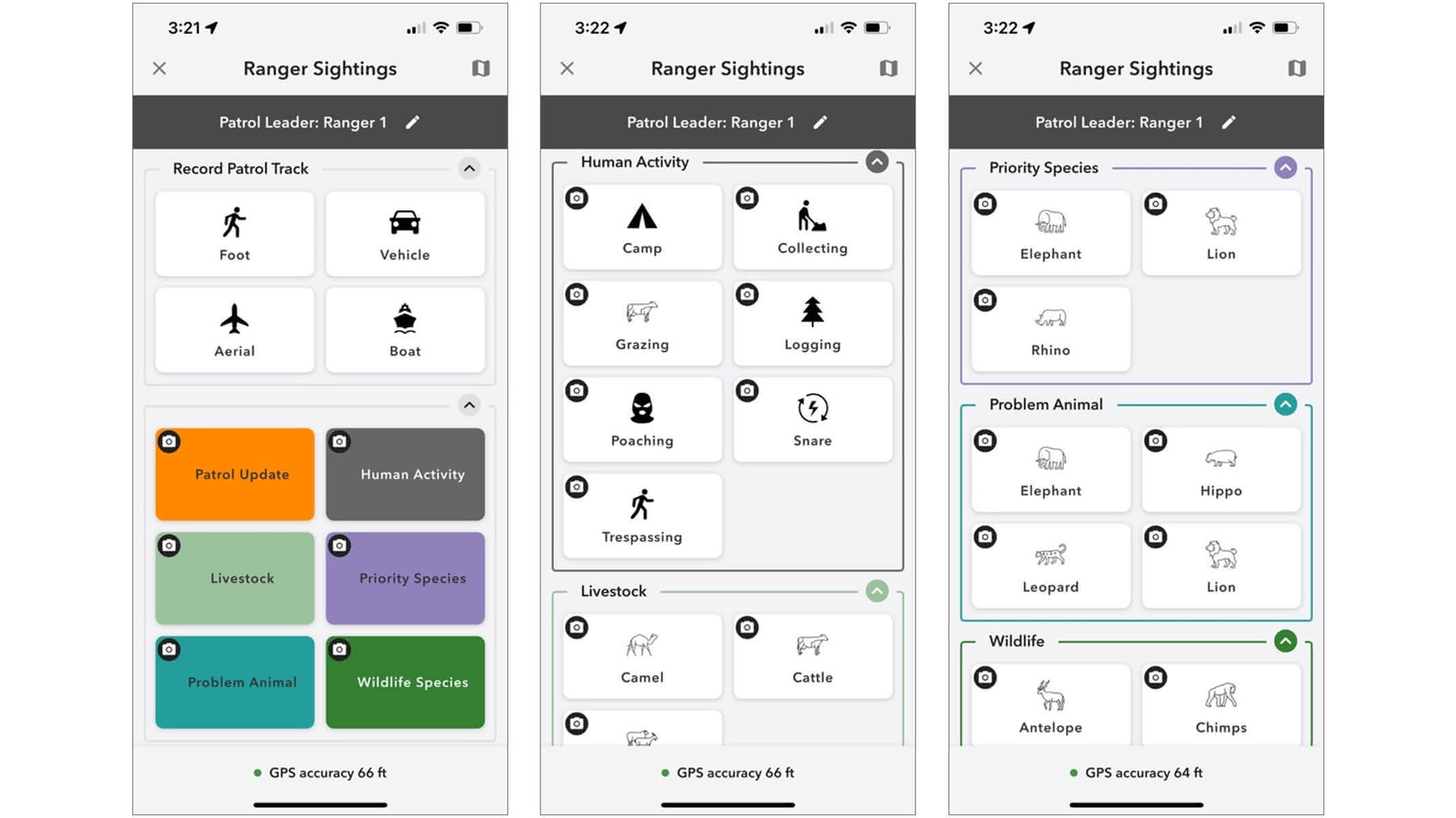
Field data collection
ArcGIS field tools let teams capture observations offline, record locations automatically, and sync data when connectivity returns. It keeps everyone focused on the work, not the workflow.

A grant program with software, training, and content for organizations conducting protected area management activities
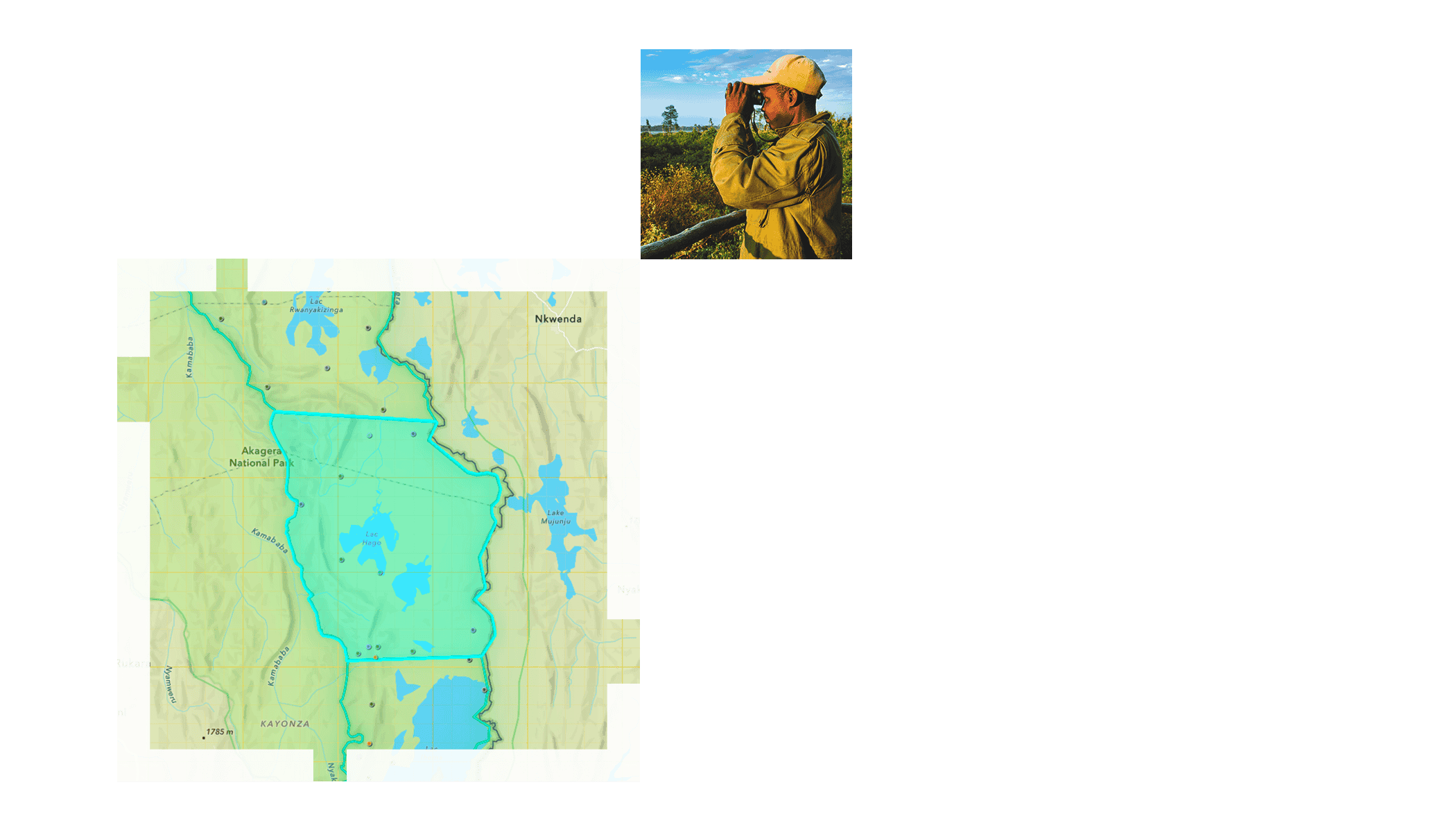
Learn how conservation programs and organizations can leverage ArcGIS technology for biodiversity monitoring and wildlife protection.

Powering conservation programs and wildlife protection with GIS streamlines processes across the entire protected areas management workflow, from field patrols and data collection to remote monitoring and storytelling.
ArcGIS field tools let teams capture observations offline, record locations automatically, and sync data when connectivity returns. It keeps everyone focused on the work, not the workflow.
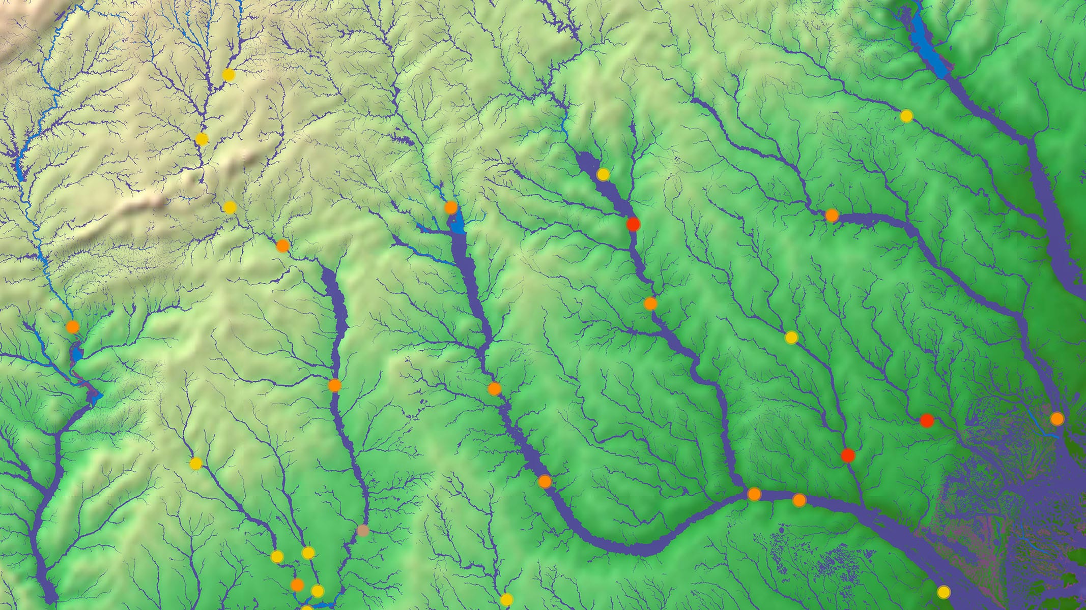
ArcGIS brings observations, indicators, and alerts into one live view, using conservation technology to help teams shift from reacting after the fact to protecting species before conditions escalate.
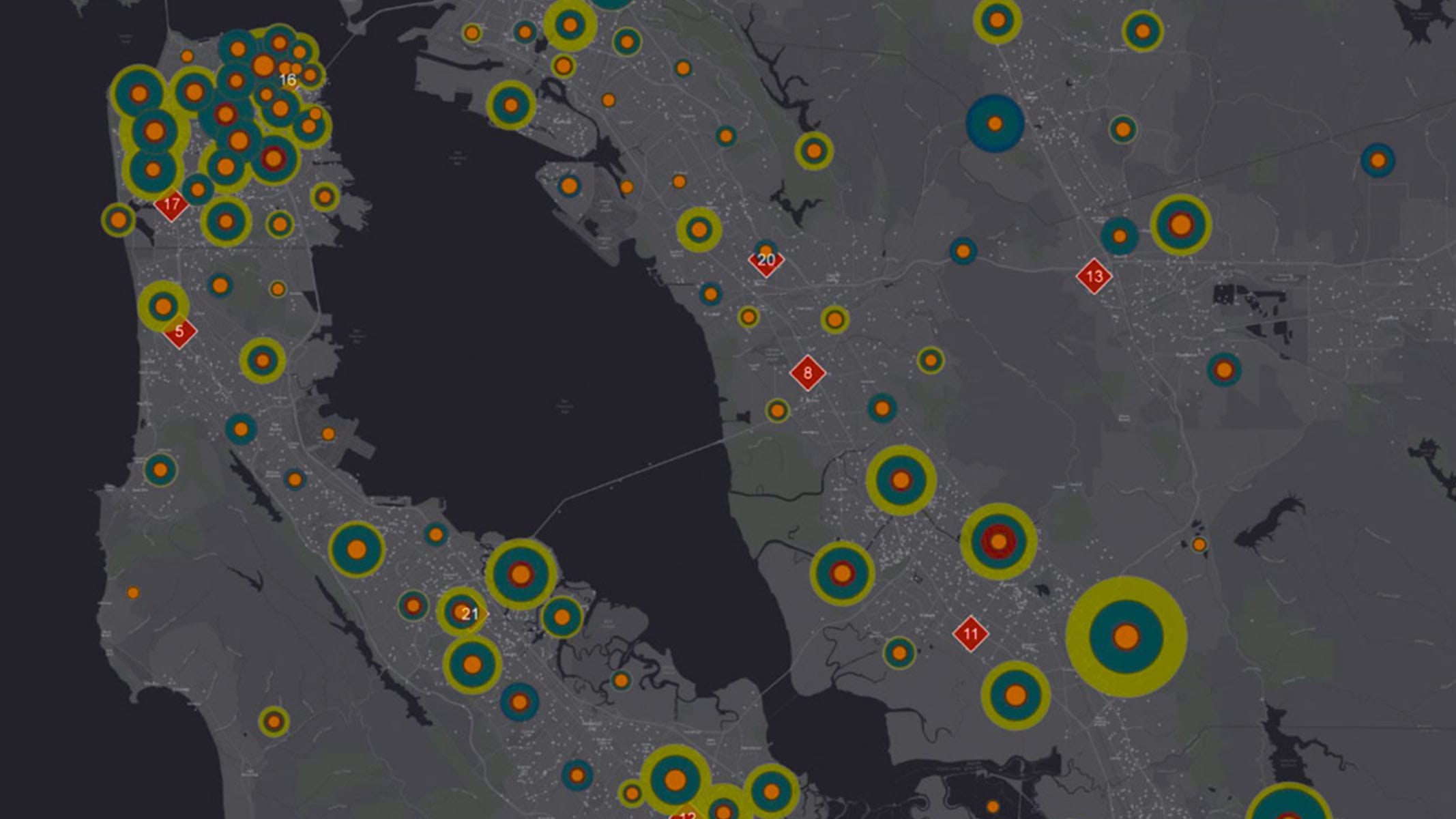
ArcGIS helps teams plan their work, coordinate across protected areas, and adjust quickly when conditions change. Easy-to-use tools keep the focus on the mission so field crews can make fast decisions, stay safe, and know exactly where they need to be.
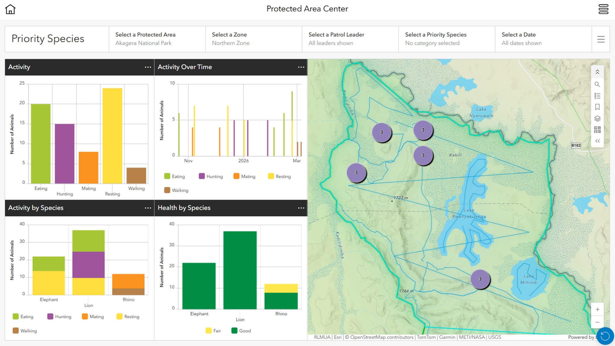
ArcGIS keeps field observations, dashboards, and reports connected, so trends are visible, progress is clear, and sharing updates with partners takes minutes, not weeks.
Gain access to tools, apps, and services that help implement a location-based strategy for wildlife management and protected area monitoring.
Discover related resources at Esri that help support your work.
The Protected Areas Management Grant is available globally, with a priority on World Bank-defined low-and-middle-income countries (LMICs) listed below
| American Samoa | Hong Kong SAR, China | Malaysia | Northern Mariana Islands | Thailand |
| Australia | Indonesia | Marshall Islands | Palau | Timor-Leste |
| Brunei Darussalam | Japan | Micronesia, Fed. Sts. | Papua New Guinea | Tonga |
| Cambodia | Kiribati | Mongolia | Philippines | Tuvalu |
| China | Korea, Dem. People’s Rep. | Myanmar | Samoa | Vanuatu |
| Fiji | Korea, Rep. | Nauru | Singapore | Vietnam |
| French Polynesia | Lao PDR | New Caledonia | Solomon Islands | |
| Guam | Macao SAR, China | New Zealand | Taiwan, China |
| Albania | Czechia | Iceland | Monaco | Slovenia |
| Andorra | Denmark | Ireland | Montenegro | Spain |
| Armenia | Estonia | Isle of Man | Netherlands | Sweden |
| Austria | Faroe Islands | Italy | North Macedonia | Switzerland |
| Azerbaijan | Finland | Kazakhstan | Norway | Tajikistan |
| Belarus | France | Kosovo | Poland | Türkiye |
| Belgium | Georgia | Kyrgyz Republic | Portugal | Turkmenistan |
| Bosnia and Herzegovina | Germany | Latvia | Romania | Ukraine |
| Bulgaria | Gibraltar | Liechtenstein | Russian Federation | United Kingdom |
| Channel Islands | Greece | Lithuania | San Marino | Uzbekistan |
| Croatia | Greenland | Luxembourg | Serbia | |
| Cyprus | Hungary | Moldova | Slovak Republic |
| Antigua and Barbuda | Cayman Islands | El Salvador | Panama | Suriname |
| Argentina | Chile | Grenada | Paraguay | Trinidad and Tobago |
| Aruba | Colombia | Guatemala | Peru | Turks and Caicos Islands |
| Bahamas | Costa Rica | Guyana | Puerto Rico | Uruguay |
| Barbados | Cuba | Haiti | Sint Maarten (Dutch part) | Venezuela, RB |
| Belize | Curacao | Honduras | St. Kitts and Nevis | Virgin Islands (US) |
| Bolivia | Dominica | Jamaica | St. Lucia | |
| Brazil | Dominican Republic | Mexico | St. Martin (French part) | |
| British Virgin Islands | Ecuador | Nicaragua | St. Vincent and the Grenadines |
| Afghanistan | Iran, Islamic Rep. | Lebanon | Pakistan | United Arab Emirates |
| Algeria | Iraq | Libya | Qatar | West Bank and Gaza |
| Bahrain | Israel | Malta | Saudi Arabia | Yemen, Rep. |
| Djibouti | Jordan | Morocco | Syrian Arab Republic | |
| Egypt, Arab Rep. | Kuwait | Oman | Tunisia |
| Bermuda | Canada | United States |
| Angola | Comoros | Guinea | Mauritius | Somalia |
| Bangladesh | Congo, Dem. Rep. | Guinea-Bissau | Mozambique | South Africa |
| Benin | Congo, Rep | India | Namibia | South Sudan |
| Bhutan | Côte d’Ivoire | Kenya | Nepal | Sri Lanka |
| Botswana | Equatorial Guinea | Lesotho | Niger | Sudan |
| Burkina Faso | Eritrea | Liberia | Nigeria | Tanzania |
| Burundi | Eswatini | Madagascar | Rwanda | Togo |
| Cabo Verde | Ethiopia | Malawi | São Tomé and Principe | Uganda |
| Cameroon | Gabon | Maldives | Senegal | Zambia |
| Central African Republic | Gambia | Mali | Seychelles | Zimbabwe |
| Chad | Ghana | Mauritania | Sierra Leone |
Organizations can apply by submitting information about their mission, conservation objectives, protected areas responsibilities, and intended use of GIS technology. Applications are reviewed to ensure alignment with the program’s conservation and public benefit goals.
No. Organizations at all levels of GIS maturity are encouraged to apply. Whether you are just beginning your geospatial journey or expanding an existing program, the resources, additional support, training, and community available through the program can help support your success.
It’s an ongoing program, created to support your mission today and also as your organization grows, adapts, and evolves. Conservation work doesn’t happen on a fixed timeline, and neither does this partnership.
Technology, organizational needs, and the broader conservation landscape will continue to change. In response, Esri has extended the Protected Areas Management (PAM) Grant program through 2035 to support continuity, stability, and access to the tools you rely on.
At the conclusion of the program period, Esri recognizes that your work does not stop. After 2035, participating organizations will transition into the Esri Conservation Program (ECP), ensuring continued access to GIS technology that supports conservation outcomes.
This program is available to organizations and entities whose work aligns with conservation and public benefit goals, including:
Eligibility is reviewed as part of the application process to ensure alignment with program intent and impact.
The commercial value of the licensing included in this program reflects the full breadth of Esri’s technology platform, and organizations are encouraged to use that stated value to help demonstrate in‑kind support, strengthen proposals, and build momentum with funders. For nonprofit organizations, discounted conservation pricing applies based on existing nonprofit rates.
Government organizations interested in participating should contact conservation@esri.com to discuss eligibility and pricing options specific to their needs.
Yes. Your licensing is not limited to one purpose‑built application or workflow. It supports a comprehensive GIS platform that can evolve with your organization, enabling you to:
This flexibility allows your organization to derive broader, long‑term value than a single‑purpose system, while maintaining control over your data and workflows.
Yes. To ensure the program delivers meaningful impact, participating organizations are asked to share basic information about how the technology is being used. This helps Esri better support you and strengthens conservation outcomes across the community.
This includes:
These requirements are designed to be lightweight and focused on understanding impact, not creating administrative burden.
If you are interested in finding out if you and your organization qualify, fill out the form to reach one of Esri’s sales representatives for more information.