Tactical Situational Awareness with ArcGIS
Introducing ArcGIS Mission—an all-inclusive, tactical situational awareness, and mission management software solution.

Discover new insights, innovative best practices, and the latest advancements in GIS technology.

Stay up-to-date on public safety trends, technology, and best practices.
Public safety focused event that takes place just before the UC. Watch the proceedings and save the date for July 12–15, 2025
Watch the 2024 proceedings and save the date for next year's event July 14–18, 2025 | San Diego, California
| Date | Event | Location |
|---|---|---|
| March 20-22, 2024 | ASIS Europe | Vienna, Austria |
| April 9-12, 2024 | ISC West | Las Vegas, NV |
| September 23-25, 2024 | Global Security Exchange (GSX) | Orlando, FL |
| November 19-21, 2024 | ISC East | New York, NY |
| Date | Event | Location |
|---|---|---|
| February 10–11, 2026 | Esri FedGIS | Washington, DC |
| March 9–10, 2025 | Esri Partner Conference | Palm Springs, California |
| July 12–15, 2025 | Safety and Security Summit | San Diego, California |
| July 14–18, 2025 | Esri User Conference | San Diego, California |
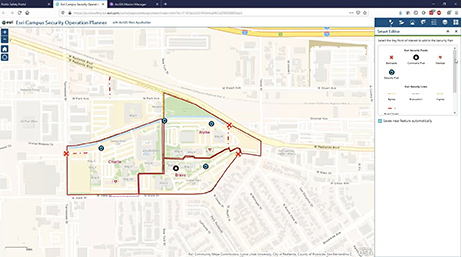
Tactical Situational Awareness with ArcGIS
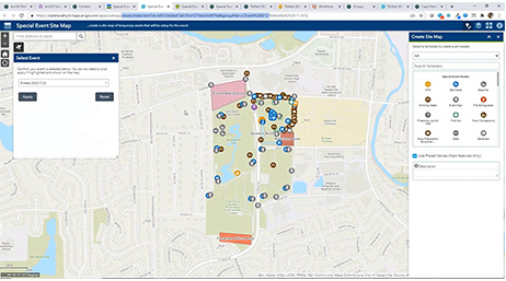
Plan and Manage Special Events with GIS Tools

Esri's New Special Event Solution
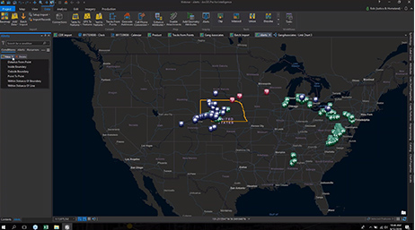
Intel Ops and Analysis with ArcGIS Pro
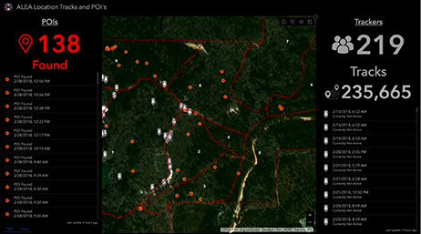
GIS and Global Security Operations Centers