
Digital field data collection
Learn how ArcGIS Survey123 and ArcGIS Field Maps improve census data quality and field operations with demonstrations and real-world examples.

Discover new insights, innovative best practices, and the latest advances in GIS technology.

Digital field data collection
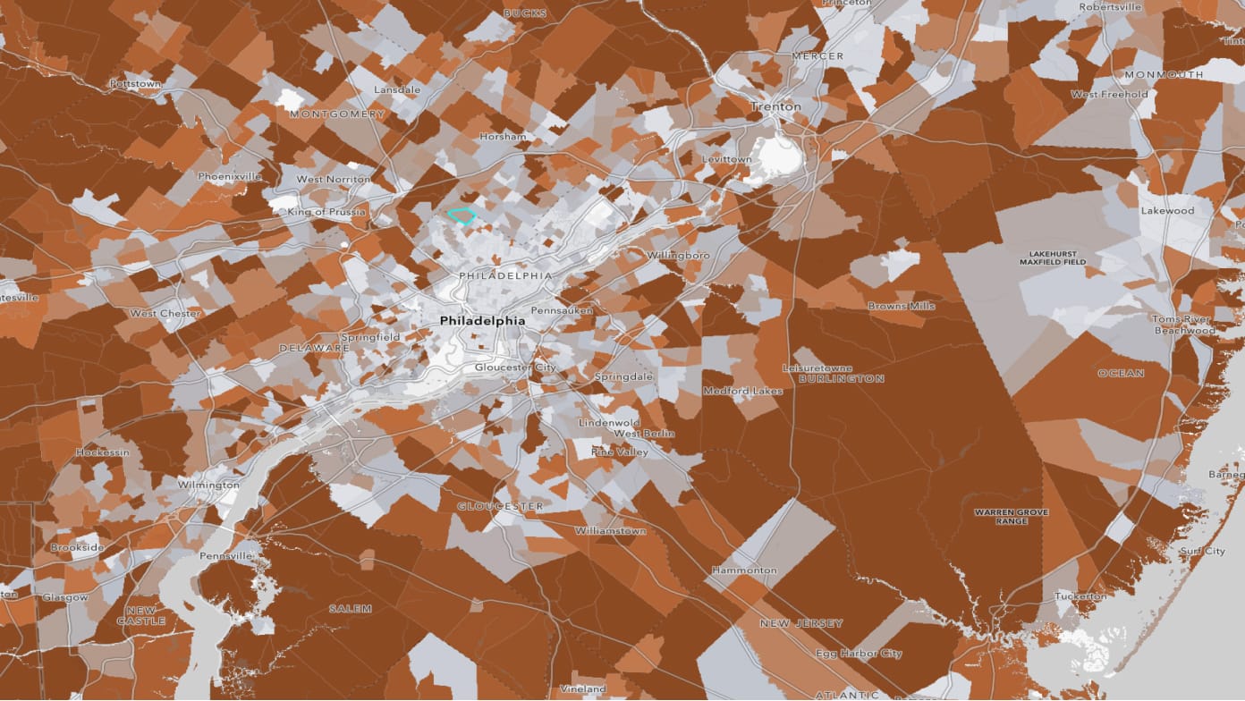
Modernizing data dissemination

Data science part 1: GIS and spatial analytics
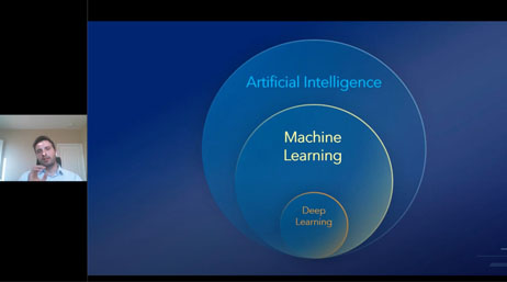
Data Science Part 2: AI, GIS and Statistics
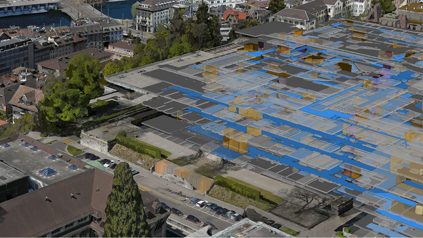
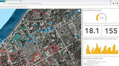
A digital twin for Grenada
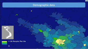
GIS and statistics for population estimation
UN STATISTICAL COMMISSION
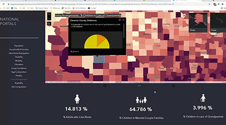
Dissemination and National Portals
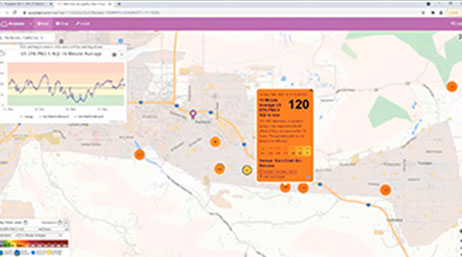
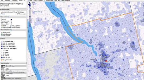
GIS, Spatial Analysis, and Statistics
ArcGIS Survey123 for Census and Statistics

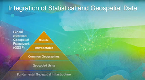
Modernization of Statistical Systems with GIS
UN STATISTICAL COMMISSION
Differential Privacy for GIS Users
CENSUS
GeoAI Workflows for Mapping and Statistics
Introduction to Official Statistics

Imagery for Understanding and Counting

SDGs and Dissemination