Skip to Content

Water

GIS for holistic water system management

Person in a yellow safety vest standing next to a fire hydrant and a map of water utilities along a street

Improving efficiency and reliability

Enable your utility with a modern spatial data platform that creates real business value across the utility enterprise

Utilities need to manage assets, analyze data, and make data-driven decisions. ArcGIS empowers utilities to do this with a modern data model, out-of-the-box analytics tools, and easy-to-use maps and applications. It supports digital twins, provides data in real time, and makes sharing data across the enterprise easy. ArcGIS consumes external data, includes artificial intelligence and machine learning tools, and can increase effectiveness in every corner of the utility.

Enabling the intelligent water system with GIS

Asset management

Esri's ArcGIS supports a holistic approach to asset management. Our location-based technology provides fresh insights about asset performance, risks, resources, and costs.

Modernize asset management
Asset failure and risk assessment map

Operational intelligence

Enable innovative ways to get insights for operations management. Increase situational awareness, reveal inefficiencies, and make informed decisions.

Transform operations
Map of project status

Planning and engineering

Deliver workflows, designs, and solutions that increase the bottom line. Analyze projects, deliver essential workflows, and share asset information with your stakeholders.

Streamline projects
Engineering project collaboration dashboard with map

Customer care

Share vital information with customer service staff and the public to improve customer satisfaction. Deliver real-time data via easy-to-understand maps and apps to support transparency and understanding.

Empower customers
Delaware water quality dashboard with map

Planning for lead service line replacement

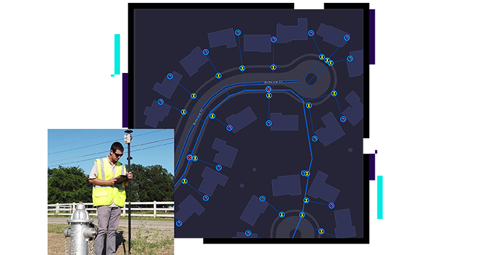
ArcGIS can help water systems staff meet lead service line replacement requirements using analytics, mapping, mobile apps, dashboards, and more. Quickly get started identifying lead in your system, validating lead material from the field, and sharing this information with stakeholders. Esri's Lead Service Line Inventory solution provides a jump start to compliance.

Learn about compliance tools
The Lead Service Line Viewer symbolizing confirmed lead, potential lead, and unknown service lines and a heat map of lead service line hot spots

REPORT

GIS & Digital Water

This Esri and Bluefield Research report discusses how GIS is uniquely suited to serve as the foundation for digital water transformation.

Download the report

Business solutions

You face many challenges, and Esri is here to help you modernize your water utility with solutions configured to meet the needs of your key business units and their workflows.

Previous
Next

Water utilities segments

Previous
Next
See all water industries

Contact sales

Connect with the Esri water utilities team