Skip to Content

Wastewater

GIS for wastewater utilities

Two people looking at tablet computers, map of water infrastructure

Promoting efficiency and innovation

ArcGIS provides sewage solutions that enable utilities to easily collect and manage infrastructure data; perform advanced analytics and visualizations; and share information across systems, improving efficiency and encouraging innovation. Understanding where your infrastructure is, what it is, and how it is networked is essential for managing and planning a sustainable future.

Managing your sewer system with ArcGIS

Build an asset inventory

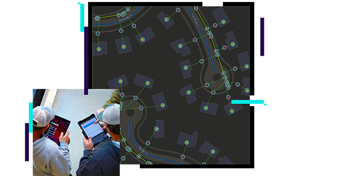
Capture, edit, and share accurate asset data to provide an authoritative view of your wastewater system. Quickly get started with out-of-the-box applications and dashboards for field and office staff at your organization.

Explore sewer solutions
Map of wastewater infrastructure

Analyze and report

Analyze asset performance via powerful visualizations and tools for improved decision-making. Utilize results to create reports that support transparency with internal and external stakeholders.

Sewer and stormwater assignments in workforce assignments map dashboard

Plan for sustainability

Data models, tools, and solutions make it easier to manage your sewer system now and into the future. ArcGIS transforms data into a living product that enables strong decision-making and planning.

Maps and graphs for planning

Industry blog

Enterprise GIS supports efficiency and output

Madison Metropolitan Sewerage District uses Esri apps to improve utility locating, asset management, pollution prevention, and other programs.

Read the blog

Sewer Data Management

Used to map sewer assets, edit data, view system maps in the field and office, view asset reports, and collaborate with map notes.

Explore the solution

Water utilities segments

Previous
Next
See all water industries

Contact sales

Connect with the Esri water utilities team