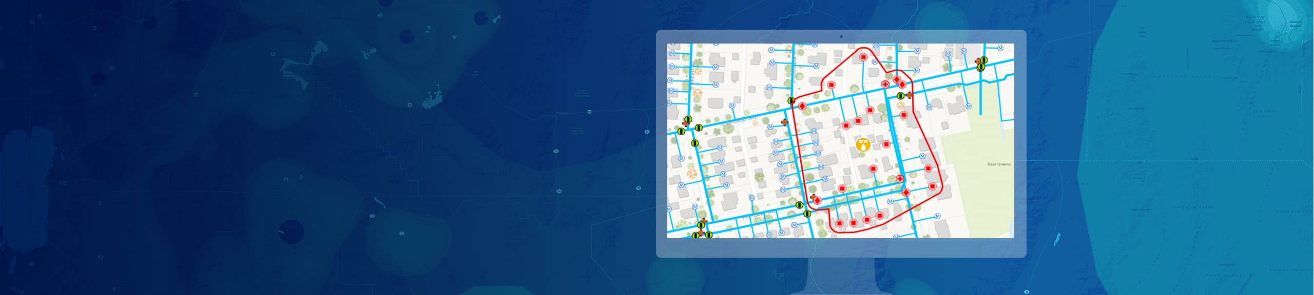
Sub-DMA Planning
Plan and create sub-DMAs with interactive tools and models.
Solve Water System Challenges and Save Money
The ArcGIS platform offers a suite of water-loss detection and response solutions, including leak logger apps and nighttime flow analysis apps, to respond faster and more strategically to main breaks and water leaks and manage your infrastructure data to make more informed decisions about capital improvement spending. This will ultimately help you reduce water losses and long-term capital expenditures.
Nighttime Flow Analysis is based on permanent or temporary District Metering Areas and step testing to identify where loss is occurring and to pinpoint the location of leaks.
Save time and money by understanding the best locations to place your leak loggers. Extend the value of your investment by improving the efficiency of your crews, and make timelier, more informed decisions.
Our engineering team estimates the total direct savings to be $1 million per year from the implementation of Esri’s water loss solutions, with more than $200,000 of that coming from early leak detection.
We’d like to help you get started. Fill out the form to talk to an expert and discuss what you need to get started with the Water Loss solution.