ArcGIS Enterprise: An Introduction
Get comprehensive GIS functionality to map, analyze, and manage spatial content and location-enabled data on infrastructure you control.


Go beyond the Esri UC experience
The 2020 Esri UC has ended, but your chance to learn is just beginning.
Get comprehensive GIS functionality to map, analyze, and manage spatial content and location-enabled data on infrastructure you control.
Modernize your platform and optimize performance. Seamlessly move users, groups, and content from one GIS system to another.

Build your foundation with the platform that started it all. ArcGIS Enterprise is the complete system for all your geospatial needs.

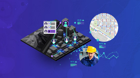
Improve coordination, drive operational efficiency, and reduce reliance on paper workflows with location-enabled applications. Get more details on implementing and integrating mobile GIS technology.

Leveraging ArcGIS for Field Operations
2020 Esri User Conference

Transform Your Field Operations
Esri ebook
Field Operations
Tools and Solutions
Location technology is at the forefront of real-time data collection, visualization, and analysis. Find out more about leveraging your GIS platform to uncover trends in big data, tap into the Internet of Things (IoT), and maintain situational awareness.
Real Time across the ArcGIS platform
2020 Esri User Conference

ArcGIS Velocity: An Introduction
2020 Esri User Conference

Real-Time Visualization and Analytics
Tools and Solutions
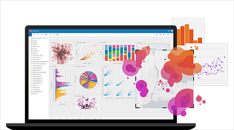
Revolutionize decision-making with analysis that provides previously unexplored insights gained from the perspective of where. See what else is possible with a deeper understanding of analytics tools like ArcGIS Insights.
ArcGIS Insights: An Introduction
2020 Esri User Conference

ArcGIS Insights: Best Practices
2020 Esri User Conference
ArcGIS Insights
Tools and Solutions
ArcGIS Pro is Esri's powerful, single desktop GIS application that's coupled tightly with the ArcGIS platform. Expand your knowledge of this essential GIS software to take your work to the next level.

ArcGIS Pro: Migrating from ArcMap
2020 Esri User Conference
An Introduction to Mapping and Visualization
2020 Esri User Conference
ArcGIS Pro
Tools and Solutions
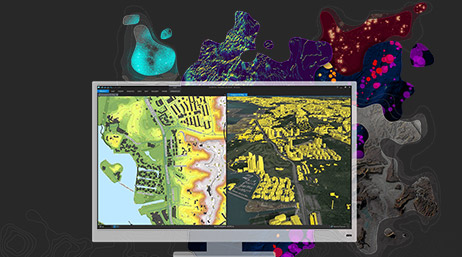
Earth observations provide powerful insights that empower smarter, faster decision-making. Dive deeper into the integrated imagery and remote-sensing capabilities in the ArcGIS platform.
What's New in Imagery
2020 Esri User Conference
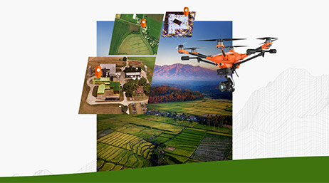
ArcGIS Drone Collections
Tools and Solutions

Imagery and Remote Sensing
Tools and Solutions