Skip to Content

Integrate ArcGIS Urban into your existing workflows

We have been collecting all the questions that we got asked a lot about ArcGIS Urban. We hope that with this collection of frequently asked questions you will find all the answers that you are looking for. And if not, please ask us anything else you are curious about here! We are looking forward to hearing from you.

Frequently asked questions

  • View a digital representation of your city in which all urban developments are visualized in one place for collaboration among stakeholder groups.
  • Visualize zoning rules in 3D. Convert legal text into a visual representation that can be used for detailed scenario planning down to the parcel level.
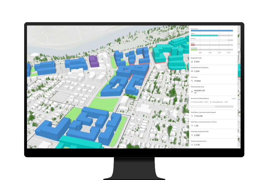
  • Generate plausible buildings and analyze the impact of plans with automatically generated capacity indicators data and by comparing different design scenarios.

ArcGIS Urban is built on top of ArcGIS Online. ArcGIS Urban uses hosted web layers to display and manage data that is published in an ArcGIS Online organization.

No, Urban is currently only available for ArcGIS Online.

The ArcGIS Urban databases can be opened in ArcGIS Pro when connecting to the ArcGIS Online organization where they have been created. The feature layers can be displayed and edited through ArcGIS Pro; however, there is no dedicated integration available. 

There is a dedicated integration available between ArcGIS CityEngine and ArcGIS Urban. CityEngine can automatically connect to an ArcGIS Urban model and load plans and projects from ArcGIS Urban. Changes and edits made in CityEngine can be synchronized back to ArcGIS Urban, and new scenarios can be created.

ArcGIS Urban and ArcGIS CityEngine have a lot of things in common (e.g., they use the same procedural engine under the hood to create models), but they also differ. With CityEngine, you can write your own custom AGA rule, whereas ArcGIS Urban provides a built-in rule that cannot be modified. What you can change about the rule in ArcGIS Urban are the parameters that are used, such as the maximum height or the allowed floor area ratio. ArcGIS Urban is also a web-based application, whereas CityEngine is a desktop tool that is installed locally. In general, ArcGIS Urban is a common platform—not just a tool or web app—that supports urban planning workflows and facilitates communication between stakeholders. CityEngine supports the creation of detailed urban designs and produces sophisticated and realistic models of built-out scenarios. 

ArcGIS GeoPlanner supports creating 2D scenarios on a regional scale across many industries. ArcGIS Urban is designed to support urban planning workflows such as rezoning by displaying and calculating capacity indicators based on procedurally built 3D scenarios. In general, ArcGIS GeoPlanner supports more generic workflows, whereas ArcGIS Urban has a strong focus on urban planning because it uses the procedural engine of ArcGIS CityEngine to produce plausible 3D buildings and zoning envelopes.    

There are two options for bringing CAD/building information modeling (BIM) data into ArcGIS Urban:

  • CAD/BIM integration through ArcGIS CityEngine: The Urban-CityEngine integration allows the importing of data of different 3D formats (dxf, dae, fbx, glTF, kml/kmz, obj) into CityEngine, and from there the models can be attached to an ArcGIS Urban scenario directly. 
  • CAD/BIM integration through ArcGIS Pro: ArcGIS Urban can display SceneLayers and BuildingSceneLayers that have been published through ArcGIS Pro. These layers can come both from CAD applications or Autodesk Revit BIM data After publishing the layers from ArcGIS Pro, they can be linked as external sources in a scenario of a project/plan in ArcGIS Urban.

Yes, BIM models can be added to ArcGIS Urban, but they have to be converted to a BuildingSceneLayer first. To get the best results, it is recommended to publish a generalized version of the BIM model with a minimum number of nodes. Multiple BIM models can be attached to different scenarios, but for performance reasons they will not be loaded/displayed at the same time.

No, ArcGIS Urban is a web-based application and needs an internet connection.

ArcGIS Urban runs best with Chrome; however, Firefox, Safari, and Edge are also supported. Only Internet Explorer cannot be used with ArcGIS Urban because it does not support the technology behind the procedural modeling of the 3D buildings.

Contact sales