
Advancing Racial Equity in State and Local Government
Webinar Series
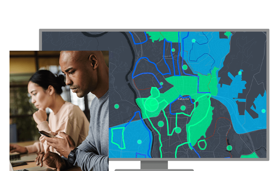
Identify inequities and operationalize racial equity best practices with GIS.
Helping Cities, Counties and States Use GIS to Create a More Racially Equitable Future
Join us in this webinar series to learn how state and local governments can leverage GIS to build a more equitable and just world where a person's race or ethnicity does not impact their outcomes. Worldwide, cities, counties, and states and provinces are addressing institutional racism to ensure equitable opportunity for their constituents—and geography is critical to the work. Hear from the Esri team about how GIS can advance your organization's specific racial equity work.
Webinar
Achieving Transportation Equity through GIS
Date: June 30, 2021
Time: 10:00 a.m.–11:00 a.m. (PDT)
Location: Online
Cost: Free
Language: English
Addressing racial inequities in transportation planning and design can relieve the historic and detrimental impacts on the environment, health, education, housing, and economic opportunity of marginalized communities. Inequitable transportation planning has real-life consequences for marginalized communities, such as higher rates of pedestrian deaths and inadequate access to necessary services. Rethinking mobility in major urban and rural areas through a racial equity lens can expose patterns of neglected populations and present opportunities to rebalance our transportation infrastructure expenditures and provide options to meet the needs of our residents.
Combining the power of location with a critical eye towards inequity can yield better outcomes for all. Transportation planning through GIS can combine planning and design, real-time mobility data, and demographic information to yield a more thoughtful approach to our transportation networks and access to public transit. This webinar will explore how GIS can assist transportation planners to understand the different travel behaviors of various groups and evaluate accessibility to help define a more equitable distribution of transportation resources in their community.
Join us to
· Learn how GIS can be applied to ensure more equitable transportation planning.
· See demonstrations of departments implementing GIS to achieve more equitable transportation infrastructure.
· Ask questions and engage with our transportation and racial equity experts.
Webinar
Jump-Start Your Racial Equity Work with GIS—Operationalize Your Racial Equity Impact Assessment
Date: April 1, 2021
Time: 10:00 a.m.–11:00 a.m. (PDT)
Location: Online
Cost: Free
Language: English
State and local governments are looking for opportunities to rapidly address inequities in developing public policy and services. These same governments are turning to GIS to improve decision-making and ensure equitable service delivery to underserved communities. The use of geospatial technology coupled with a robust framework for racial equity provides communities, government, and organizations with empowering tools to accelerate their efforts.
Join us for a conversation and technical deep dive with Esri's racial equity team leader, Clinton Johnson, and Esri's policy maps expert, Diana Lavery, into the data, maps, and workflows that can help operationalize your equity impact assessment.
This webinar will include the following:
- Using location technology to demonstrate gaps in access to community assets and other inequities
- Accessing available data on racial equity topics ranging from economic mobility to environmental factors to health outcomes
- Exploring Esri Maps for Public Policy, a curated collection of content, training, and datasets, to use as a baseline for your research and analysis
- Leveraging tools, such as interactive maps and dashboards, to educate and act on the results of your analysis
Webinar
Using Location Intelligence to Address the Impact of Racial Injustice on Health Equity
Date: January 27, 2021
Time: 10:00 a.m.–11:00 a.m. (PST)
Location: Online
Cost: Free
Language: English
Join us for a conversation with subject matter experts in the areas of racial justice, health, and location technology as we discuss how geospatial thinking and the use of geospatial technology can provide a winning framework and tools to help achieve equity in health.
Esri will share a data-driven approach to better understand vital issues from the context of people and neighborhoods. We will also demonstrate how GIS can help you go beyond identifying racial inequities to operationalizing best practices that can help reverse the impacts of racial injustice.
This webinar will include the following:
- A discussion of the intersection between racial injustice and health inequity and how GIS can help promote equality
- Examples of how organizations are using GIS to address issues surrounding racial injustice and health inequity
- A workflow that provides a location-centric racial equity perspective on your work
- Demonstrations of Esri's racial equity and health equity solutions
Webinar
A Framework for Racial Equity and Community Outreach in State and Local Government
Date: November 12, 2020
Time: 10:00 a.m.–11:00 a.m. (PST)
Location: Online
Cost: Free
Language: English
Explore how state and local governments can use GIS to address racial equity. We will demonstrate how the Esri Racial Equity Community Outreach solution enables jurisdictions to more effectively communicate progress on racial equity initiatives.
Learn how to
- Visualize workforce diversity metrics.
- Gauge public sentiment.
- Share authoritative information about racial equity with the community.