AEC Community Webinar featuring WSB
Watch the recording
GIS for Environmental Management
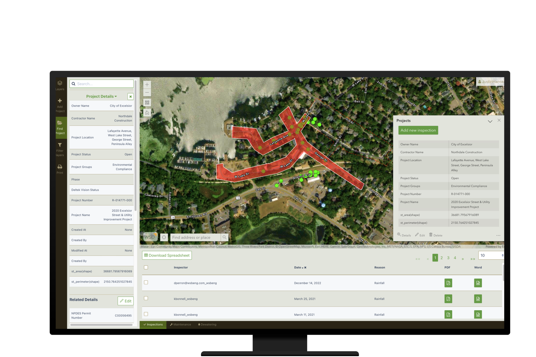
Are you interested in the latest innovations in GIS for environmental management and analysis? This webinar showcases WSB's Storm Water Asset Management Program (SWAMP) and Datafi apps.
WSB provides a deep dive into the SWAMP and Datafi apps, including its use of Esri's ArcGIS system to deliver a powerful set of features and functionality. You'll also learn how leading organizations are using these apps to manage environmental risks and achieve compliance.
Learn about the latest tools and strategies for environmental management and discover how SWAMP and Datafi can transform your environmental management practices.
Watch the webinar recording here.