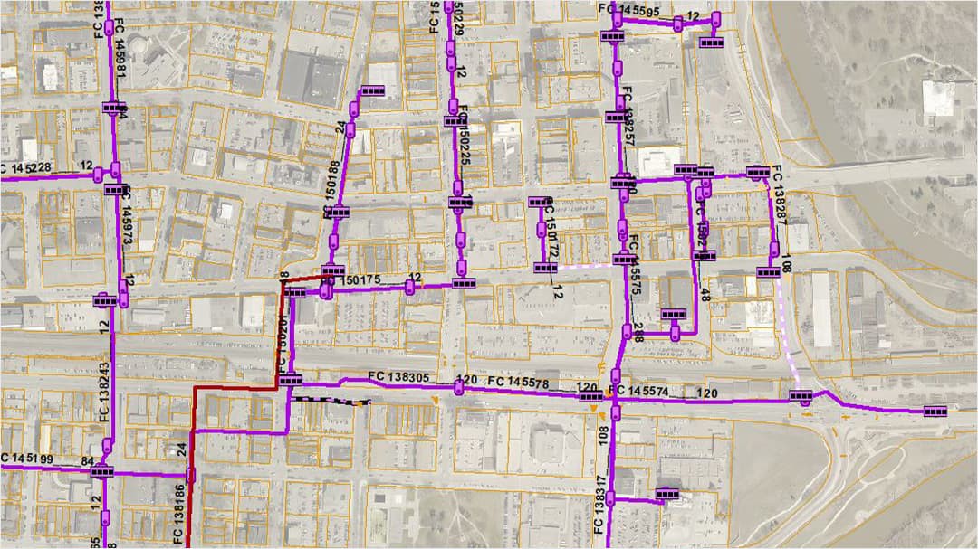
This solution is a real game changer for the City of Fargo. By leveraging geometric networks, the Ptarmigan software has provided the City of Fargo with a tool that can be used to manage existing assets and plan for the future.
Case Study
Telecommunication on the Prairie: Updating the Fiber-Optic Utility Network for the City of Fargo
The City of Fargo, North Dakota, had been looking for a way to map out its utility network that would allow it to track attribute data for each individual strand of fiber-optic cable and maintain a network of physical conduits and features that house the fiber-optic cables.

User
City of Fargo, North Dakota
Challenge
The City of Fargo required a solution that could digitally splice the fiber-optic cable and ultimately set up a fiber-optic utility network.
Solution
City staff installed the cables intersection by intersection until the entire city was covered, resulting in about 75 miles of fiber-optic cable. As ArcGIS Desktop proved to be simple to use and straightforward, the City of Fargo was able to increase functionality and efficiency, saving staff the time that would have been spent looking through splicing diagrams.
Results
With Esri software, City of Fargo staff were able to pinpoint breaks with precision, trace fiber-optic routes with mobile phones and tablets, and connect data in one shared map for a single source of truth. Streamlining data collection and analysis made work more efficient for those in the office and the field.
Partner
Ptarmigan Software, Inc.
Challenge
The City of Fargo required a solution that could digitally splice the fiber-optic cable and ultimately set up a fiber-optic utility network. The product would need to be compatible with Esri's ArcMap and ArcGIS Pro software and also incorporate the existing Cityworks asset management system. Specifically, the City of Fargo was searching for a workflow that could attribute each strand of fiber-optic cable to locate its start and end point, identify the jurisdiction and who owned it, and determine the size and strand count of the fiber-optic bundles. Along with this, the physical features, such as pull boxes and conduits, needed to be working hand-in-hand so routing and locating could be achieved.
Solution
The City of Fargo used the Ptarmigan Software, Inc., Condor toolbar to digitally splice fiber-optic cables to their appropriate connections. After the initial data conversion was done by Ptarmigan, Esri spearheaded the process on the City of Fargo's end to establish splice closure connections and the network layout of its fiber-optic cables. City staff installed the cables intersection by intersection until the entire city was covered, resulting in about 75 miles of fiber-optic cable. As ArcMap and ArcGIS Pro software proved to be simple to use and straightforward, the City of Fargo was able to increase functionality and efficiency, saving staff the time that would have been spent looking through splicing diagrams.
Results
Being able to trace an individual fiber-optic strand from beginning to end over 75 miles through various pull boxes and splices was a gratifying experience for City of Fargo staff. With Esri software, they were able to pinpoint breaks accurately and proficiently, trace fiber-optic routes by using their mobile phone or tablet, and much more. This added a greater level of convenience and efficiency and eliminated time spent having to go back and forth from the office to the field.
