
To everyone who attended the 2013 Esri International User Conference, I want to thank you for helping to make this year’s conference such a great success. For those who could not attend, let me take a few minutes to give you an overview of the opening remarks from Monday morning. Also, if you would like to view the Monday Plenary Session, it is available at esri.com/uc.

The theme of this year’s conference was “GIS: Transforming Our World.” The word transformation can refer to two types of change: physical change, as well as change in how we perceive things. GIS is relevant to both.
The work of GIS professionals is creating many information products that are directly changing our physical world. Their work also changes how we see, understand, and interact with our world.
Today, our world is facing serious challenges on many fronts. It’s becoming clear that we need to collectively work to create a better future. This means leveraging our very best design talent, as well as our best technology and science, to create a more sustainable future. GIS provides the platform for doing this.
The Power of GIS
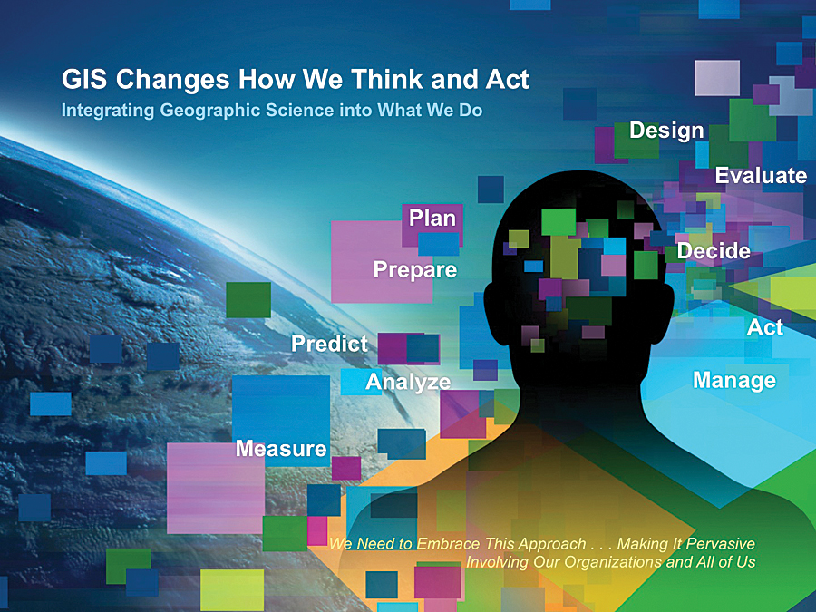
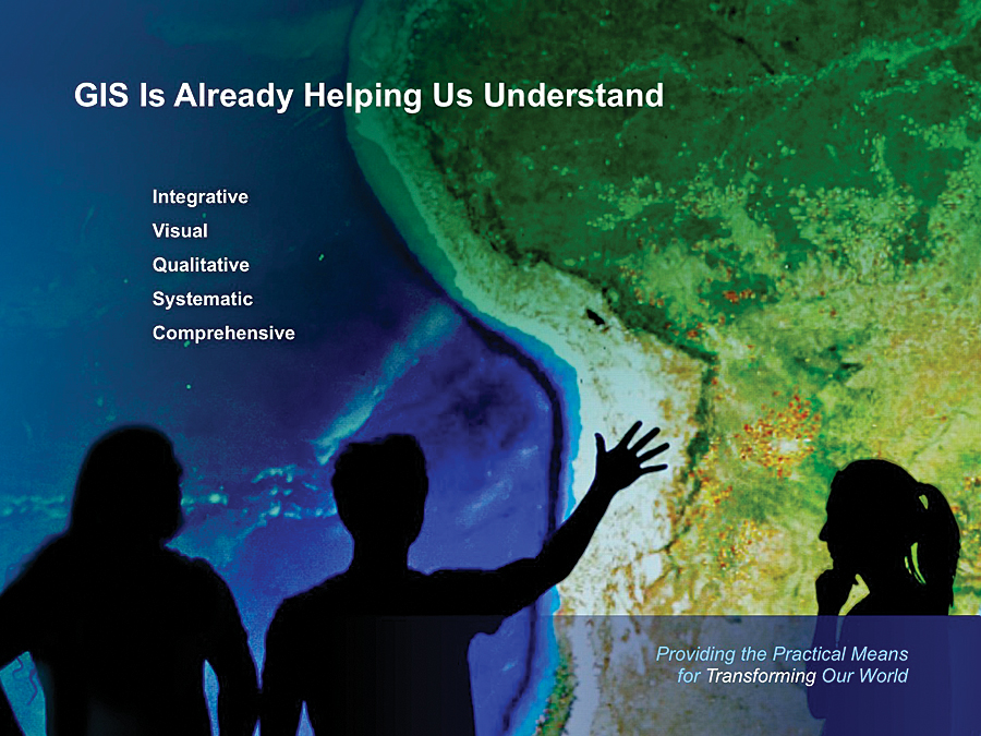
GIS is already changing how we think and how we act. It is built on the science of geography and, as such, it provides an integrative and comprehensive framework that cuts across many disciplines and organizations. GIS also has the power of qualitative analytics blended with easy-to-comprehend geospatial visualization.
By integrating geographic science into everything we do, GIS is improving how we measure and analyze things, as well as how we predict the future. It is also providing better ways to plan, design, and make decisions. The success of the GIS community is creating tens of thousands of important systems around the world and providing evidence of the huge contributions our field is making.
For all these reasons, GIS is a promising technology for addressing issues at a larger scale—a global scale—in the world. To do this, we clearly need to also dramatically scale up its application and make it pervasive.
Scaling Up
By scaling up, I mean that we need to dramatically grow the application of GIS, leveraging the current community of users. We need to make it pervasive throughout organizations and across society.
Is this possible? My sense, as well as personal experience with other pervasive technologies such as the Internet and GPS, is that this scaling up is both possible and in some ways inevitable. GPS, for example, has been radically simplified, and this in turn has rapidly transformed human beings’ sense of place. Together with consumer web mapping, we can now see both our whole planet and where we are at any time.
GIS will become pervasive in the same way, leveraging the connectivity of the web and cloud computing. The result will be better decisions that reflect better understanding and ultimately a more sustainable future.
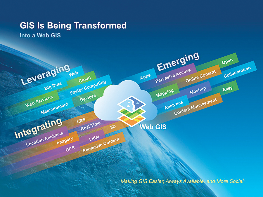
GIS → Web GIS
This next step in the evolution of GIS involves a new technology pattern—web GIS. With release 10.2 of ArcGIS is a complete web GIS, not just mapping. It integrates Esri’s and other geospatial technology (i.e., using strong engineering and open standards). This platform takes advantage of the latest trends, including web and cloud technologies, big data, faster machines, and pervasive devices. Web GIS also directly models and integrates all the geospatial data types—remote sensing, GPS, the sensor web, 3D data, crowdsourcing data, real-time data, and pervasive web content.
The emerging platform is easy to use, more open, accessible, and collaborative. It uses focused apps for making maps, doing analytics, and accessing a rich, living library of shared maps and geographic data.
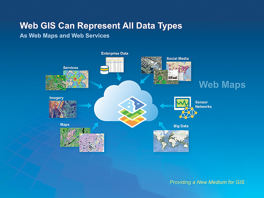
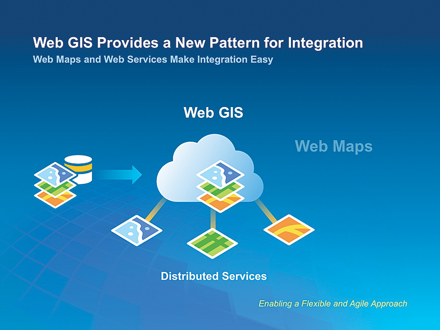
Web GIS Integrates Any Data
One of the key concepts of web GIS is how it organizes content. Web GIS models all types of information as web maps and web services. These web maps can represent typical geospatial data types—maps and imagery, as well as tabular data, such as geodatabases, spreadsheets, and enterprise databases. It also integrates social media and sensor networks with real-time information and the whole world of big data.
GIS is all about integration of data. Web GIS also provides new patterns for involving information sharing and collaboration, web maps and services, and visually and analytically combining geospatial data.
Another intriguing aspect of web GIS is that it can help break down the fundamental barriers that separate organizations. Whether the silos are professional or organizational, the ability of the web GIS environment to fluidly integrate different disciplines and activities gives us a new framework for collaboration.
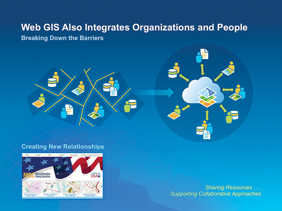
Web GIS has one other interesting ingredient: it can help us easily organize our work. It provides content management capabilities for all your maps, apps, and models and also simplifies sharing these within a group or across departments and organizations.
Driving the Transformation
While web GIS is just starting, it is already proving to be an attractive platform that is helping us to scale up and leverage the work and knowledge of GIS professionals.
For GIS professionals, understanding this pattern and its underlying technology is important. Embracing these patterns will both leverage existing investments and drive geospatial adoption across organizations. Ultimately, this pattern promises to make huge contributions to our understanding of the world around us.
When you put all this together, you begin to realize that we have a huge opportunity to amplify the power of GIS. GIS professionals are essential to making this happen. In my mind, there has never been a more exciting time to be a GIS professional.
Thank you again for making the 2013 User Conference an amazing experience. As Esri continues to grow and evolve, you constantly remind us to stay focused on what is important: our mission of advancing GIS and supporting our users. Your efforts are having a large impact on our world. Thank you for letting us help you make a difference.
