
How Advanced Geospatial Technology Will Help Meet Sustainable Development Goals
")
It takes initiative to formulate a plan to fix global problems. In 2014, the United Nations (UN) created such a plan and presented it at the UN Sustainable Development Summit the following year. Called Transforming Our World: The 2030 Agenda for Sustainable Development (Agenda 2030 for short), the proposal outlines 17 Sustainable Development Goals (SDGs, or Global Goals) to overcome the world’s challenges, including poverty, inequality, and the effects of climate change. Organizations representing all sectors of society recognized the feasibility of the plan and officially adopted it in September 2015.
The SDGs build on decades of work on the Millennium Development Goals. One leader at the forefront of creating and carrying out the Global Goals is Nikhil Seth of India. With more than 35 years of experience as an international and national civil servant, Seth joined the UN Institute for Training and Research (UNITAR) as executive director in June 2015. One of his responsibilities is to oversee UNITAR’s Operational Satellite Applications Programme (UNOSAT), which allows UN member states to easily access GIS technology and imagery from UNITAR for international disaster response and sustainable development efforts.
Seth, who also played a key role in constructing the Millennium Development Goals, recently talked with Esri about how GIS is critical to accomplishing the Global Goals by 2030.
The SDGs are a set of ambitious objectives. How can technology bring the sustainable world community’s mission into focus and help organizations and people stay on track?
I could go through each of the Sustainable Development Goals and demonstrate how important technology is for their realization, particularly for poorer countries. Let’s look at the first one on eradication of poverty. It’s very clear that financial inclusion plays a key role in poverty eradication. In fact, countries that have managed to dramatically increase financial inclusion have had significant increases in their gross domestic product (GDP). Mobile technology has great potential for increasing financial inclusion.
What value does the GIS community bring to the SDGs?
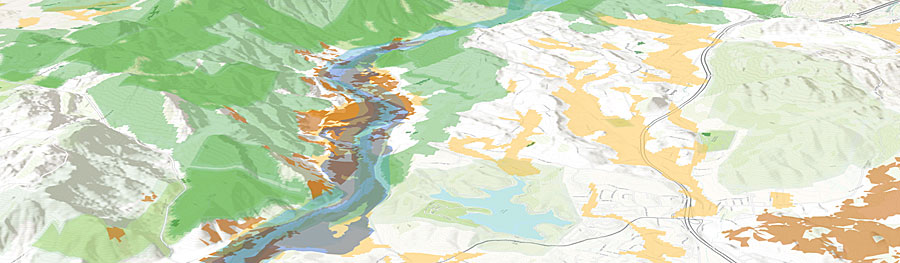
The kind of information that is made available through GIS and how the community uses the technology—whether it’s remote sensing or mapping—have critical relevance to the goals, particularly environmental goals and goals on disaster risk reduction and resilience. The GIS community has a pivotal role to play in helping countries accomplish all the SDGs by 2030 by providing policy makers with data to facilitate evidence-based decision-making.
What, in your opinion, is an overarching need that connects the goals?
The SDGs reflect human aspirations—human aspirations of an economic nature; human aspirations of a social nature; human aspirations reflecting environmental concerns; and, of course, human aspirations for peace and justice. All these have been brought under one very logical umbrella, and that is the context in which we should see the work of UNITAR. The SDGs put a strong emphasis on the necessity for data to support evidence-based decision-making. They call for a large amount of disaggregated data, and I think in all these areas, UNOSAT will provide geospatial intelligence and data for the realization of the SDGs.
As diverse as the SDGs are, as you mentioned, they are under one umbrella—one broad umbrella. Do you see similarities between the Global Goals and the GIS community, as they both cross all sectors of society? How do you see this relationship bringing the SDGs to fruition?
One basic principle of the SDGs is that they have to be realized in an integrated way. Agenda 2030 is not a shopping list of things to be done but is a network of interconnections. Spatial analysis—and the kinds of relationships that you see through spatial analysis—is the right way to go when you’re looking at the complexity and the interrelated nature of the SDGs. GIS helps in seeing this interrelationship.
Agenda 2030 was created by the engagement of all, including the business sector; academia; governments, of course; and civil society at large. Because GIS permeates all sectors, technology and the GIS community are critical to the SDGs. Spatial analysis helps us to understand the integration of different issues and the complexity of the relationships among the environment, the economy, and society, and, of course, between justice and peace. All these components have come together in this agenda, and we have the challenge and opportunity to use GIS to understand these interconnections. GIS is also critical in engaging everyone—especially those from the humanities who are not traditionally engaged, such as the economic and social sectors. These connections will emerge much stronger than ever before.
What role does UNOSAT have in helping countries achieve the Global Goals using geospatial technology, data, and imagery?
I say this to everyone—UNOSAT is the crown jewel of UNITAR. Its overall mission is the same: enabling policy makers—especially in developing countries—to develop capacities and enhance their decision-making abilities. By providing satellite imagery analysis and mapping products, UNOSAT is helping countries improve evidence-based decision-making to achieve the Global Goals. The applications of UNOSAT are numerous—in the UN’s humanitarian fieldwork, environmental work, and resource mapping. UNOSAT’s work is critical for disaster risk reduction and postdisaster reconstruction. UNOSAT is also involved in urban planning and, as we saw in Palmyra, Syria, is linked to the preservation of the cultural heritage of humanity. UNOSAT’s applications are diverse, touching on all the program areas of UNITAR. I’m very proud of what we do and what we will continue to do to help countries achieve the SDGs.
What advice do you have for the people and organizations working toward achieving the Global Goals? How do we accomplish the long-term vision and not get sidetracked by short-term challenges?
In all my years in the development business, what I’ve found throws us off is sudden and unexpected shocks. These shocks could come through disasters, environmental shocks, economic shocks like the financial crisis we saw in 2008, or social shocks of the type we are seeing all over the Arab world. So how do you keep your long-term vision when experiencing such shocks has become the new norm in our lives?
Every day you expect to read in the news about some big disaster—economic, social, or environmental in nature—or about a crisis with respect to peace and justice. The lesson I’ve learned is to be determined, be resilient. The communities engaged in long-term development should not waiver from their long-term determination. They should not be carried away by political short-termism, which seems to be the defining characteristic of our world today. Every four or five years, we get diverted in one political direction or another, by elections, and so on, with very short-term horizons. My appeal to the community would be to look at these things with more long-term vision. By definition, GIS and the work we do is long term. We should be unwavering in this vision because the seeds of shock result from the absence of long-term vision.
In the past, we’ve been jerked around from one issue to another, and as a result, we’ve lost the longer-term perspective. If you look at the root causes of all the problems that are happening around us today—whether it’s migration or refugees—these are all triggered by things such as the absence of employment opportunities for the youth, the absence of peaceful and just societies, and all kinds of environmental consequences caused by neglecting issues such as climate change. What we need to do with this long-term perspective is stay determined, stay on track, and not get swayed by these temporary shocks and aberrations that seem to strike our world with increasing frequency.